Three High Peaks, One Long Day
What up Road Trip Warriors!? I bagged these three new Adirondack High Peaks recently leaving me at 28/46 summited! Seward Mountain, Donaldson Mountain, and Mount Emmons of the Seward Range make for a long day hike. It is wet and muddy over tough terrain. However, being on some of the most remote peaks in the Adirondacks adds a little more adventure to the hike! Anyway, here is all you need to know about hiking these three High Peaks! I also believe the route below is the best and safest approach to hiking these three peaks.
Summary of Seward Mountain, Donaldson Mountain and Mount Emmons Hike
- Difficulty: Very Strenuous
- Length: Roughly 18 miles round trip (Up Blueberry route and down Calkins Brook route
- Seward Elevation: 4,361′ above sea level
- Donaldson Elevation: 4,140′ above sea level
- Mount Emmons: 4,040′ above sea level
- Hiking Time: 11-12 hours (with minimal breaks)
- Photo Opportunities: The summit of Seward Mountain offers some decent views, but you get the best views while moving along the ridge of the mountain range. You’ll come across various openings that provide commanding views of the surrounding Adirondack Wilderness. Donaldson Mountain probably has the best views out of the three mountains. Mount Emmons has the worst view of the three as the summit is mostly wooded.
Trailhead to Hike Seward Mountain, Donaldson Mountain and Mount Emmons
The trailhead for the Seward Range is located about 5.5 miles down Coreys Road in Saranac, NY. The road is paved and turns to a dirt road as you continue down it. You will cross a one lane bridge to continue towards the trailhead. Eventually you will pass a large dirt parking lot on your right and go through an open gate. That parking lot is the overflow lot and the lot you would have to park in if you planned on doing this hike in the winter. The Seward Range Trailhead will be 3 miles on the right after this gate.
Hiking to BlueBerry Lean-to (Started at 6:40 AM)
The hike in from the trailhead to BlueBerry Lean-to is roughly 5 miles over relatively flat terrain. The beginning of the trail winds you through the woods. Eventually you will reach an intersection where you can continue straight towards BlueBerry Lean-to or take a right and go down Calkins Brook trail. There are signs here that are hard to miss. We continued straight to BlueBerry which was a little over 3 miles away.
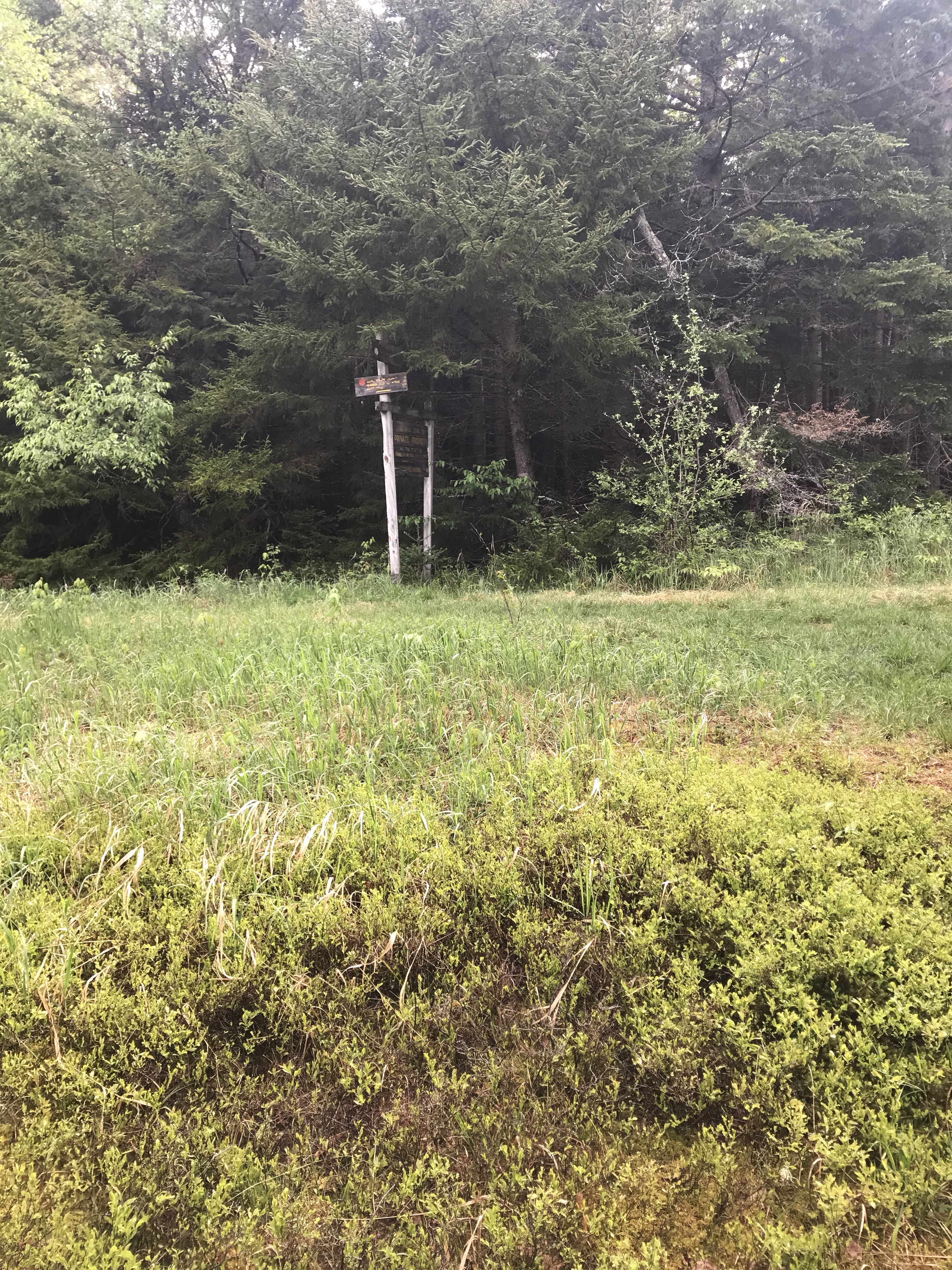
You’ll eventually come to a grassy clearing where there are a couple signs. You will take a right at this clearing.
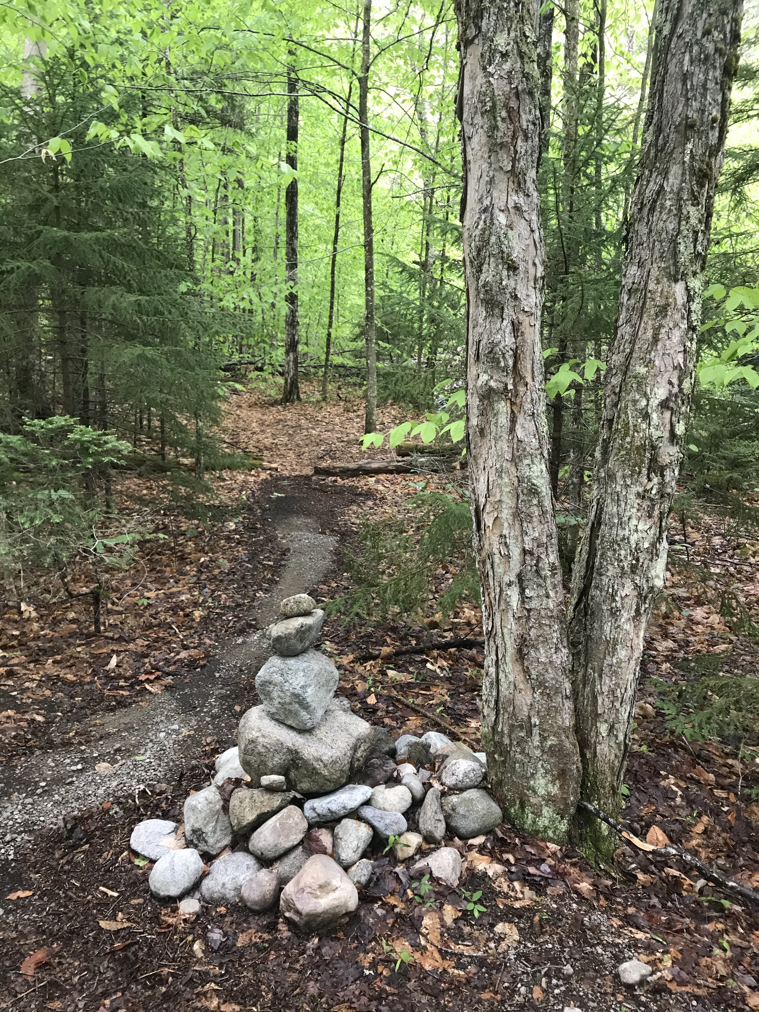
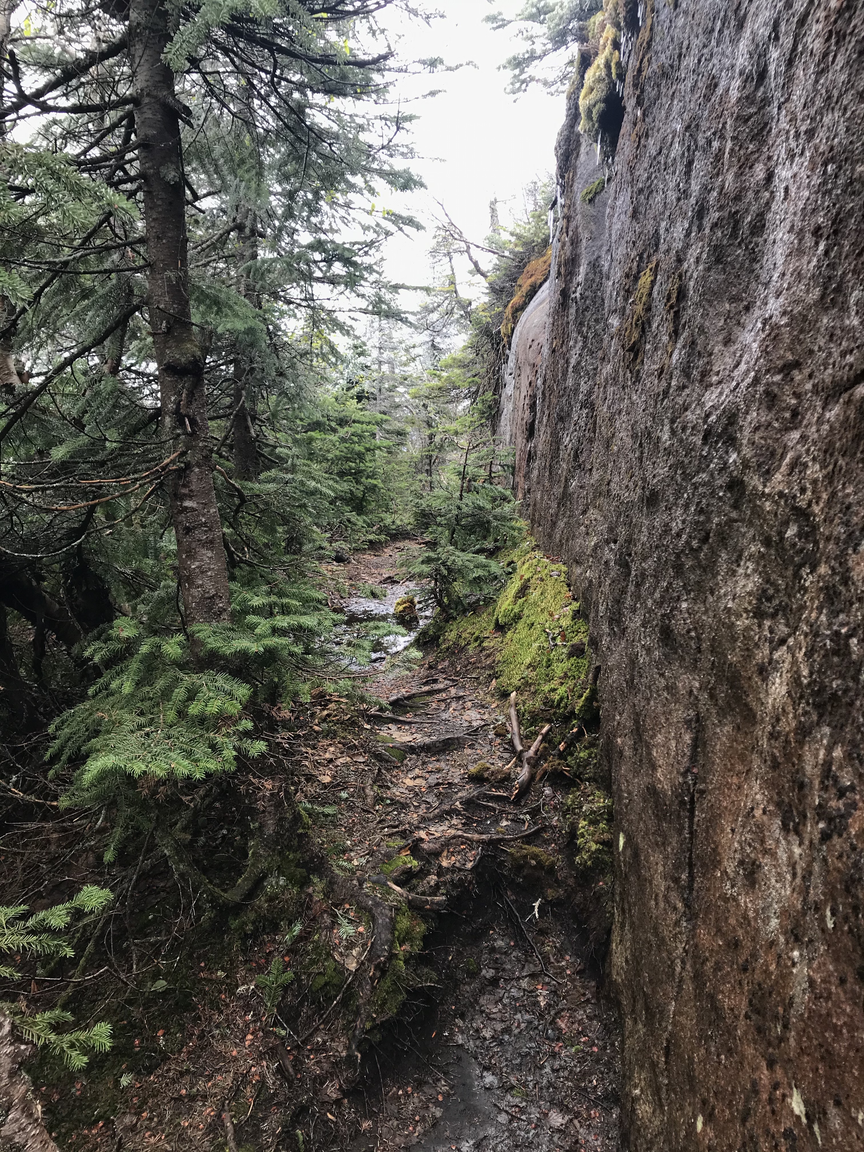
BlueBerry Lean-to has only one lean-to and there is a bridge right after the lean-to. Cross that bridge and continue for a a couple tenths of a mile. You will come across a rock cairn on the right. This rock cairn is where you will want to turn to head towards Seward Mountain. See below for what the rock cairn looks like. DISCLAIMER: This rock cairn is not very big and can be easily passed without notice so be on the lookout after passing Blueberry Lean-to.
Climbing Seward Mountain (Summited 11:10 AM)
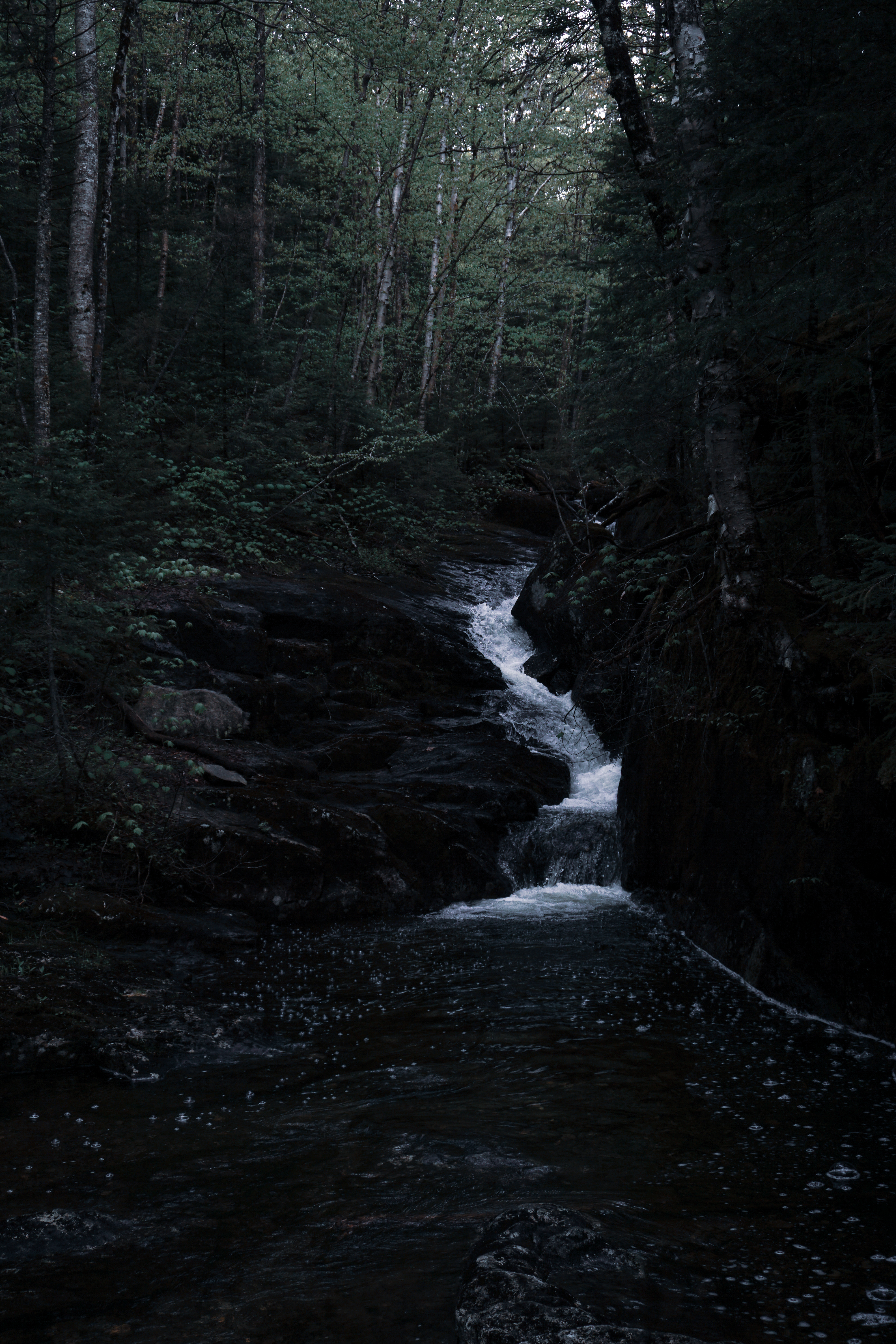
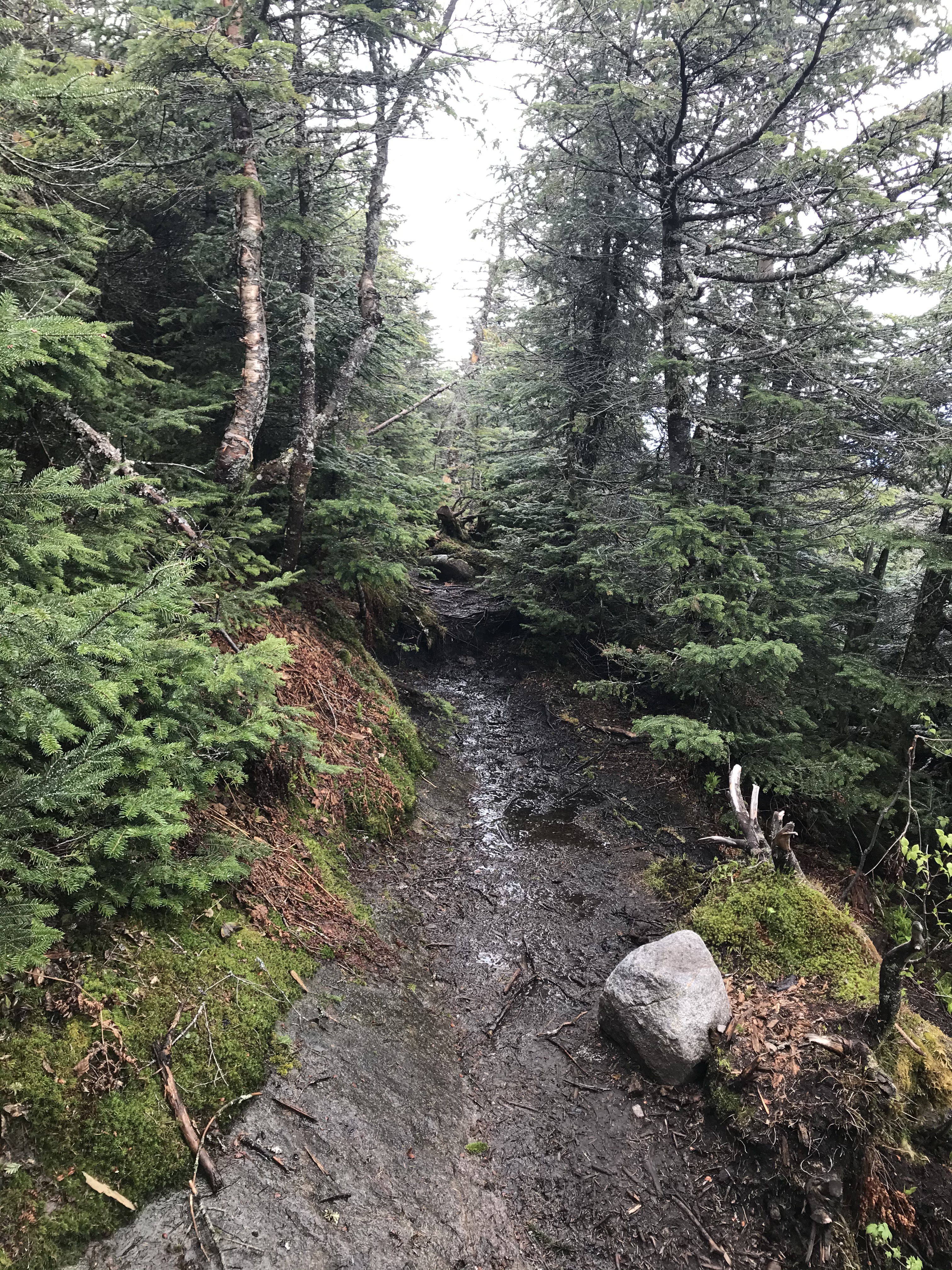
The climb up Seward Mountain is demanding and steep. After taking a right at the rock cairn, you’ll be following a brook the entire way until you’re close to the summit. It is a wet and muddy trail that crosses over the brook several times. Since we hiked Seward right after the remaining snow melted, crossing the brook was difficult at times because of the heavy water flow.
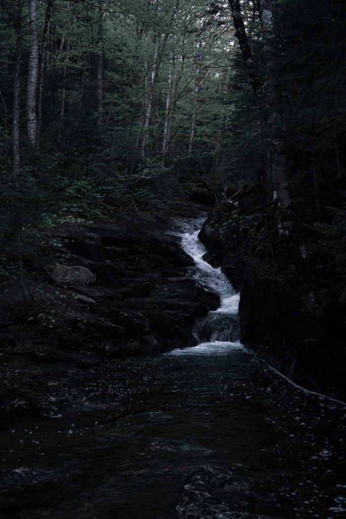
I don’t suggest taking many breaks if you plan on hitting all three High Peaks in one day, but if you need to take one there are some awesome spots along the brook. We stopped on a rock that was between some small waterfalls, see below.
The climb gets very steep toward the end and water running down the trail and rock slides doesn’t make it any easier. Take your time and watch your step. We grasped the trunks of trees along the trail when needed to hold on to. Eventually you will come to a rock wall which you will take a left. Shortly after the rock wall you will be on the summit of Seward Mountain!
Hiking to Donaldson Mountain (Summited 12:20 PM)
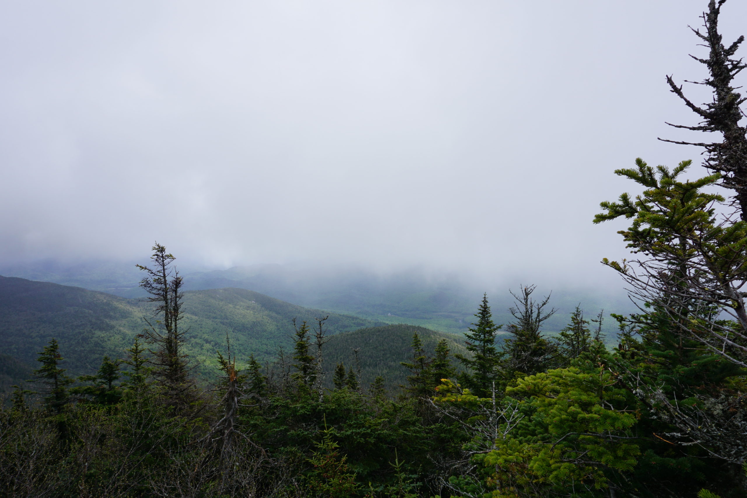
Don’t waste too much time on Seward Mountain because the views along the way to Donaldson and on its summit are more rewarding. As you make your way past Seward, you’ll come to openings where you can take sight of Donaldson and Emmons. They appear to be more work than they are, but you completed the most arduous task already by climbing Seward.
You will drop steeply down Seward and then climb gradually up Donaldson Mountain. Depending on your pace, you should be able to reach Donaldson in an hour. Donaldson has the best views out of the three peaks, although we were dealing with some heavy fog and snow flurries. I was able to capture the shot below.
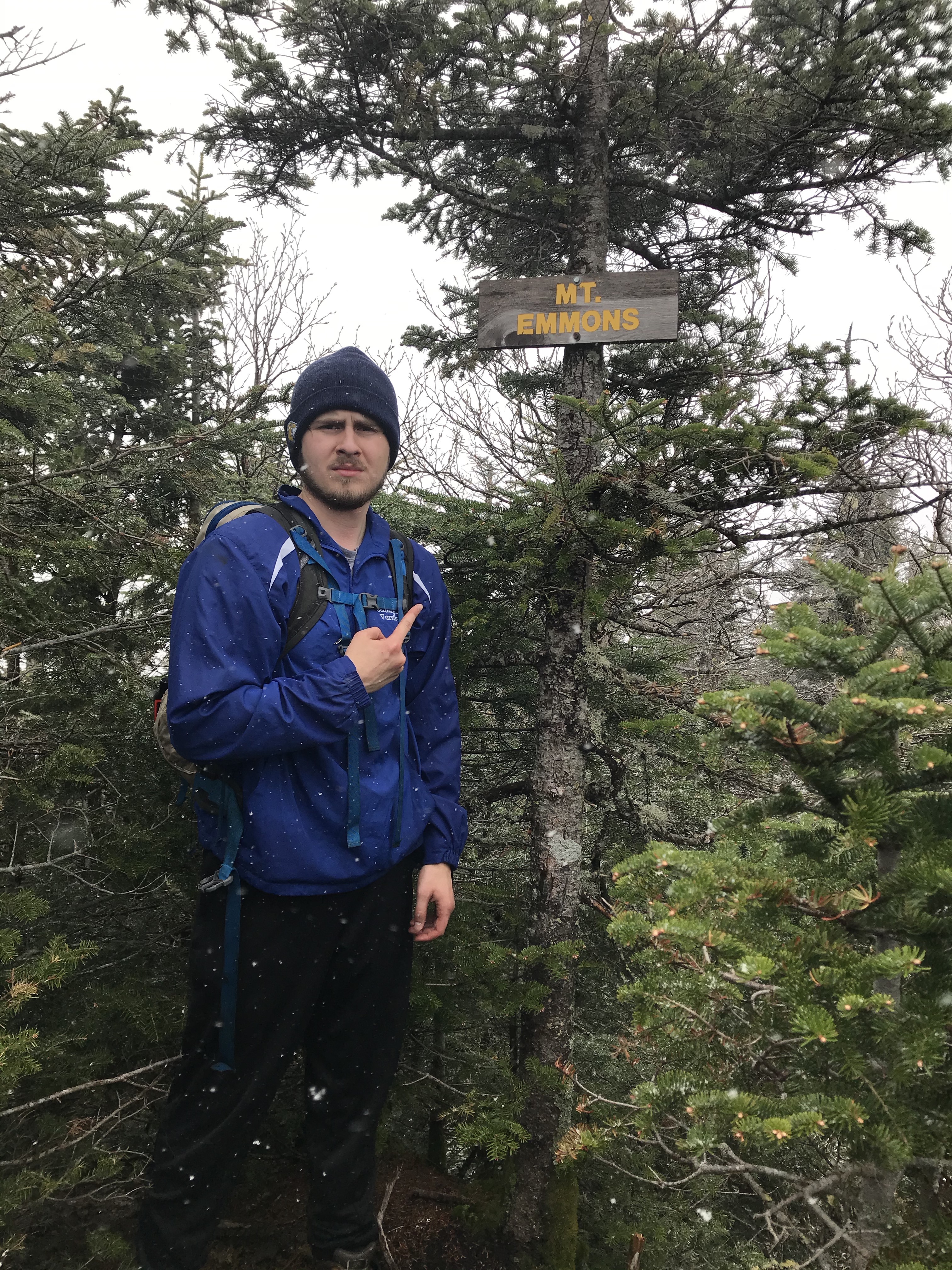
Reaching Mount Emmons (Summited 1:20 PM)
Depending on your pace, you should be able to reach Emmons from Donaldson in forty-five minutes to an hour. You’ll descend moderately and then climb up to the summit of Emmons Mountain. The summit is completely wooded so there won’t be much of a view but it is another High Peak you can add to your growing list!
Back Up Donaldson and Descending Via Calkins Brooke
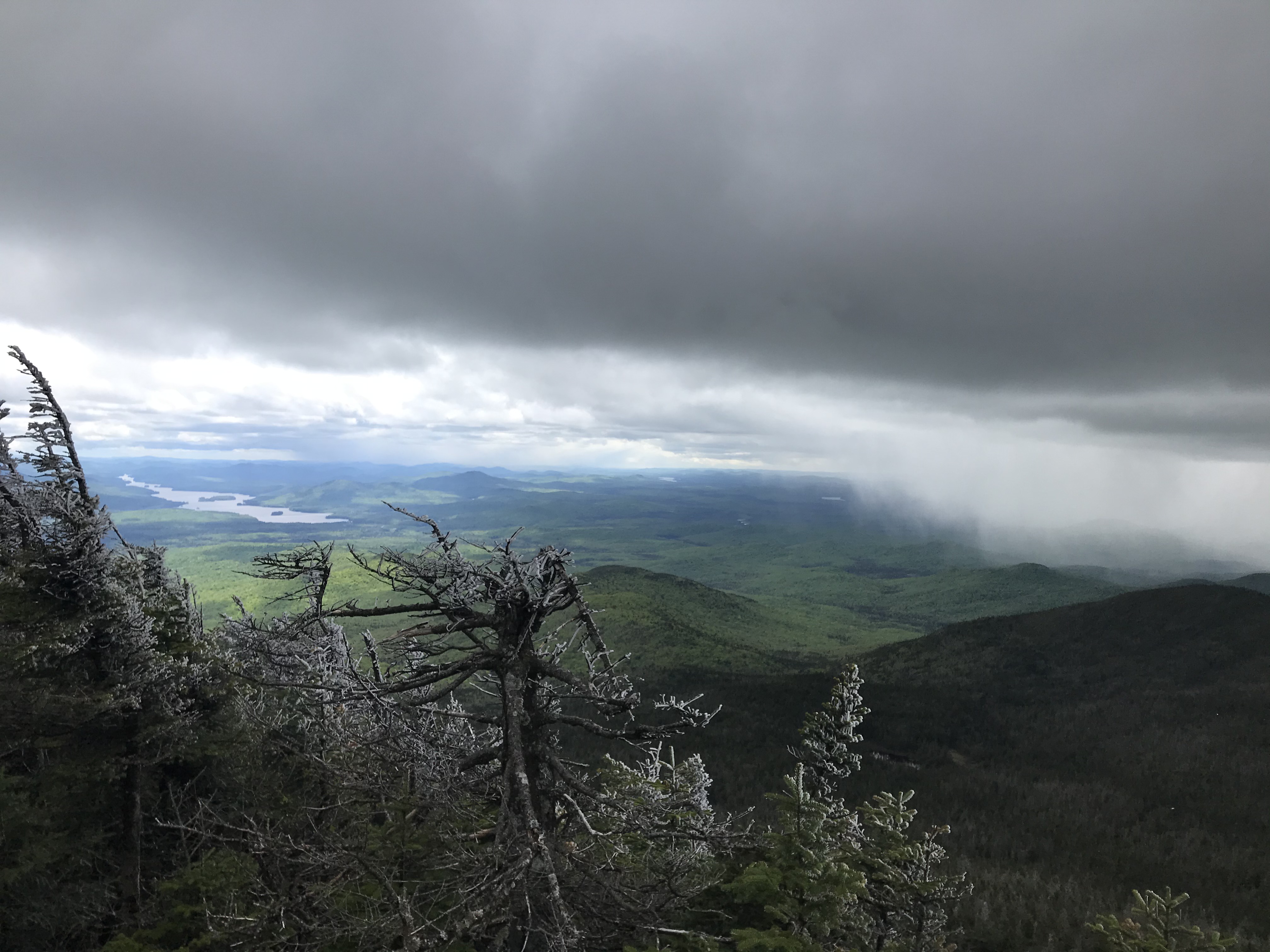
The best and safest way to get down from the Seward Range is via Calkins Brooke which you can reach by going back towards Donaldson. You will re-climb Donaldson and continue past it briefly. Be on the lookout for views when hiking back along the ridge. I was able to capture an opening through the fog and snow squalls to take this picture below with my phone. You can see another snow cloud that ended up heading in our direction!
There will eventually be a split in the trail where you will turn left and begin your descent. The picture below displays where you turn left to begin heading back to the trailhead.
Getting Back to the Trailhead
The trail down is relatively easy to follow. Just pay attention to where you’re walking and don’t get distracted. The hike down is typically muddy so following footprints shouldn’t be a problem. There was one spot where we got a little confused when we ended up at a campsite. If that happens to you, just backtrace your steps and you’ll end up on the trail again.
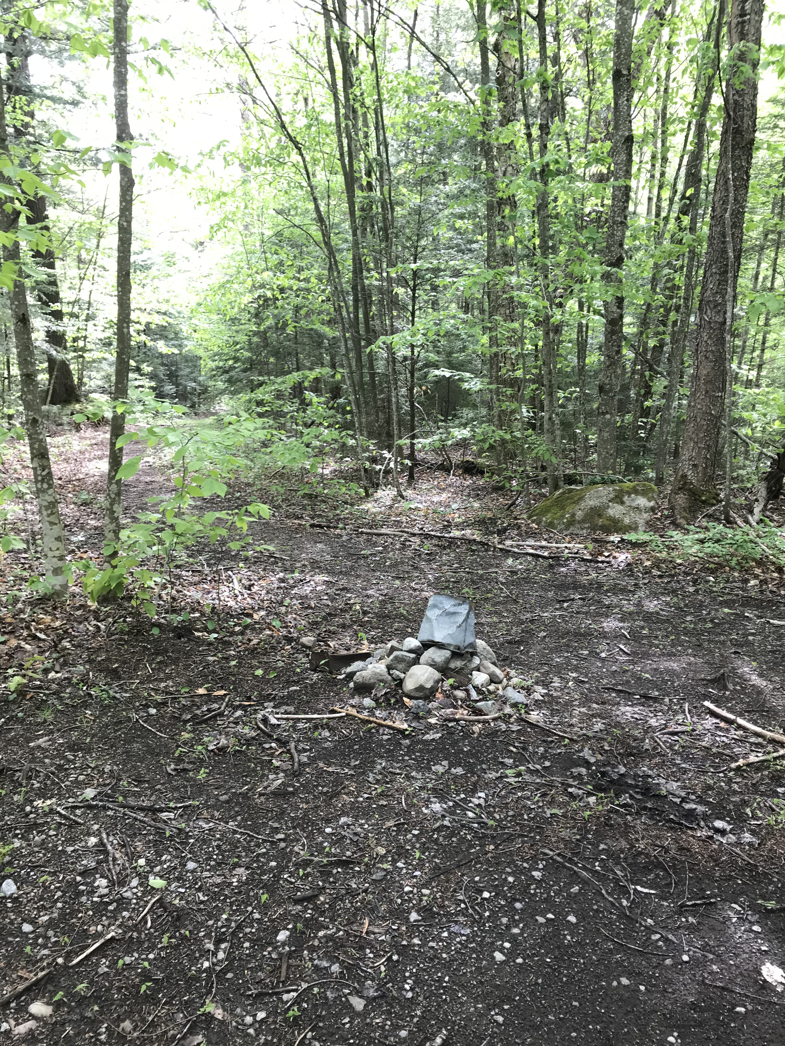
There are rock cairns as you head down that are useful. After hiking for what seems forever, you’ll end up at a cairn where you’ll take a right. It leads to a wide trail that will bring you back to the trailhead parking lot! The rock cairn below is where you turn right and the last one you’ll see for the day!
Dog-Friendly
I definitely do NOT recommend bringing a dog on this hike. The climb up Seward Mountain was rough, steep, and the water flows heavy in some parts of the ascent. I don’t believe bringing your dog for this hike is worth the risk.
Fam-Friendly
This hike is definitely not family-friendly. As mentioned above, the hike is 18 miles round trip and it is over rough terrain. It is a wet, muddy hike with some treacherous portions as you ascend Seward. Unless you’re experienced and going for your forty-sixer challenge, you may want to consider hiking other mountains first.
Clothes/Gear Worn
- Timberland Hiking Boots
- Nike Compression shorts
- Athletic shorts
- Adidas Joggers
- Athletic T-shirt
- Wind-breaker
- Gloves
- Winter Beanie
- EMS Hiking socks (warmest pair they make)
Gear/Food Brought
- 2.5L of water
- Peanut butter granola bars, and peanut butter sandwiches
- Extra EMS hiking socks
- LL Bean mid-layer
- Balaclava
- Bandana
- Extra shirts, compression shorts, and underarmour
- Wind/Rain Pants
- Emergency tents and blankets
- Knife
- Paracord and two carabiners
- Water-proof matches
- LifeStraw (water filtration, costs about $20)
- Trekking poles
- First-Aid Kit
- Garmin inReach (satellite device that has a GPS, can send texts, send SOS, and has many other helpful features)
Helpful Links
- Another Difficult Adirondack High Peaks Loop – Haystack, Basin, and Saddleback Loop
- Additional Information on the Seward Range – Seward Range
RTW Note
Thanks for checking out this hike in the Adirondacks! my fellow Road Trip Warriors! If you liked this post or found it helpful, share the link to the post with others and leave a comment! Your actions help grow and enhance this website so trail information can continue to be posted and updated! I hope you all stay safe and enjoy the mountains responsibly!
Remember to practice Leave No Trace principles!
-Ant