Baxter Mountain
What is going on my Road Trip Warriors!? Last weekend on 1/12/19, my brother, one of my close pals, and I decided to hike Baxter Mountain. We chose Baxter because my friend had to work in the afternoon and I knew it was a relatively short hike. I had passed by the Baxter Mountain trailhead numerous times so finding it would be easy. For those of you that don’t know, it is right off Route 9N in Keene, NY. It is located near the Baxter Mountain Tavern. Anyways, I am excited to share information about this hike and the photos we captured with you all!
Short Summary of Baxter Mountain
- Difficulty: Easy. I strongly believe that most individuals would find this hike laid back. It is a good way to get some fresh air and some exercise.
- Length: 3 miles round trip
- Elevation: 2,440′. Don’t think that Baxter lacks views because of its smaller stature. The summit is actually rewarding with a great vantage point of the Adirondacks. It is an ideal spot for a scenic lunch with some pals.
- Hiking Time (with snow): It took us roughly 45 minutes to hit the summit. That includes the time we stopped to take photos along the trail. We spent about 15 minutes at the summit. It took us about another 45 minutes to get down. We started the hike at 8:15 AM and got back to the car at 10:00 AM.
- Photo Opportunities: Unless there are snow-covered trees, your best spots to capture photos are the first lookout and then the summit. They are not 360º views, but Baxter offers a nice spot to view the larger mountains of the Adirondacks.
Parking and Beginning the Hike
The trailhead for Baxter Mountain is right off of Route 9N in Keene, NY. It is on the opposite side of the road as the Baxter Mountain Tavern and there is a trailhead sign that is hard to miss.
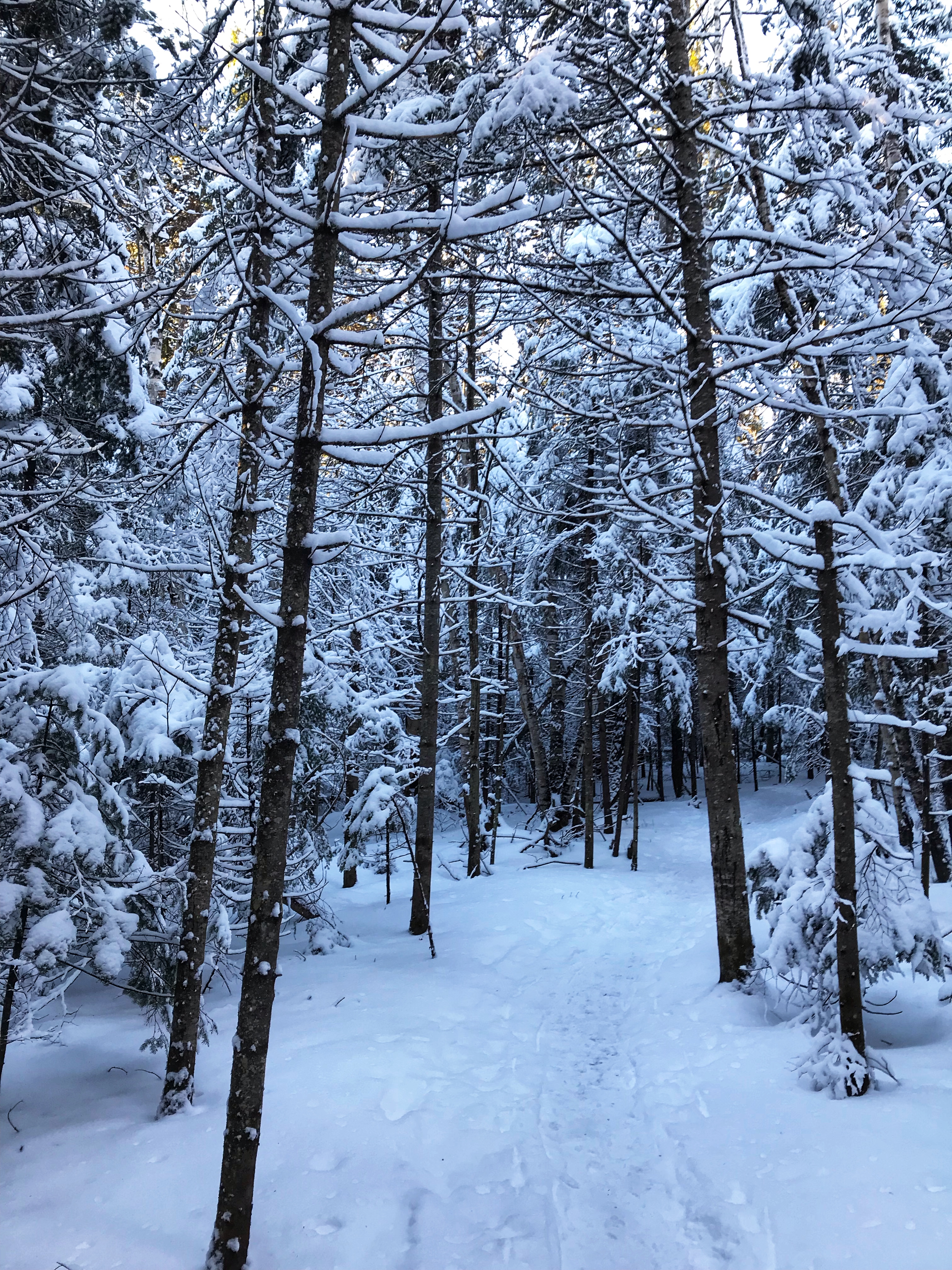
As you can see in the photo, you will be following the blue foot trail markers along this hike. They are placed on the trees as you would see during any other hike and the trail itself is well marked.
The Hike Itself
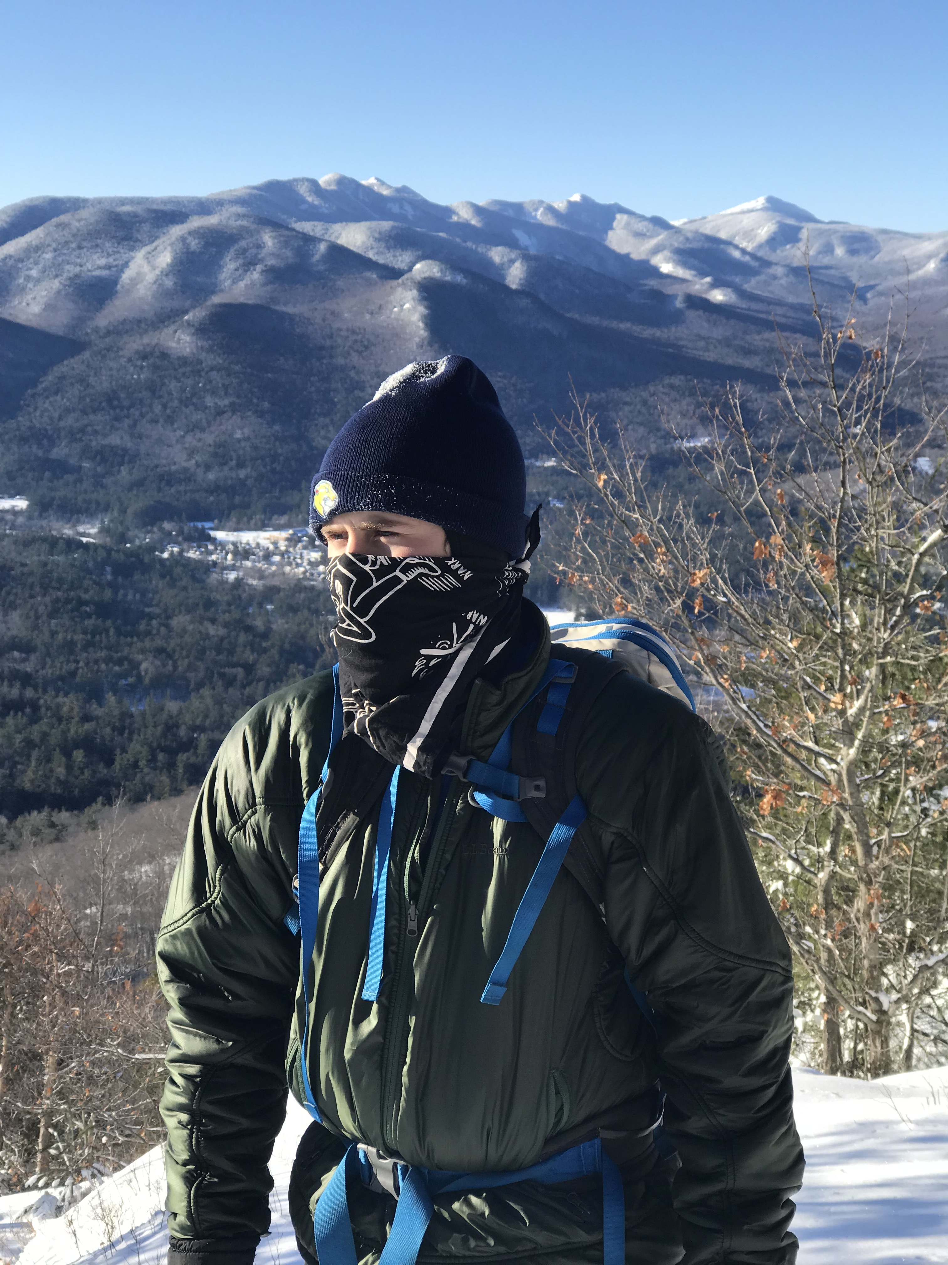
The hike is relatively short, only being 1.5 miles to reach the summit. According to All Trails, you will only gain about 740 feet of elevation as you saunter through the woods. The trees were blanketed in snow making them VERY picture-worthy.
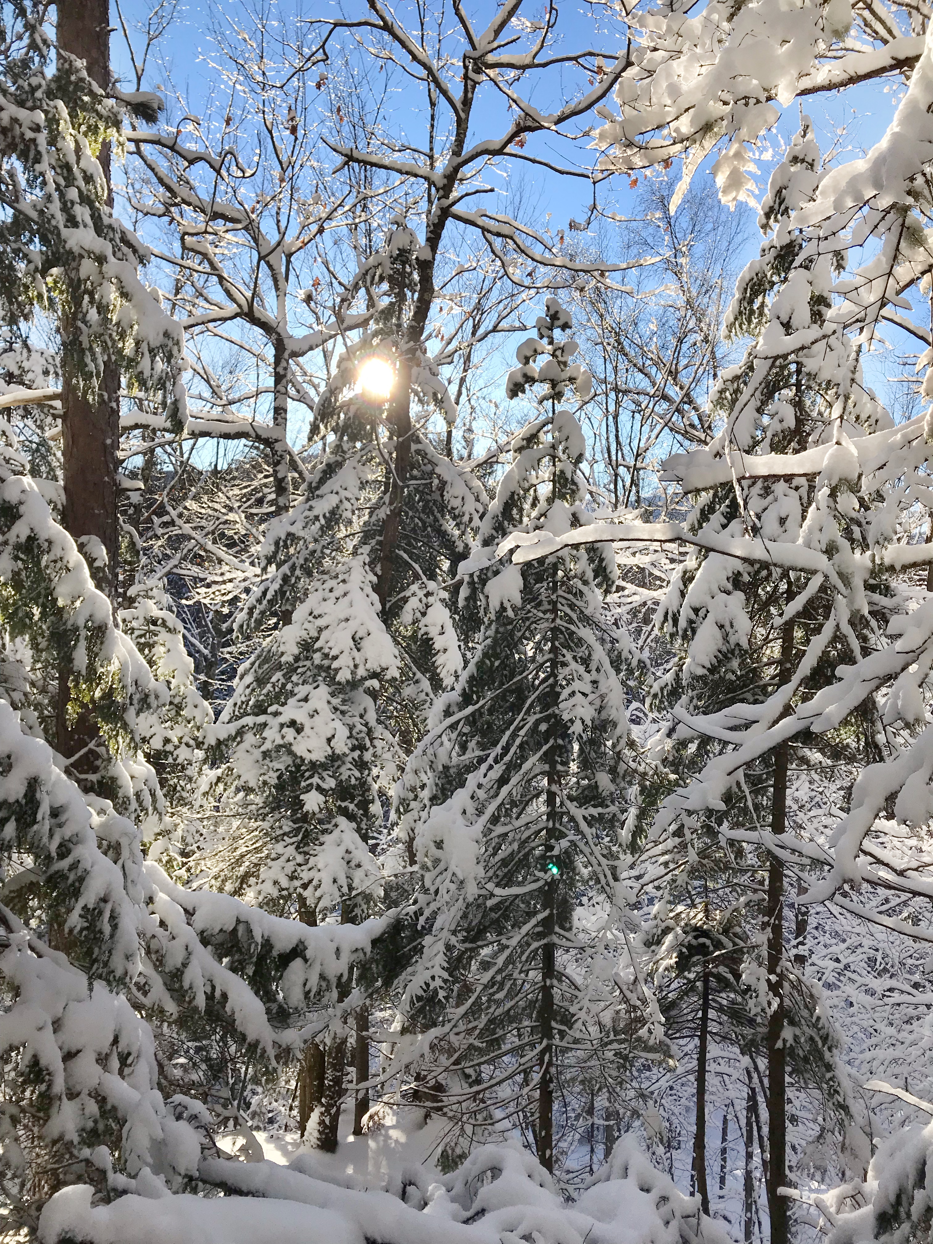
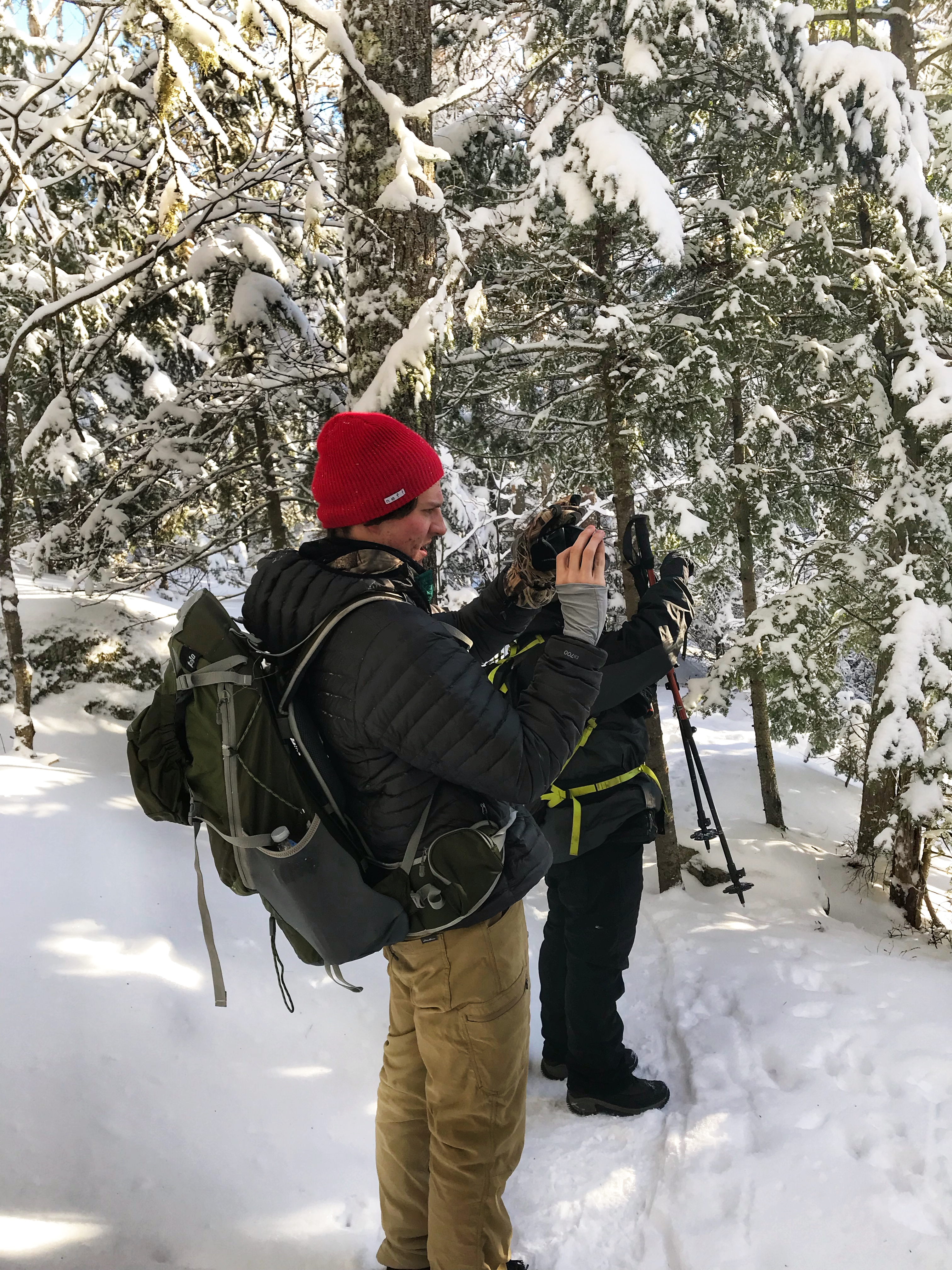
I always love how the mood of a photo in the snowy forest can seem gloomy like the top one, but once the sun pokes through the woods, that perspective changes drastically. Anyways, those two dudes in the photo above would be Adam Sleezer in the foreground (one of my best pals) and my brother, Alex, behind him….although you can’t see his lovely face.
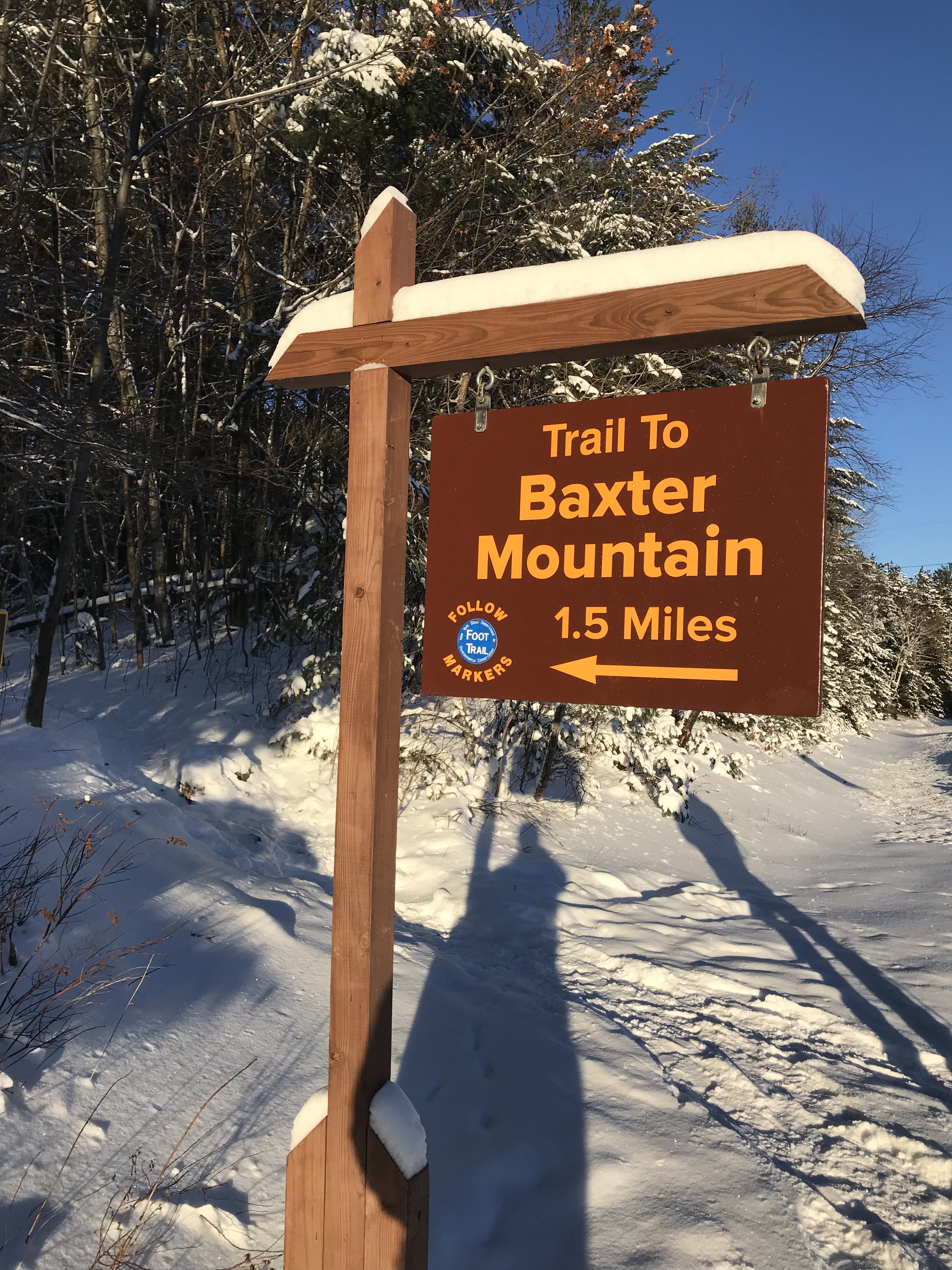
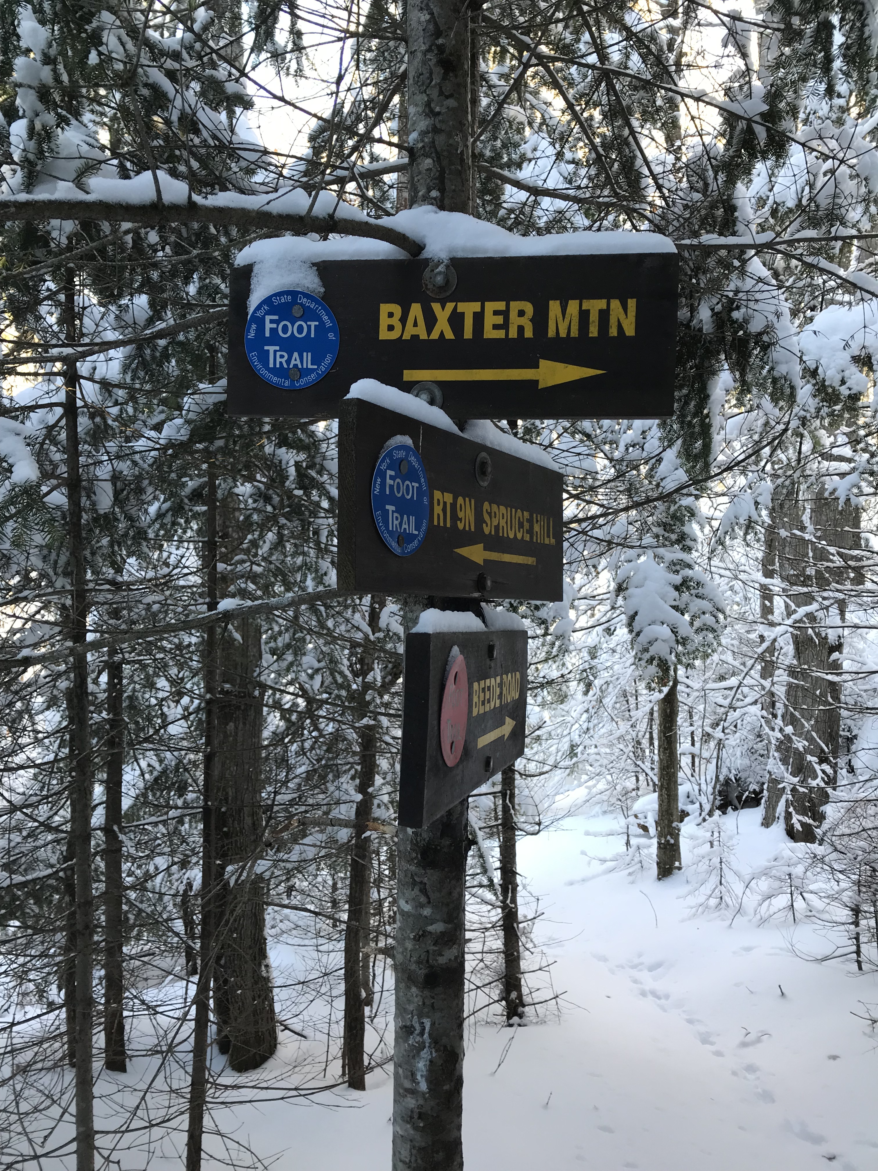
One Sign You Come Across
There is one sign that you will come across on your way to the summit of Baxter Mountain and it will look a little something like this…
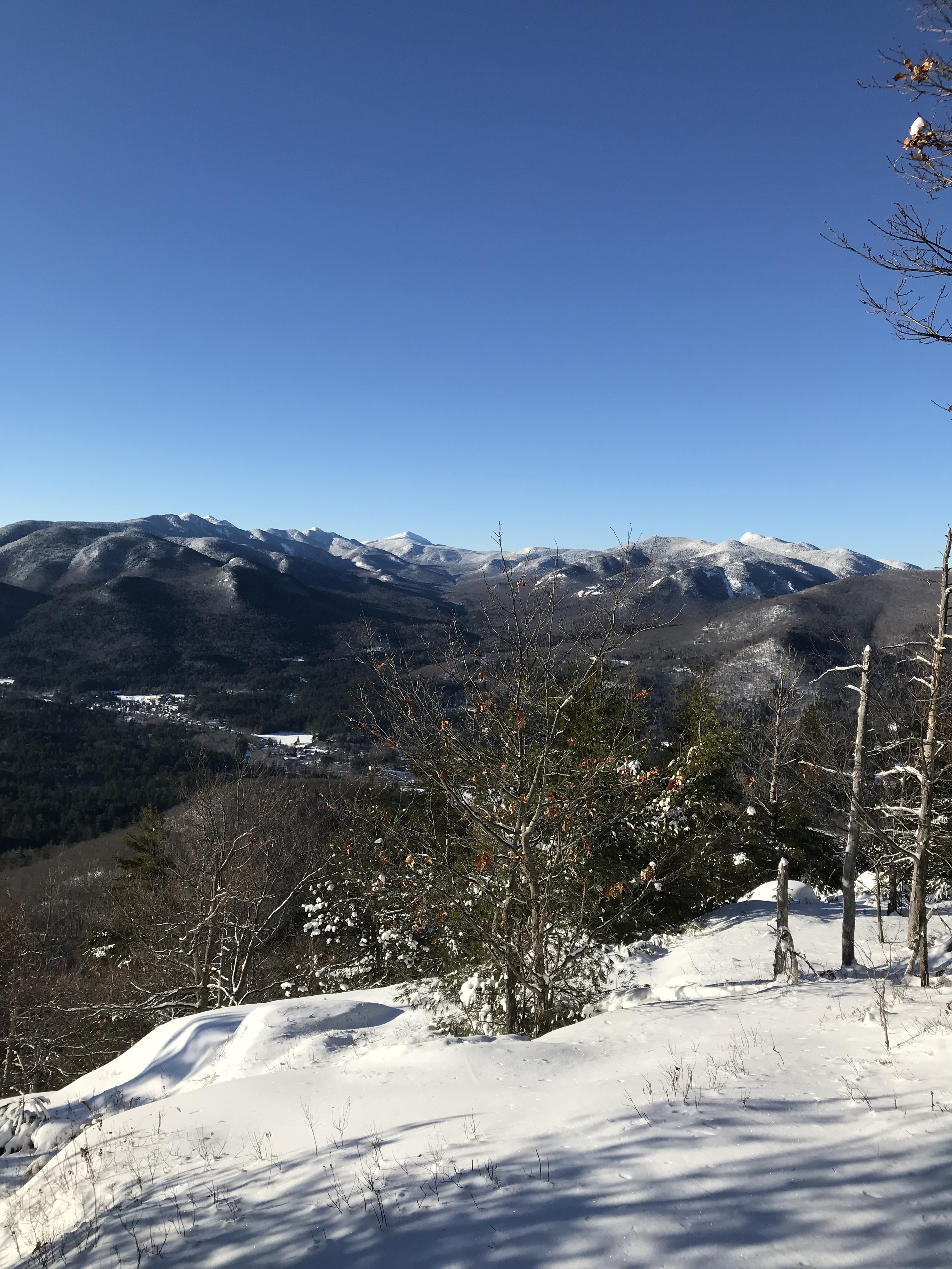
Baxter Mountain Summit
While this summit is not as high as some of the other peaks in the Adirondacks, it still offers a great view of other mountains in the area. We only chilled out here for 15 minutes because it was sort of 0º out….but on a warmer day this would be an awesome place to spend time with family/friends.
Getting Back to Your Vehicle
This hike is an out-and-back so just trek back the way you came. It should only take you 45 minutes at the most to get back to Route 9N.
Dog-Friendly
This hike is dog-friendly, but not in this kind of cold weather. I am sure your dog would love hanging out on the summit with you once the temperature increases! Remember it is three miles round trip. You know what your dog will need to stay hydrated and energized.
Fam-Friendly
This hike is very easy and most individuals should be able to do it. I do not think children would struggle. It is a great way to get out in the morning and then get a nice meal at Noonmark Diner down the road.
Clothes Worn
- Timberland Boots
- Nike Compression Leggings
- Long-johns
- Athletic shorts
- Adidas joggers
- Athletic T-shirt
- Athletic long sleeve top
- LL Bean Jacket (rated for -20º F)
- Balaclava
- Beanie
- Gloves
Gear Brought
- 3L of water
- Almonds and peanut butter sandwiches
- Wind/Rain pants
- Extra layers (UnderArmour)
- Extra hiking socks
- Knife
- Paracord and two carabiners
- Water-proof matches
- LifeStraw (water filtration, costs about $20)
- Adhesive body warmer
- Hand Warmers
- Trekking poles
- First-Aid Kit
- Garmin inReach (satellite device that has a GPS, can send texts, send SOS, and has many other helpful features)
RTW Note
Thank you to those that took the time to look at these pictures and read the info. I hope that you find a piece of this information helpful. I have recently gotten a new camera so the pictures will have an increase in their quality. My iPhone 7 can only do so much! Anyways, I hope all my fellow Road Trip Warriors are staying safe, practicing Leave No Trace principles, and ripping some wild adventures. Don’t forget to hit the like button, comment, and follow if you found this post the slightest bit interesting! I look forward to sharing more as always!
-Ant