Roaring Winds, Frozen Hats, and Bandanas
What is up my Road Trip Warriors!? Soooooooo, this past weekend my brother, Alex, and I took a road trip to the White Mountains in New Hampshire. We had read many great things about the area, the mountains, and how amazing it looks in the fall. I decided that it would be wild if we took on the Franconia Ridge. It is a hike that is rated highly by National Geographic because it is well-known for its stunning views. Unbeknownst to my brother and I, we would be in the clouds for the 1.7 miles that we were on the ridge battling punishing winds and very low visibility. We loved every minute of it!! Let us dive headfirst into this adventure!
Short Summary of Franconia Ridge
- Difficulty: Strenuous
- Distance: Roughly 9 miles
- Average Hiking Time: 6-8 hours
- Numerous waterfalls
- Greenleaf hut (can get coffee here for $1, tea, snacks)
- Mountains traversed: Little Haystack 4,760′ ; Mount Lincoln 5,089′ ; Mount Lafayette 5,260′
Road to Franconia Notch
We left the Saratoga area on 10/12/18 around 5:30 AM to head towards Franconia Notch for our hike. I made an educated guess it would not be as crowded since most people would be busy on a Friday morning. I also figured if we started the hike by 10:00 AM, we would be back to the car around 5:00 PM.
The drive to Franconia was beautiful after we got through Rutland, Vermont. We were surrounded by hills and mountains covered in colorful leaves. We drove through Woodstock, VT which is a beautiful little town. Then, we went through Queechee, VT and drove over Queechee Gorge. We did not stop at the gorge, but from the driver’s seat, the gorge looked amazing and it was DEEP. I will now have to make an effort to hike around Queechee State Park!
We parked at the Mount Lafayette campground at roughly 10:00 AM. I went to the camping information center and asked where the trailhead was so we did not waste any time looking for it. The man that worked there was very helpful and encouraged us to take the Falling Waters Trail up and Bridle Path back down. His reasoning behind this was because Falling Waters Trail was steep and slippery. We took his advice and made our way to the trail!
Falling Waters Trail
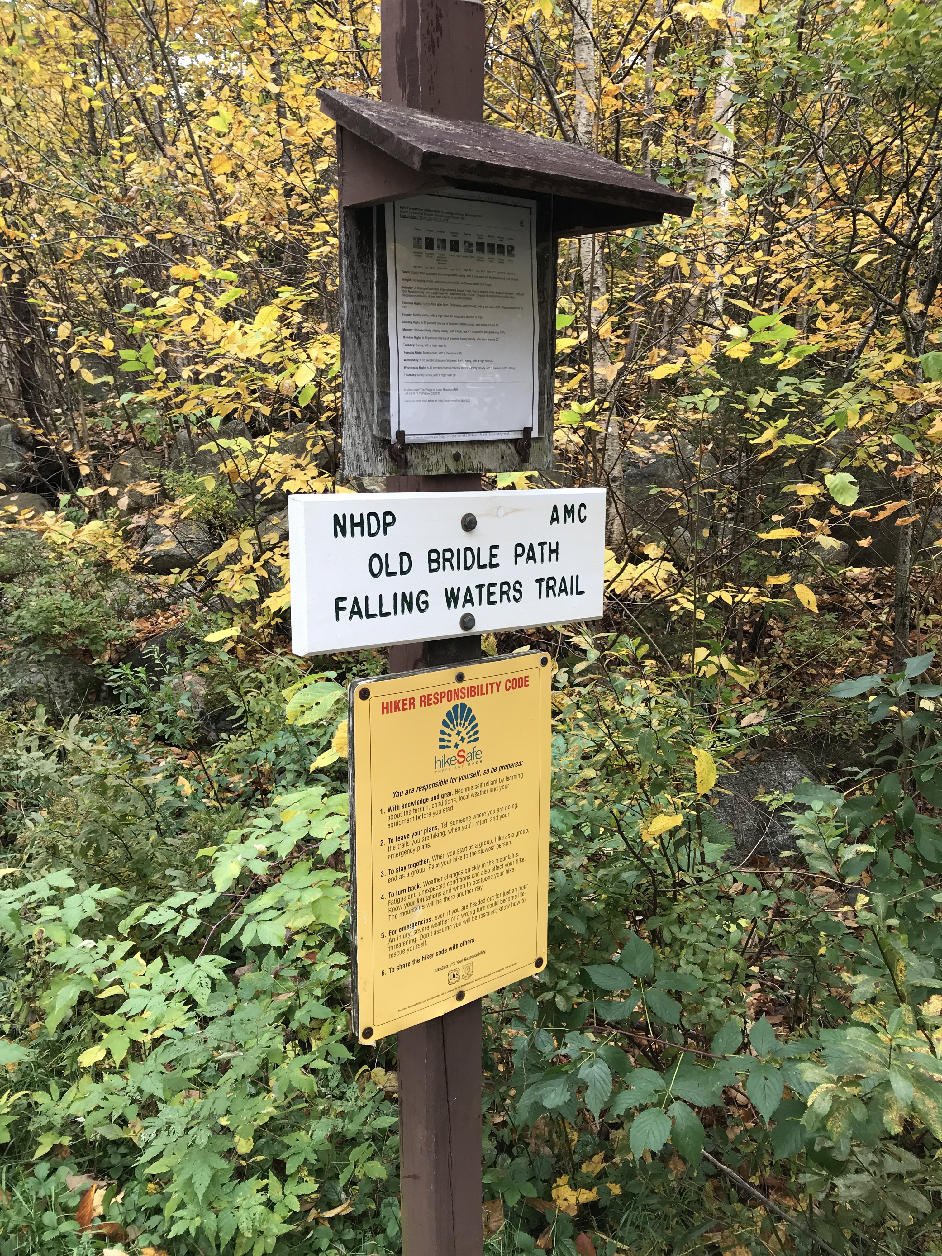
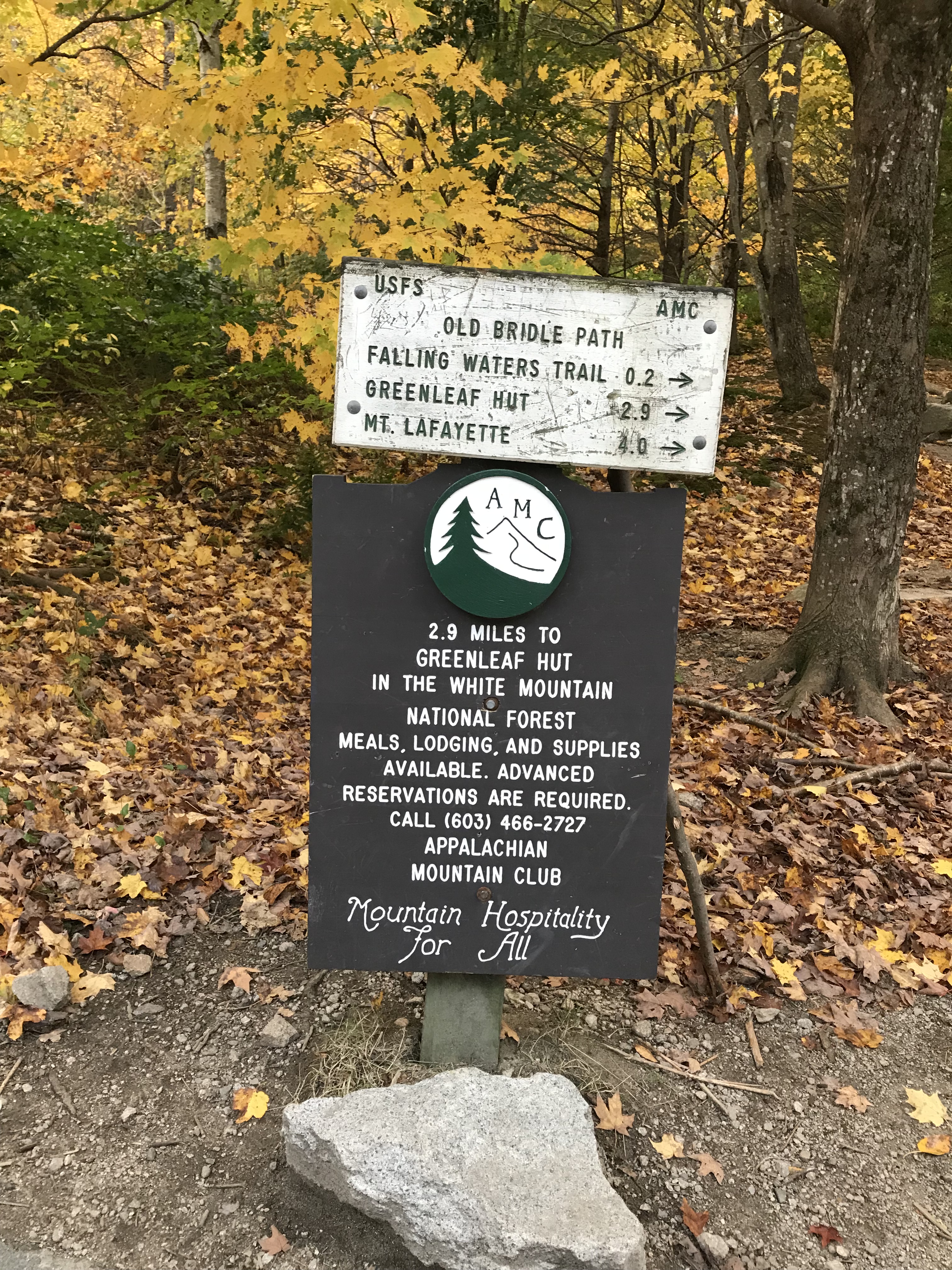
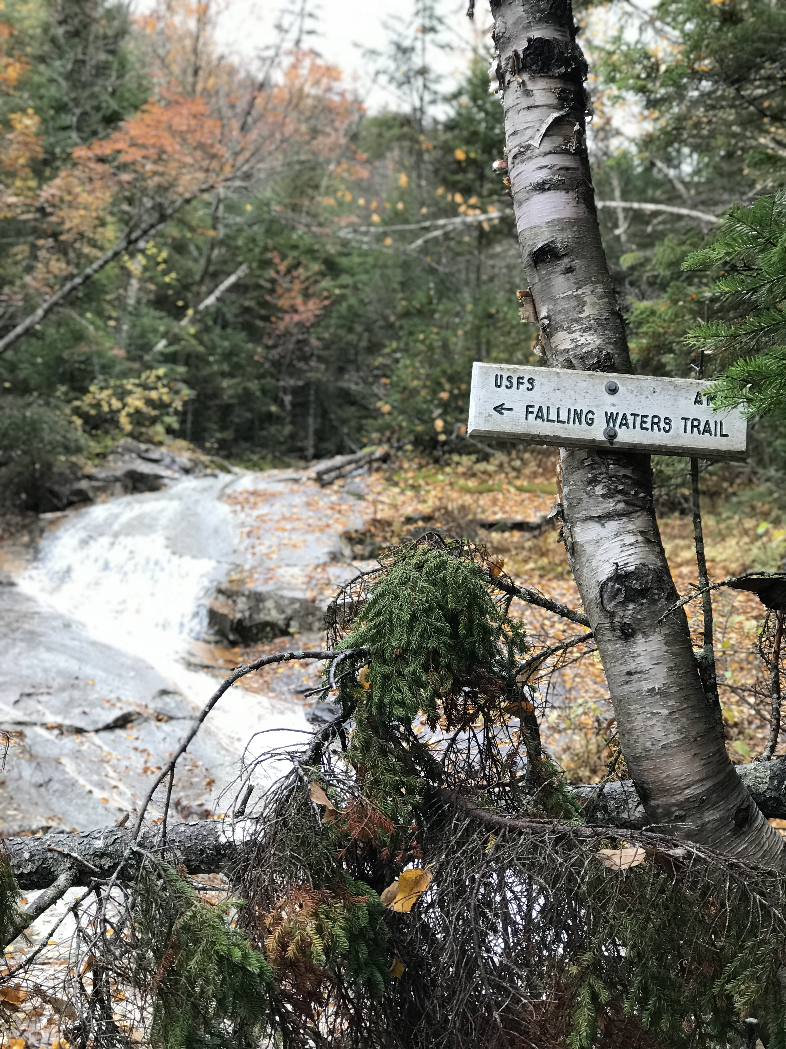
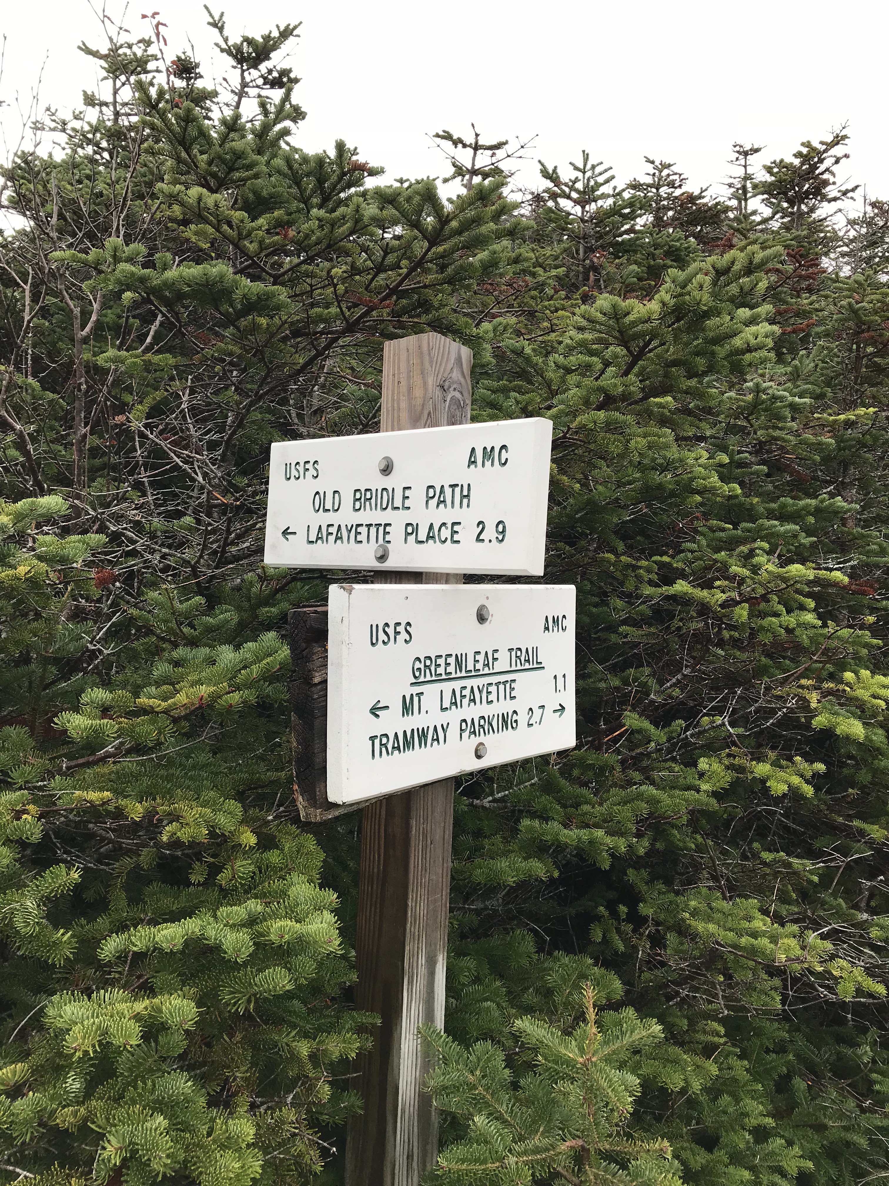
Falling Waters Trail is 3.2 miles to the summit of Little Haystack. If you parked in the lot near the Lonesome Lake Trailhead like we did, then you will have to cross the highway under a bridge. It is very easy to find. Once you walk past the hiking center, just look to your right and you will see the underpass. Make your way up through the other lot until you reach this sign. There is another sign you will see as well.
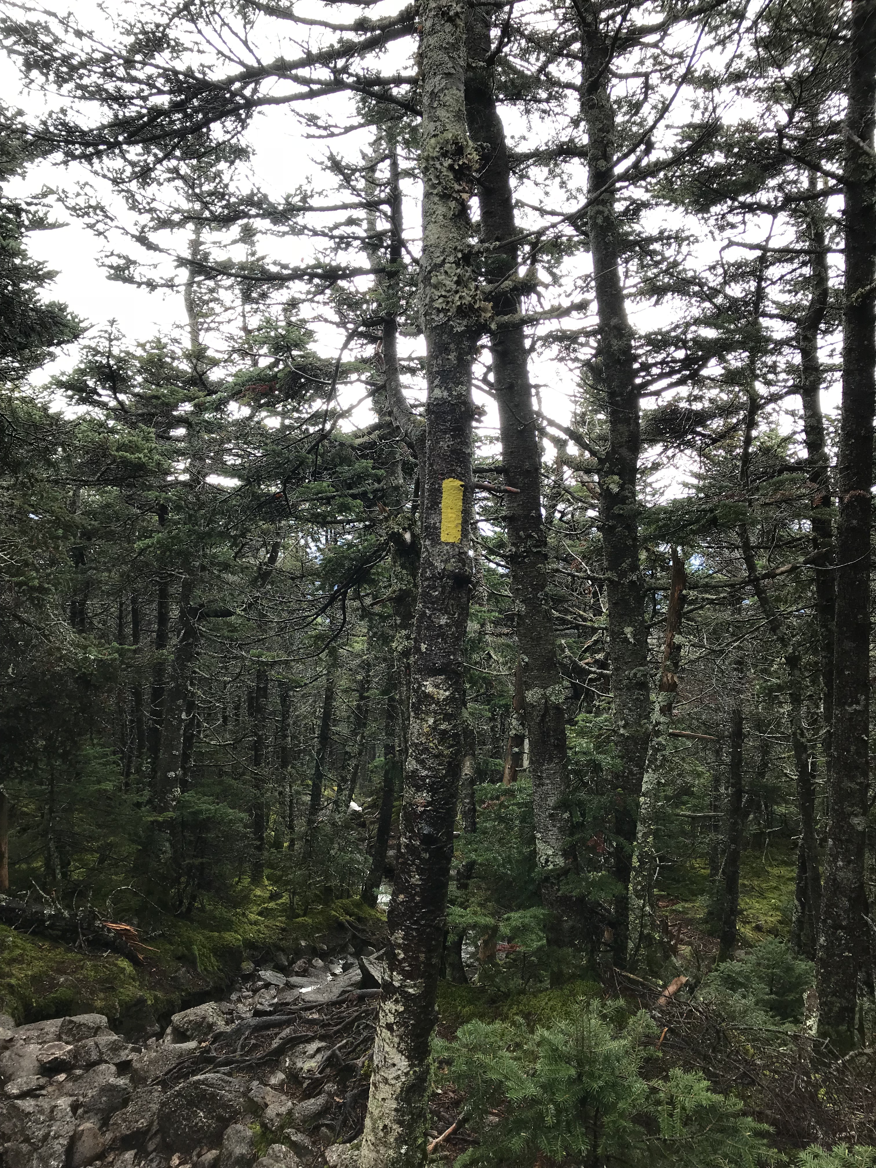
You’re going to follow the trail until you reach a bridge that looks like the picture below. Cross the bridge and you will be on the Falling Waters Trail. On this trail, you will follow the blue markers on the trees. The trail was well-marked and there was signage that ensured you stayed on track. On the weekends this trail is very heavily trafficked so I imagine it would be difficult to get lost.
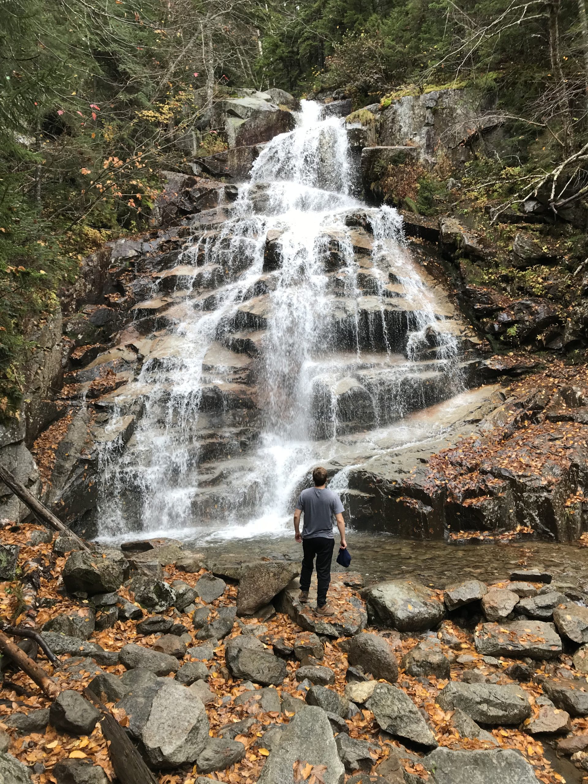
What is great about this trail is the amount of waterfalls you’ll be able to see. As you keep following these blue markers, you will be able to take numerous amazing photos. The most impressive of the waterfalls on this trail is Cloudland Falls which cascades 80 feet.

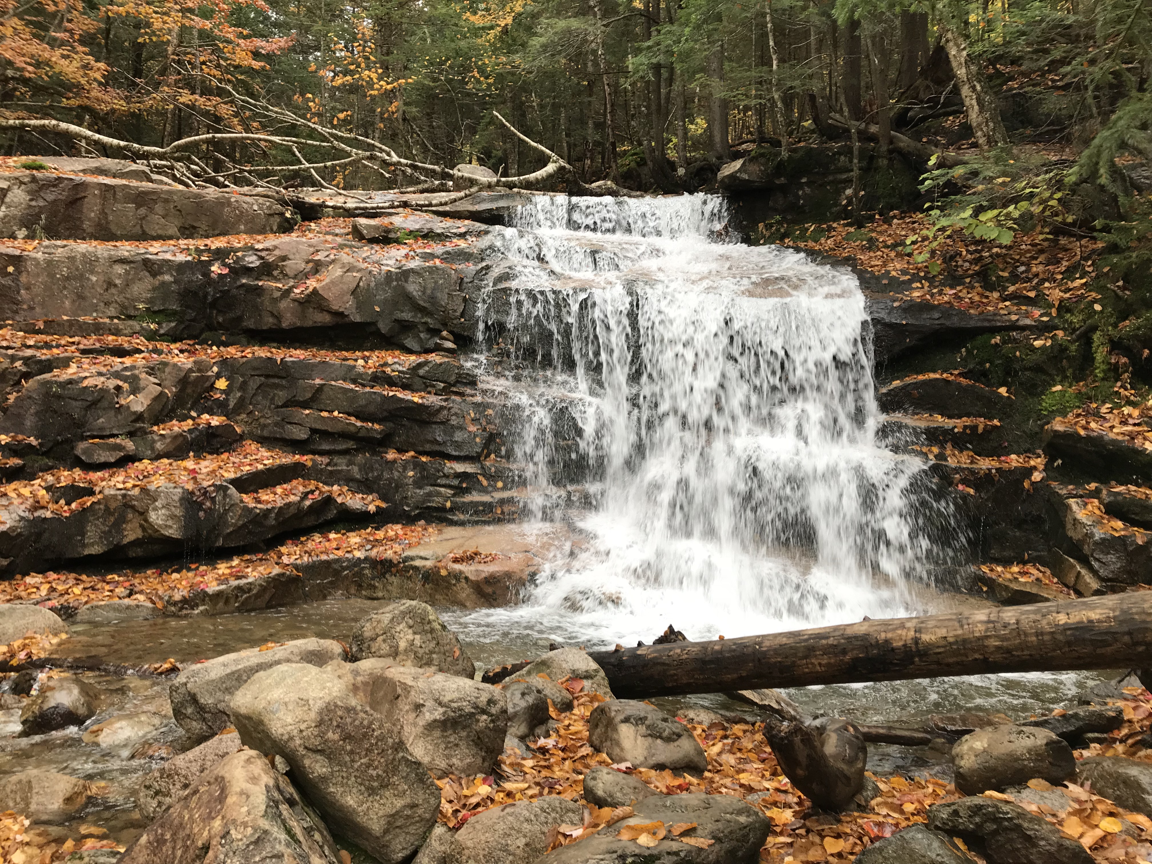
Cloudland Falls (below)

After taking pics at these beautiful waterfalls, you’ll continue following the blue markers and signs like the one below.
The hike is pretty straight-forward as you continue to climb up towards the ridge. The last sign you encounter before breaking tree-line will have on it “Shining Rock.” At this sign, go left and continue up towards Franconia Ridge.
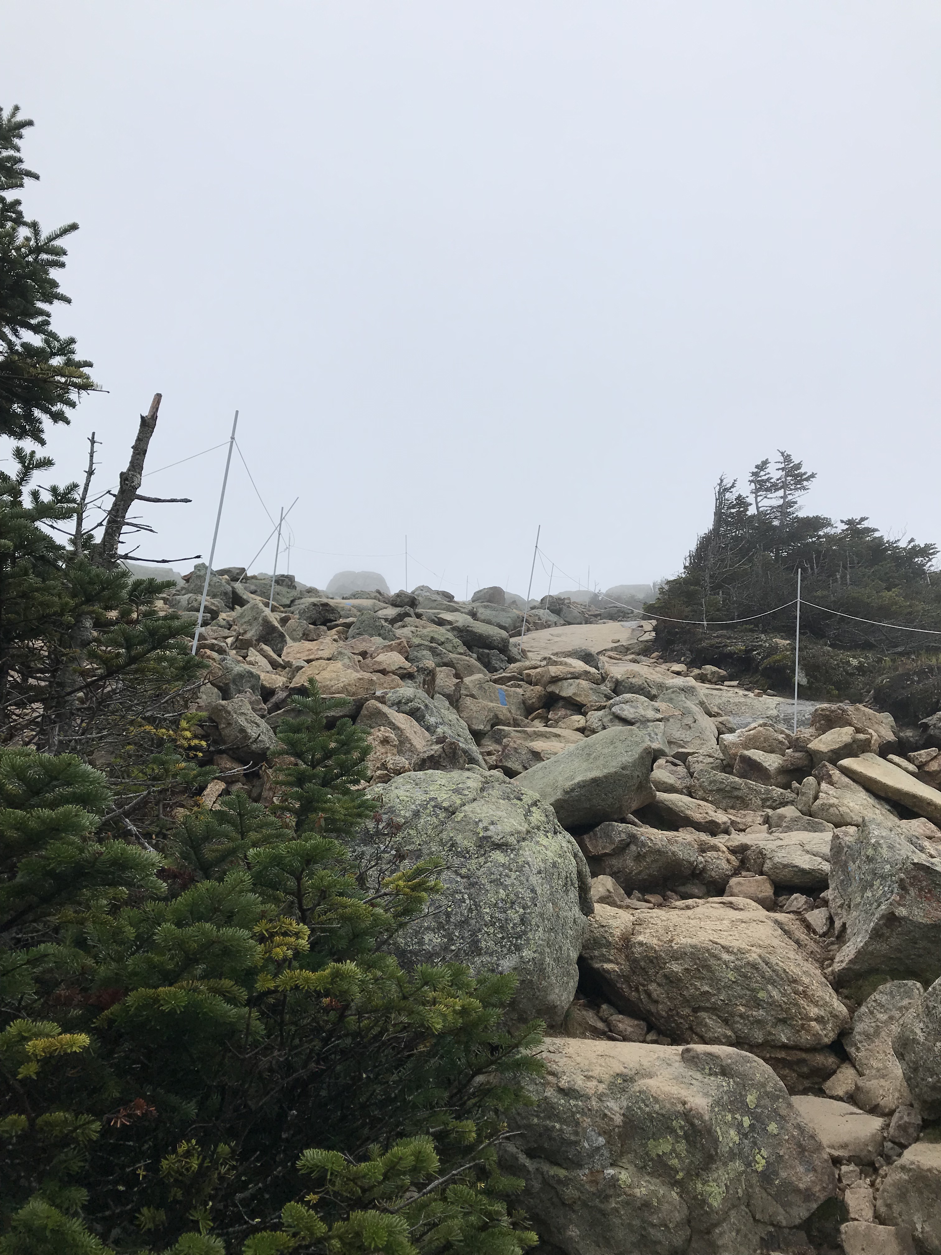
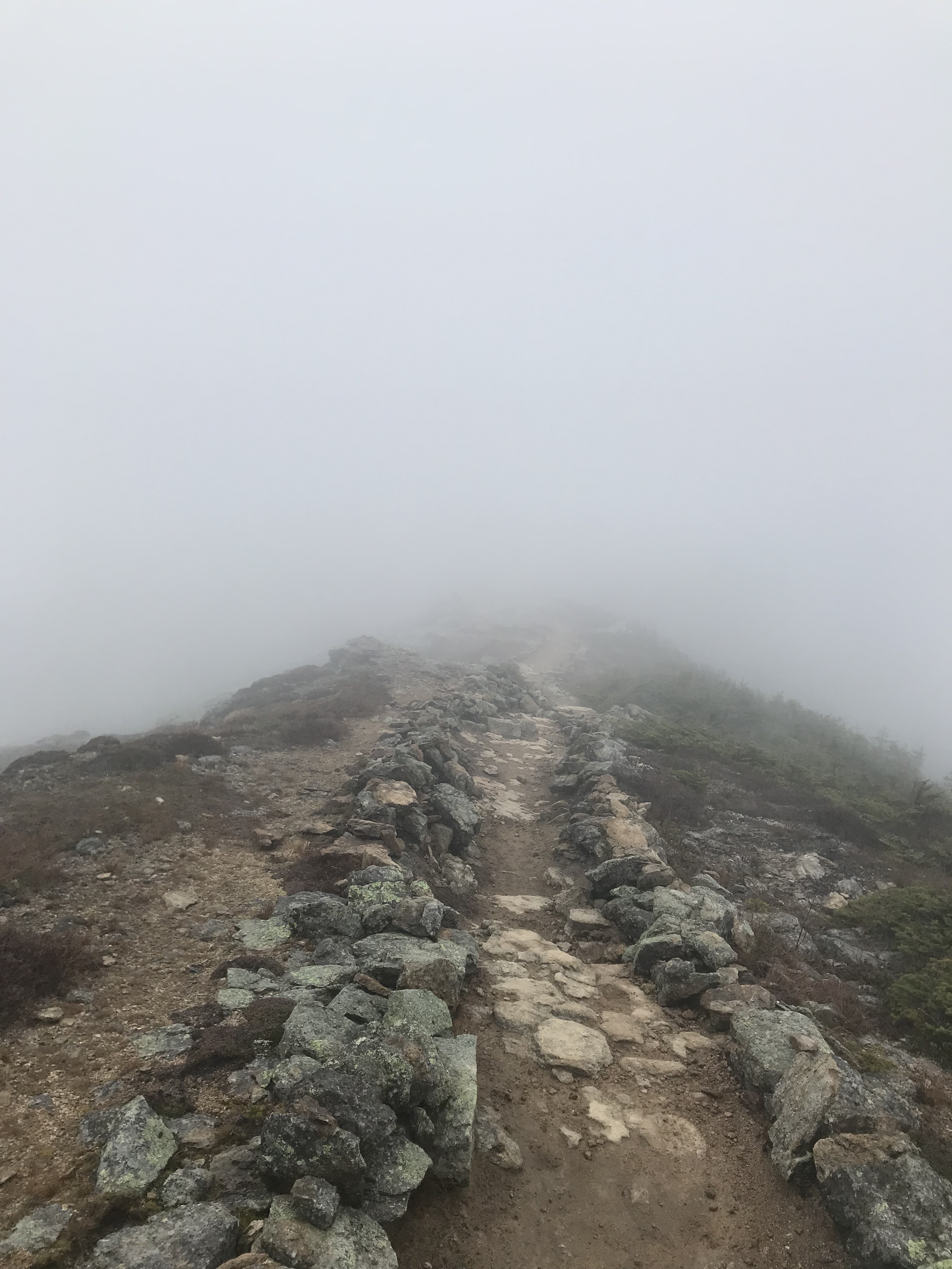
Summiting Little Haystack
When you break the tree-line, this is what you will see (hopefully much clearer than what we saw).
Climb up the rocks and you will reach a large wooden sign. My brother and I chilled out here for a bit and ate some snacks. I pulled out my adventure bag and collected any litter that I could find.
Traversing Franconia Ridge
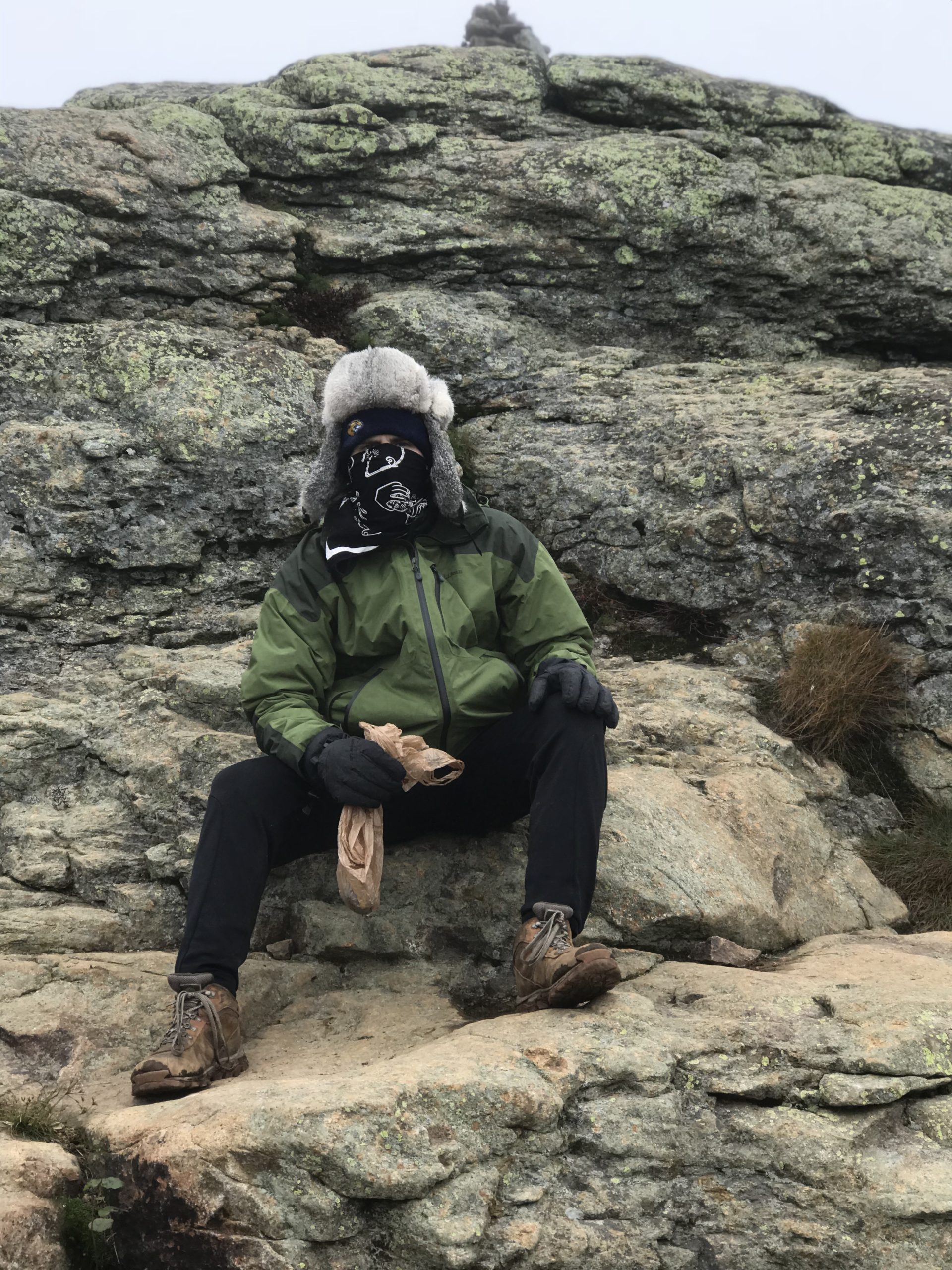
Many individuals that we came across on our way up had turned back due to the high winds. Being the adrenaline junkie that I am, we decided to traverse the ridge in the low visibility and roaring winds. It turned out to be a blast!! Franconia Ridge is 1.7 miles long that offers views I’ve heard to be unparalleled (usually). Since we had very low visibility, I unfortunately did not take many photos on the ridge. I took videos which you can see on my instagram (antbonacio_rtw) account or on twitter (@AnthonyBonacio). Below is what my brother and I were dealing with…
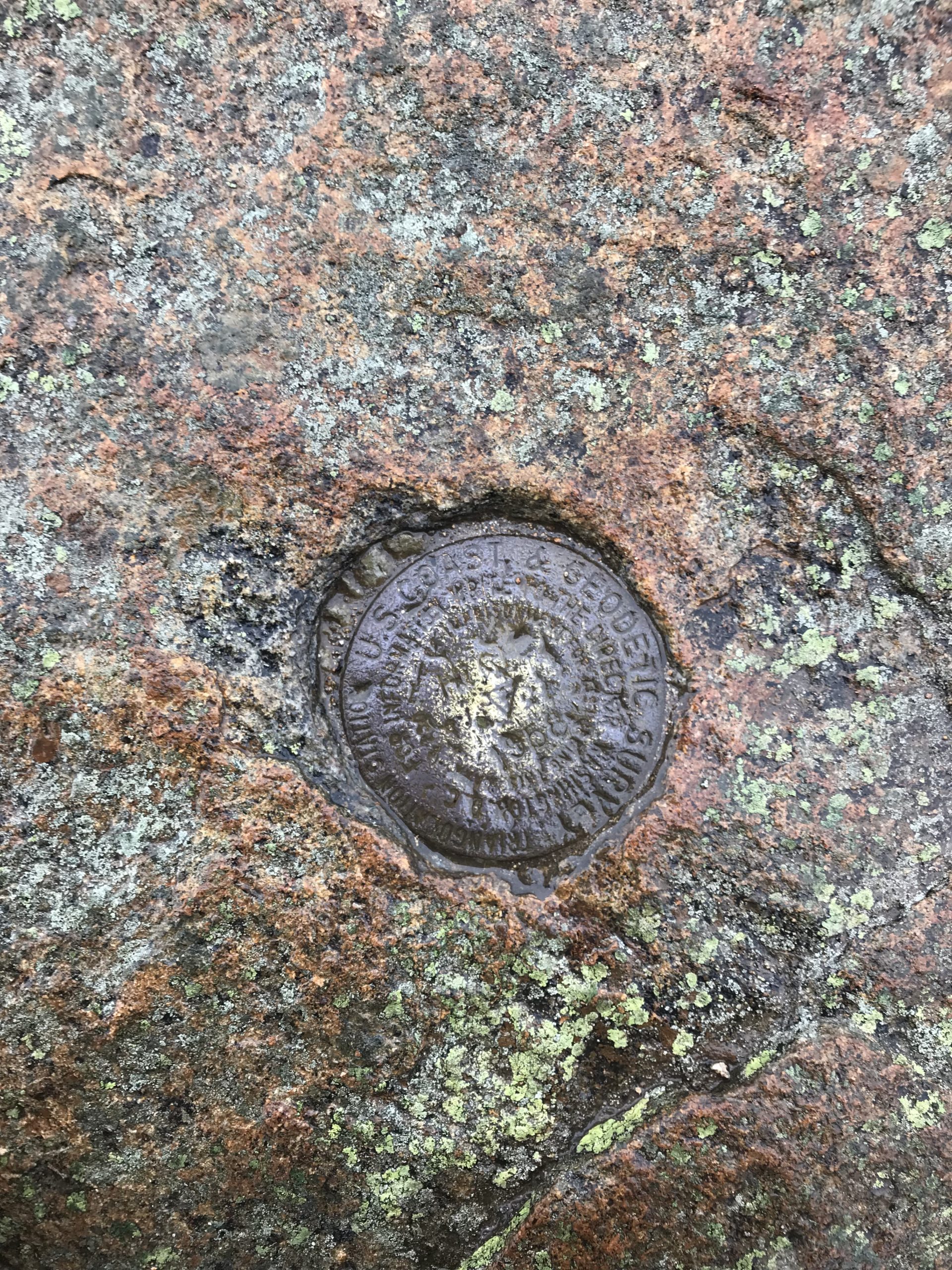
So because of the fog, I also did not take pictures when we summited Mount Lincoln which would have been my first New Hampshire 4,000 footer. Mount Lincoln sits at 5,089′ and is the 7th highest of the White Mountains.
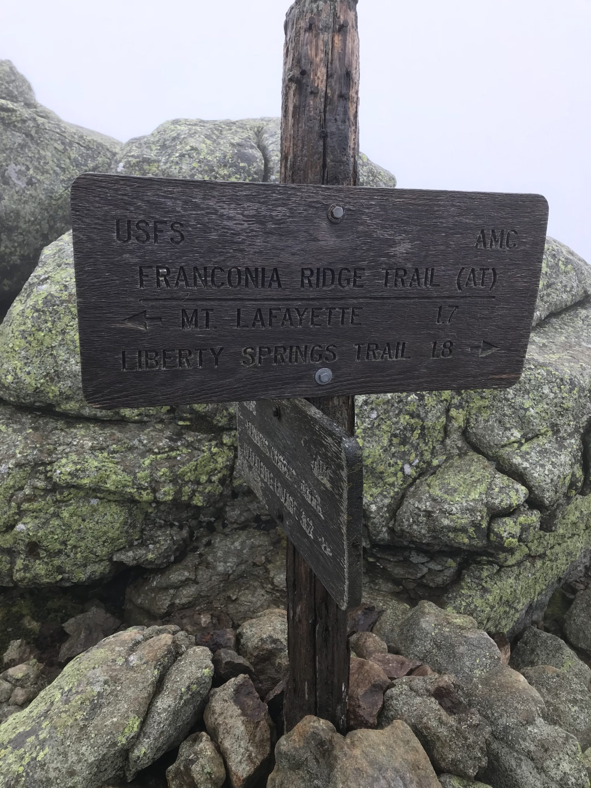
Mount Lafayette – Highest Mountain on Franconia ridge
I did take a picture of the marker when we summited Mount Lafayette and the wooden sign. This peak sits at 5,260′ and is the highest White Mountain outside of the Presidential Range. This puts it at number six out of forty-eight.
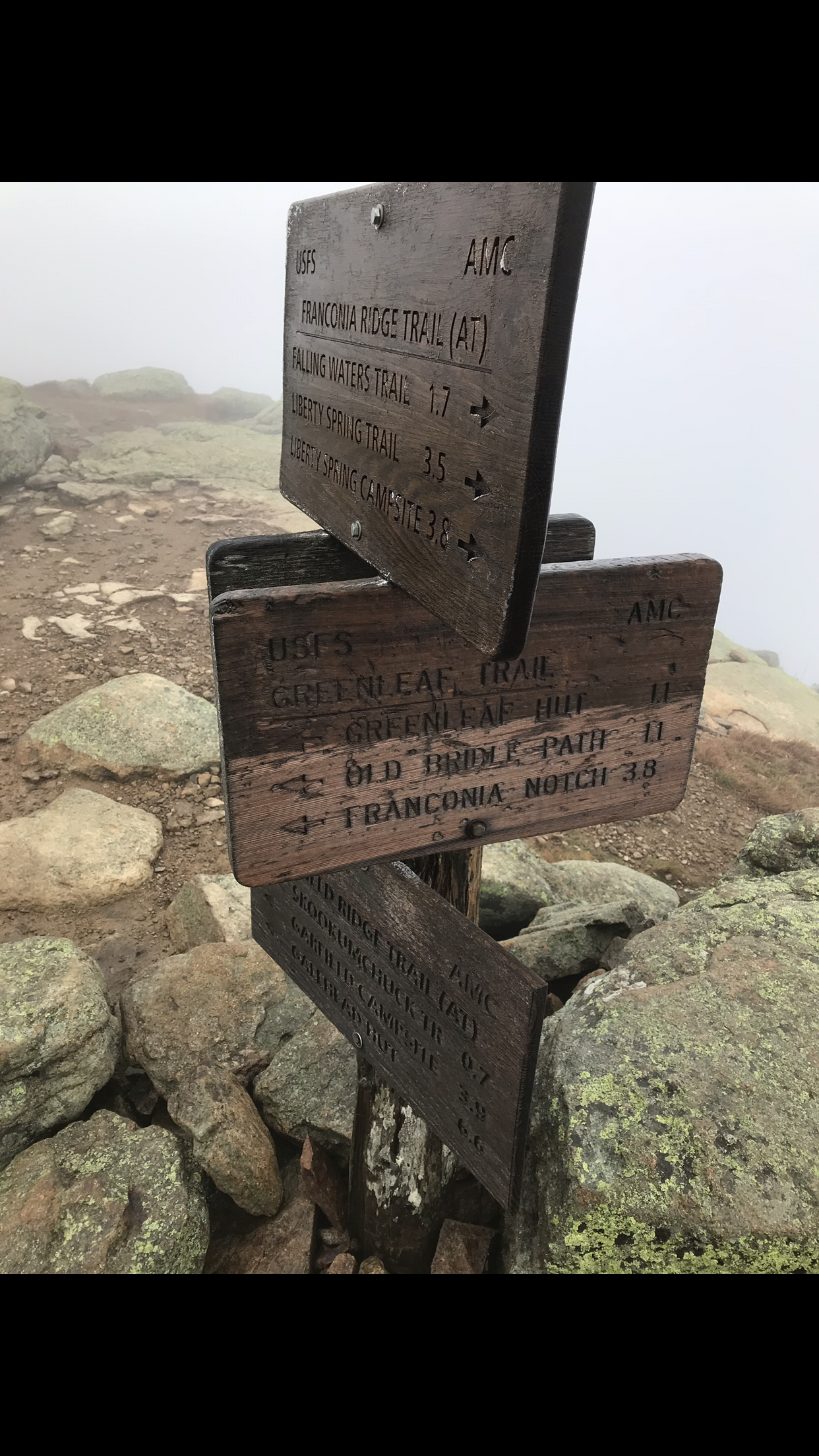
While we rehydrated and recouped on the summit behind a rock for wind cover, our hats started to freeze up. That was about time when we decided it was best that we get moving. On the sign above you will see “Franconia Notch 3.8 Miles.” That is the way you would want to go if you parked where we did.
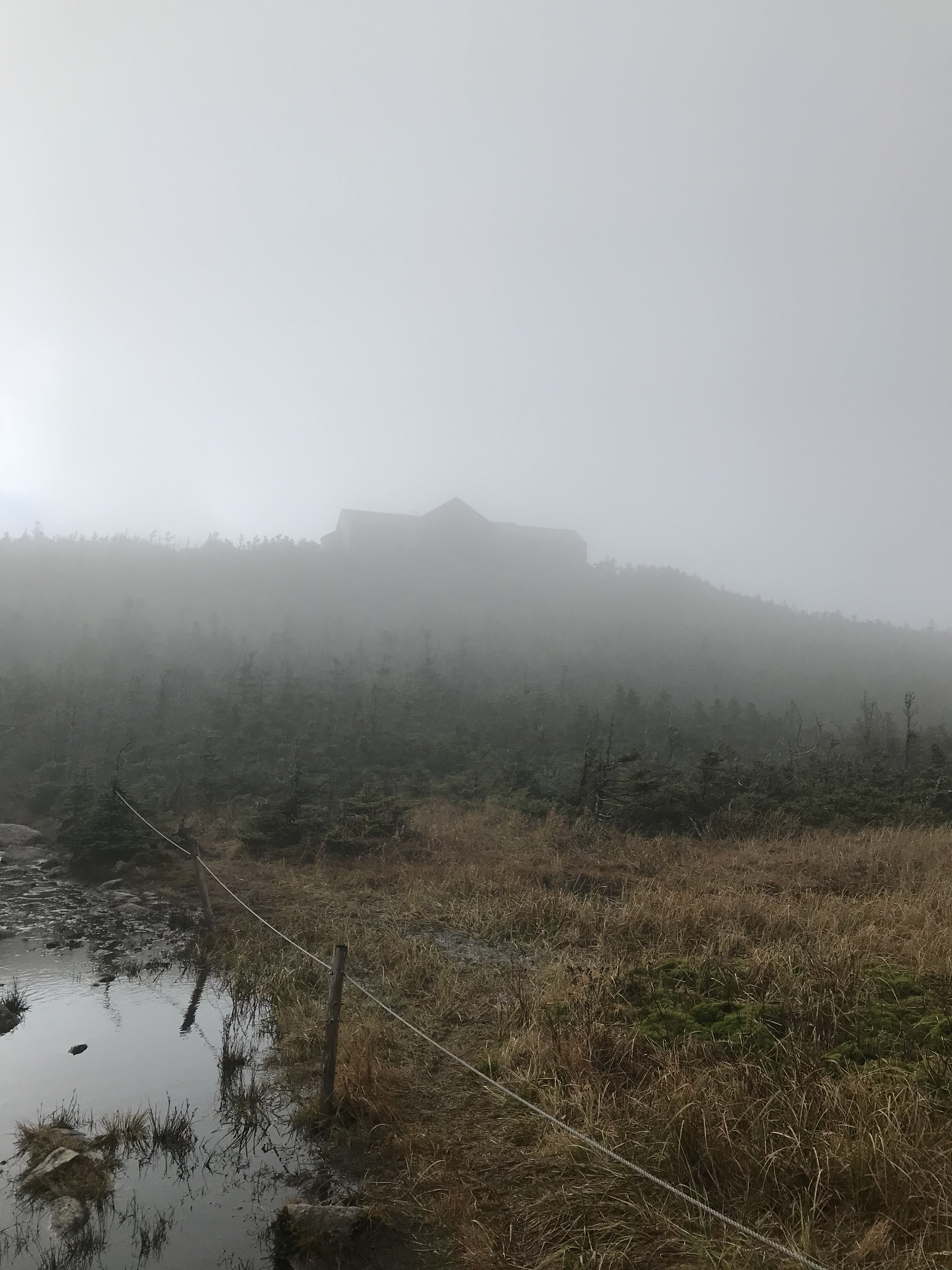
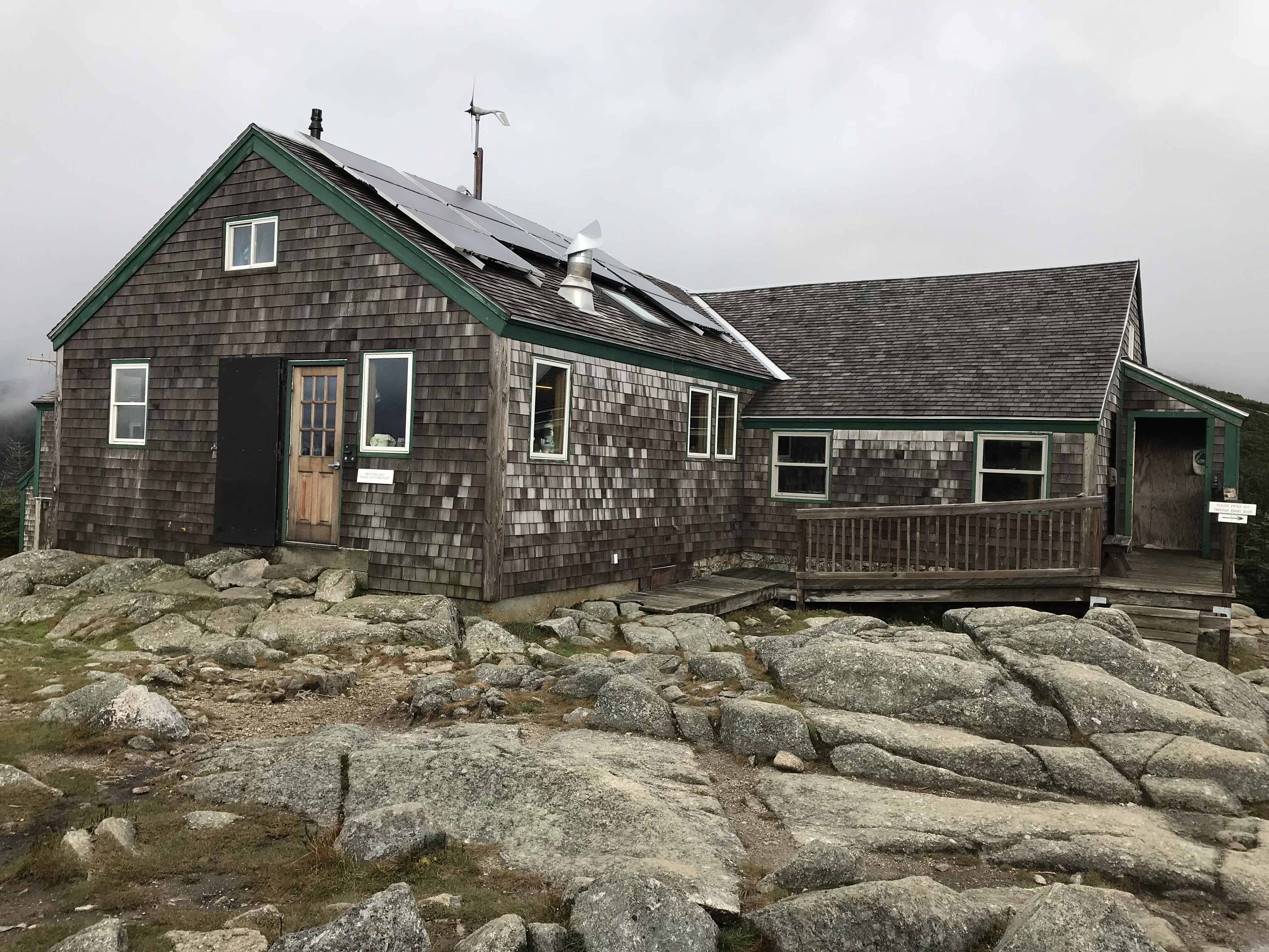
Greenleaf Hut
We made our way down Mount Lafayette excited to see what Greenleaf Hut was going to be like. Its 1.1 miles from the sign above and I heard that these huts in the White Mountains were pretty nice. As we hiked, the hut was barely visible in the fog and it made for a cool photo.
Greenleaf hut was cozy inside and for $1 you can get yourself a hot cup of coffee. There was also tea and a small variety of drinks. They also had some snacks that could be purchased. Inside you can take a seat at one of the tables and rest if you need it. My brother and I only stopped to check it out before continuing on our way. Near the hut there is a beautiful pond and your next sign that will point you in your next direction. You are going to want to take Bridle Path down if you want to end up back at Franconia Notch.
You will now be following yellow markers for the remainder of your way to the trailhead.
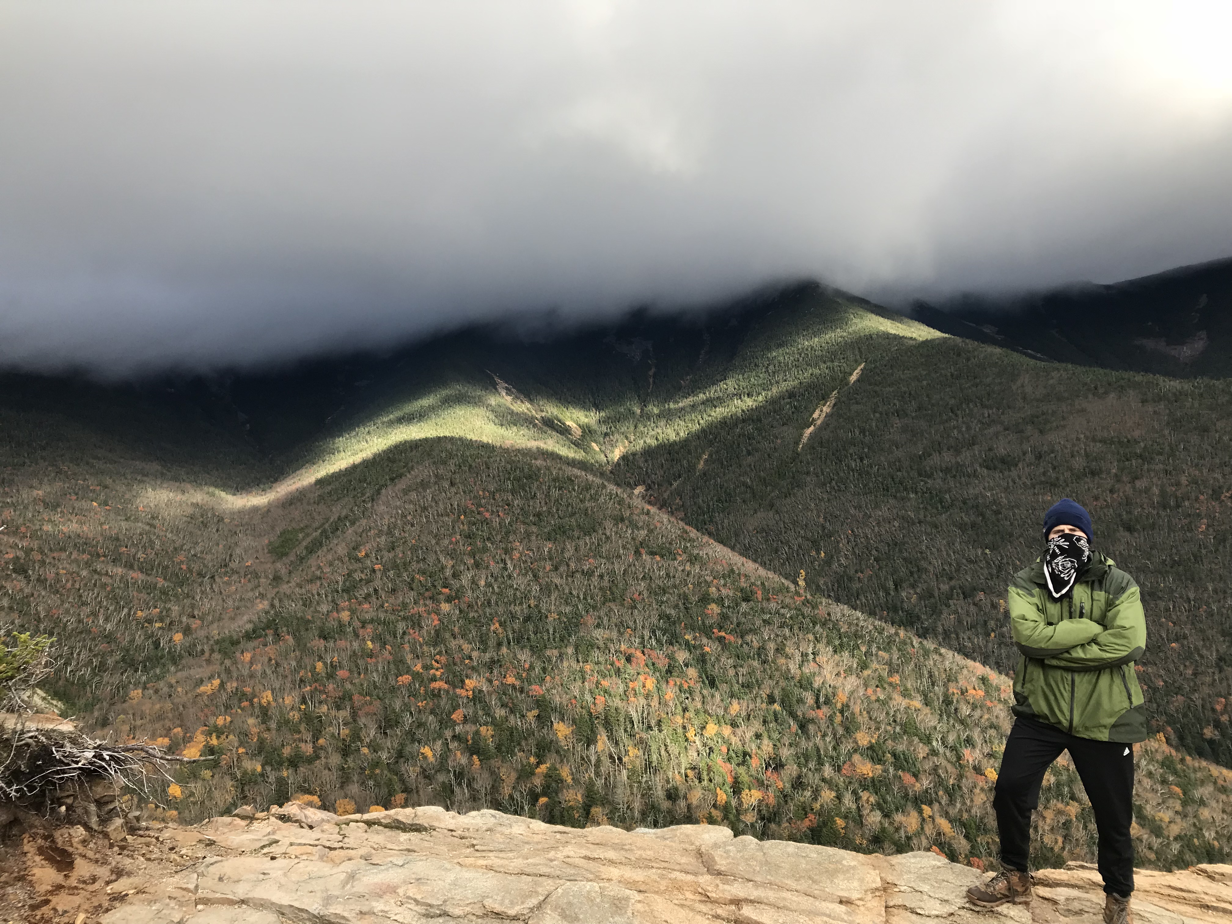
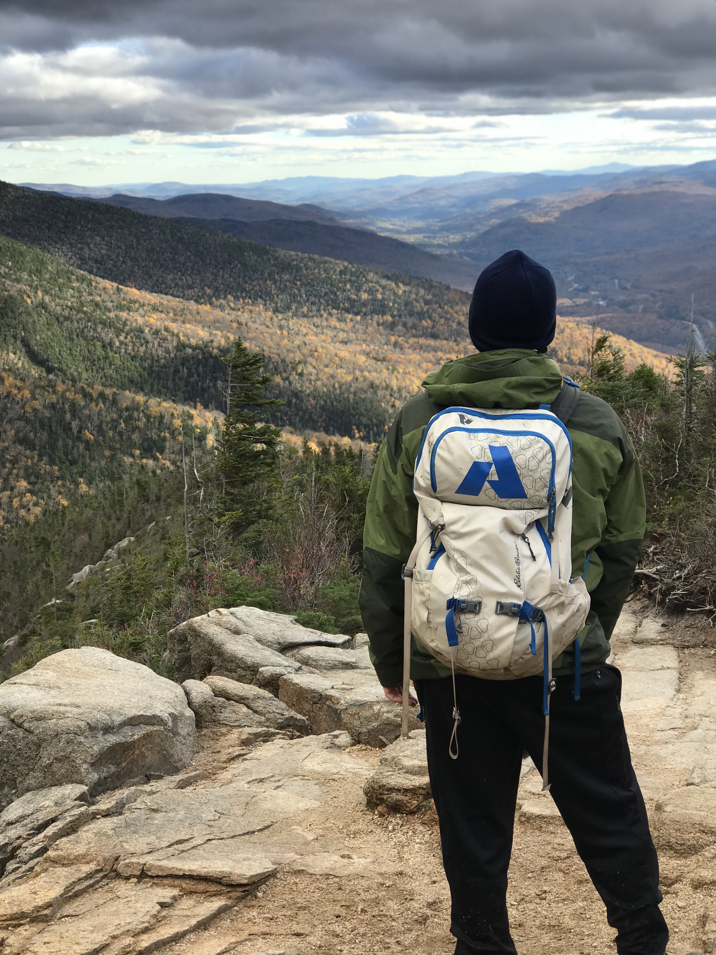
Finally Got Some Views!
On our way down we were finally rewarded with some amazing views of the White Mountain National Forest. I could not have imagined what it would have looked like if it was clear on the ridge. We took numerous photos on our way, especially of what Franconia Ridge looked like from below the clouds we trekked through.
Back to The Car
We finally got back to the car around 5:15 PM a bit tired from lack of sleep and battling the winds like warriors. The best part about a long hike in the cold….the hot shower and food that comes after.
Dog-Friendly
We did see some dogs on this trail. I would say it is definitely doable for a dog to hike along this trail if it can handle the distance of 9-ish miles. It goes without saying to just bring enough water for yourself and the dog. There weren’t any technical spots that a dog would have issue with. As far as weather, it is probably best to not bring your dog in the conditions that we hiked in. It was very windy and I love dogs so their safety is paramount.
Family-Friendly
I would say that the Franconia Ridge hike is family friendly if the weather is fair. As long as every family member can deal with the distance of 9 miles, then you should be fine. Also, if any family member doesn’t do well with heights, I don’t know if this is the right hike for them. For a majority of the ridge you are exposed to the elements and you can see every drop off. There have been deaths on this trail and many other deaths in the White Mountains. I cannot stress enough to BE PREPARED. Pack extra layers, extra food, an emergency blanket….the weather on mountains can be volatile.
Clothes Worn for franconia ridge
- Timberland Boots
- Wool socks
- Nike Pro Leggings
- Long Johns
- Athletic shorts
- Adidas sweatpants
- Adidas t-shirt
- LL Bean two-part jacket (consists of mid layer and outer-shell
- Beanie
- Trapper hat
- Bandana
- Gloves
Gear Brought for franconia ridge hike
- 4.5L of water
- Granola bars, trail mix, peanut butter sandwich
- Wind/Rain pants
- Gloves
- Extra layers (UnderArmour)
- Extra hiking socks
- Knife
- Paracord and two carabiners
- Water-proof matches
- LifeStraw (water filtration, costs about $20)
- Adhesive body warmer
- Balaclava
- Trekking poles (A MUST => weight off knees, test how deep mud is, etc)
- First-Aid Kit
RTW Note
As far as the Franconia Ridge goes….it was conquered. She put up a good fight trying to deter my brother and I with heavy winds, low visibility, and cold weather…but it was not enough to defeat a Road Trip Warrior. I hope you all continue to adventure as hard as I do and never stop exploring. Embrace a bit of your wild side. Lastly, I hope this was helpful and informative. New Hampshire is full of great outdoor recreation and I look forward to going back!
Don’t be afraid to hit the like/follow button 🙂
-Ant