
An 18 Mile Journey Through the Adirondacks
What is going on my Road Trip Warriors!? I am extremely excited to be able to tell you about another trip I went on with my brother, Alex, and my best pal, Adam. The reason for such excitement is that the hike we undertook was THE most scenic hike I have been on thus far. Our trip entailed a beautiful waterfall, Indian Head, Fish Hawk Cliffs, and to top it off, Mount Colvin! It was a long, but rewarding day and it allowed me to understand the true beauty the Adirondacks have to offer.
Beginning Our Trek at the Ausable Club
We hit the Ausable Road lot around 8:30AM (8/20/18) and put on our boots, got our bags together, and headed a half mile up towards the Ausable Club. On the way up we were able to admire the beautiful golf course the club offers with the mountains towering beyond it. Once we hit Lake Road, we turned left in-between the two tennis courts and continued between some smaller houses for a bit.
Soon, we reached where the sign-in sheet was at the beginning of the dirt road. There are many different trails in the Adirondack Mountain Reserve (AMR) so be sure to jot down your information here. At the bottom of this post, I will include a list of all the trails/mountains that can be hiked that I came across. After signing in, we walked past the wooden AMR sign and down the dirt road. This dirt road extends for about 3.5 miles and after walking just about 2.5 miles, we reached the sign for Indian Head and Mount Colvin.
Trail to Indian Head
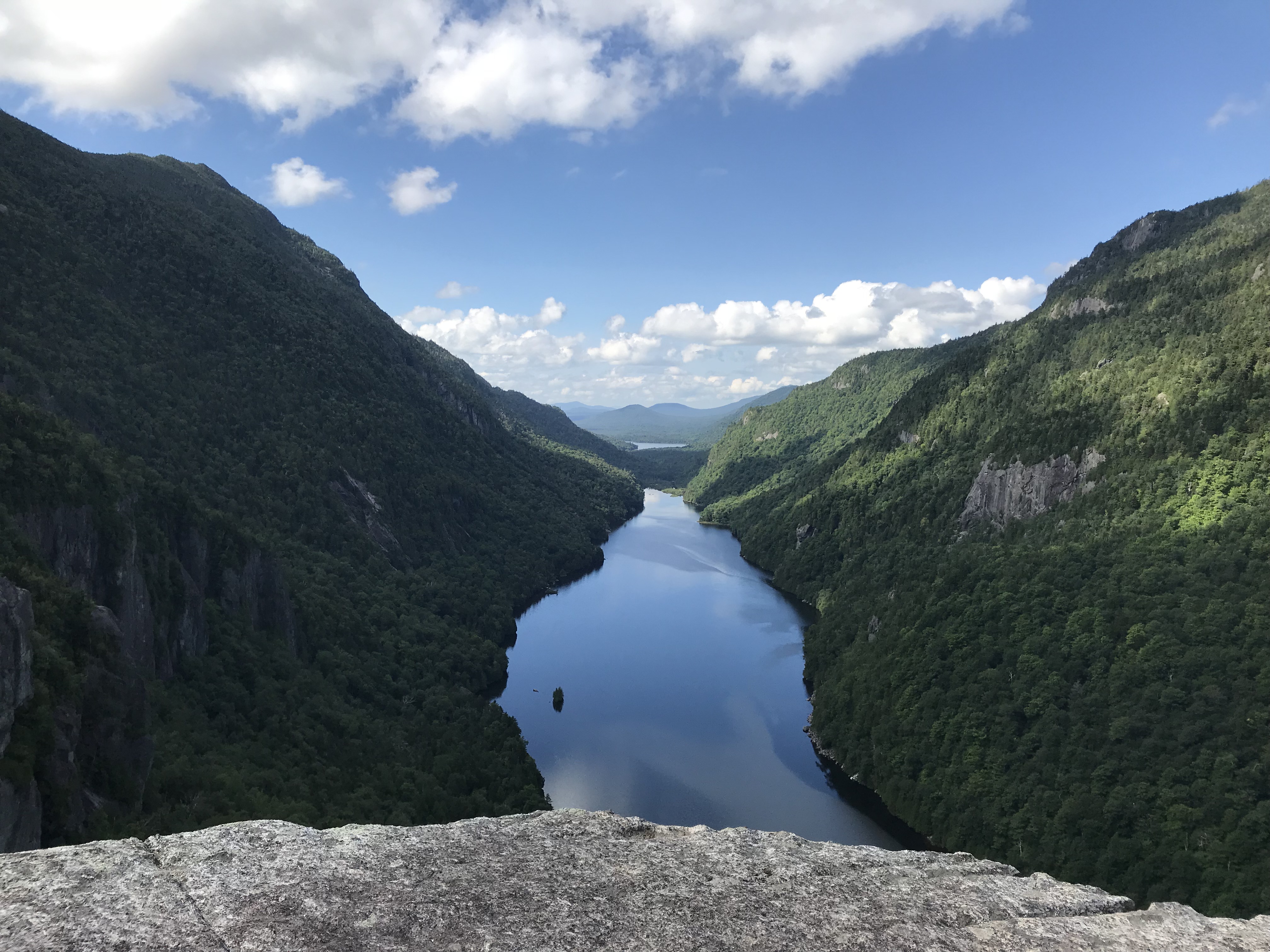
We followed the trail which was adjacent to Gill Brook. Eventually, on our left we were able to observe a beautiful waterfall. We stopped to take pictures and continued to make our way. As we continued to walk through the woods, we came across a sign. The trail split and to our right was Indian Head where as to our left was Nippletop Mountain and Mount Colvin. We had heard nothing but amazing things about Indian Head so we decided to hit that location first.
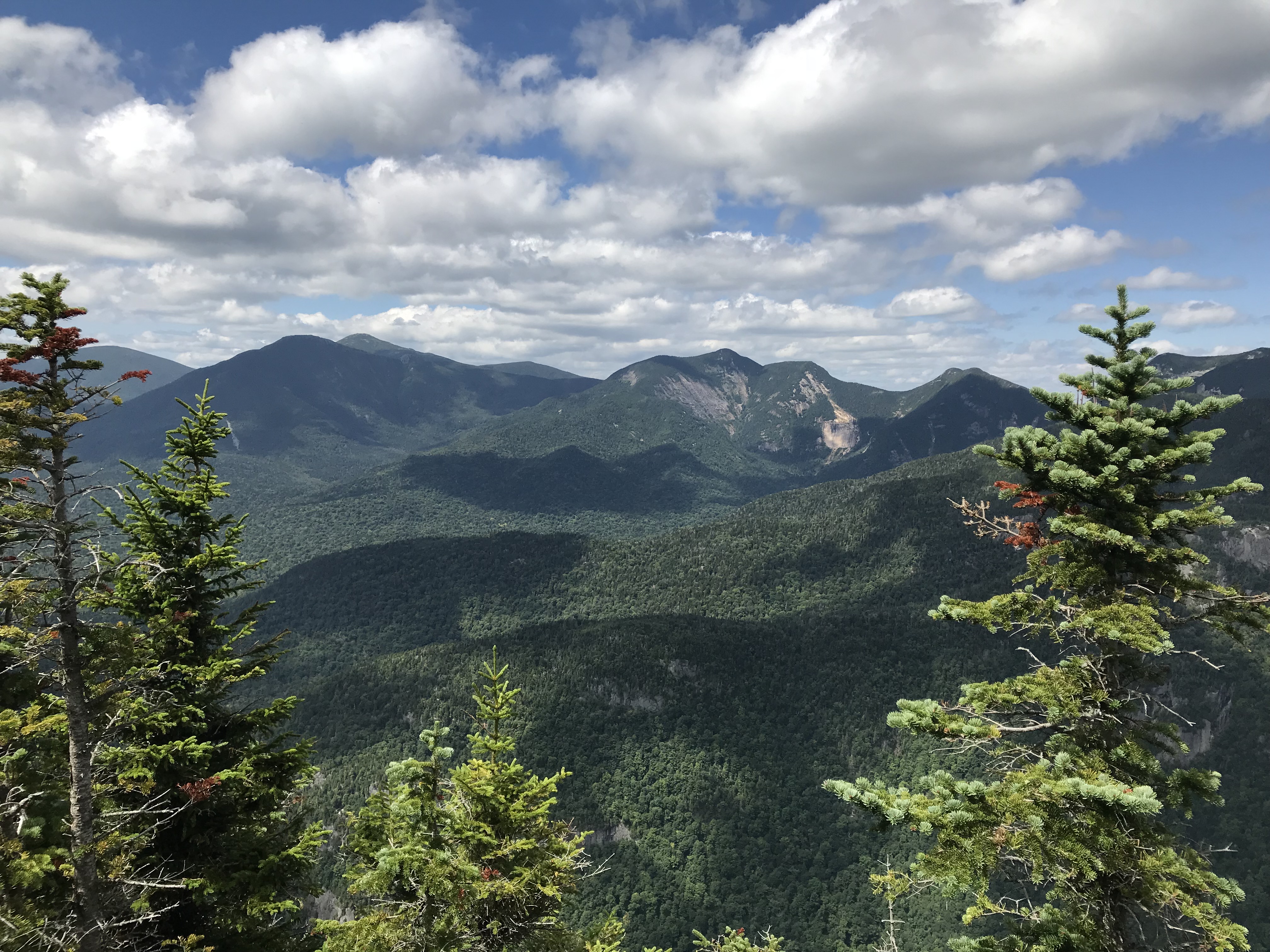
The trail was not difficult whatsoever. The occasional easy rock scramble and a gradual ascent. We reached Indian Head at roughly 10:30 AM and had the place to ourselves. When I first laid eyes on this iconic destination in the heart of the Adirondacks…it was almost surreal. Tucked away in the valley below was Lower Ausable Lake. Beautiful dark green trees cover the mountains on both sides of the lake. The lake was void of any human activity giving it a complete stillness, and there was a very light breeze. We decided to enjoy the serenity of it all before we took dozens upon dozens of pictures and videos. If I have any recommendation to anyone whom enjoys the outdoors, it would be to visit Indian Head in the Adirondacks as it’s beauty is unparalleled.
Onward to Fish Hawk Cliffs
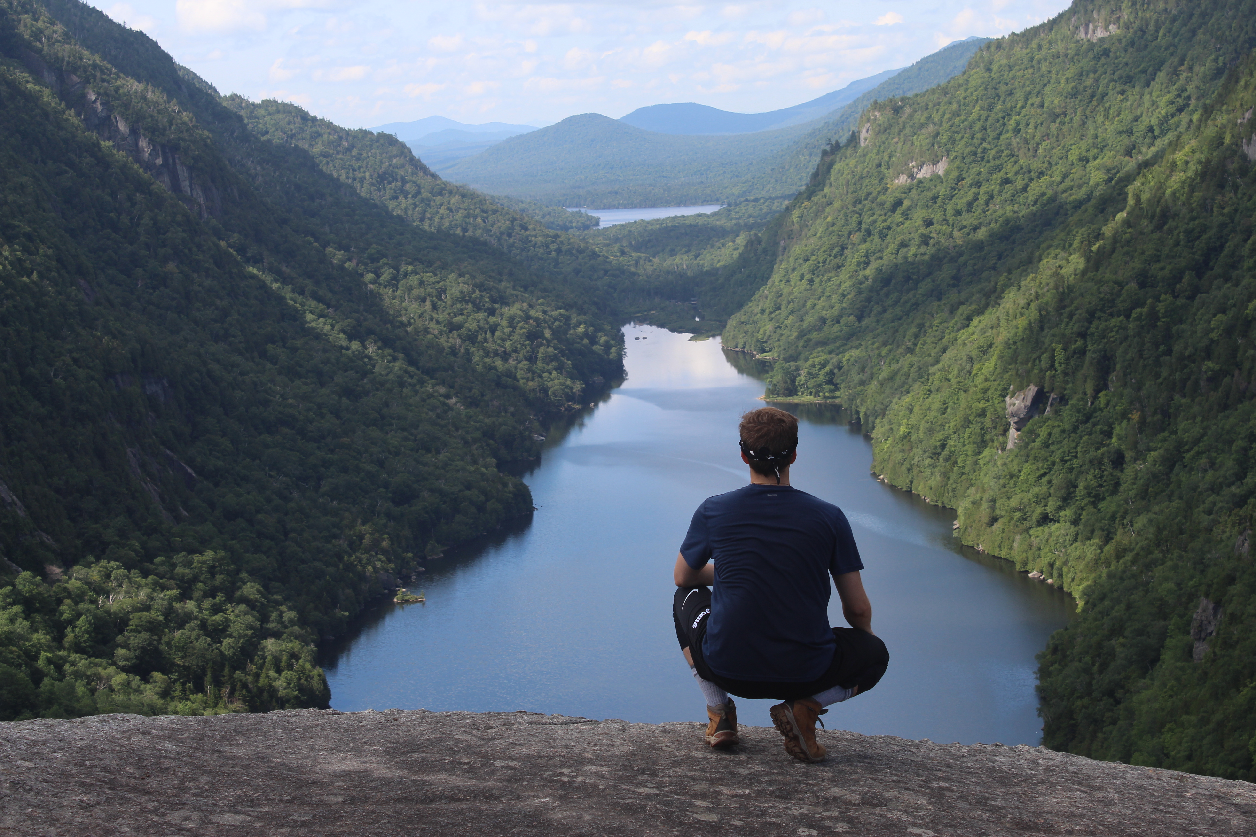
After eating and hanging out at Indian Head for about a half an hour we decided that we would hit Fish Hawk Cliffs. Seeing that it was along the trail we were following and only a short distance from where we were, it only made sense. We followed a steep, but short descent to the cliffs where it allowed us a new vantage point of Lower Ausable Lake. From here we could see an individual paddle-boarding among the glass-like water. Yes, I was extremely jealous because I have always wanted to do such an activity in a secluded location. As far as taking photos at this location, we did not take any. The reason being is that it was just another view of what we saw at Indian Head and we wanted to advance towards Mount Colvin.
Mount Colvin, Here We Come
We left Fish Hawk Cliffs and followed the trail that pointed us towards Colvin (wooden sign that says “Colvin”). The trail was muddy, the surrounding plants were bright green, and different colored fungus were littered among the plants. Not before long, we reached a split in the trail. To the left the sign stated that Nippletop Mountain was 1.9 miles away. To our right the sign stated that Mount Colvin was 1.1 miles away along with Blake Peak being 2.4 miles away from our position. Always being overeager, we planned on hitting both High Peaks and headed towards our right.
In my opinion, the climb on the trail was rather forgiving. It would ascend gradually for significant time with a sporadic flattening of the trail allowing our legs to..somewhat recover. This trail was very muddy and we had to watch our step so we did not sink into 4 inches of mud/water. As we made our way through the woods, we realized that the sign we saw stating Colvin was only 1.1 miles away had to be incorrect. It did not seem like there was an end in sight.
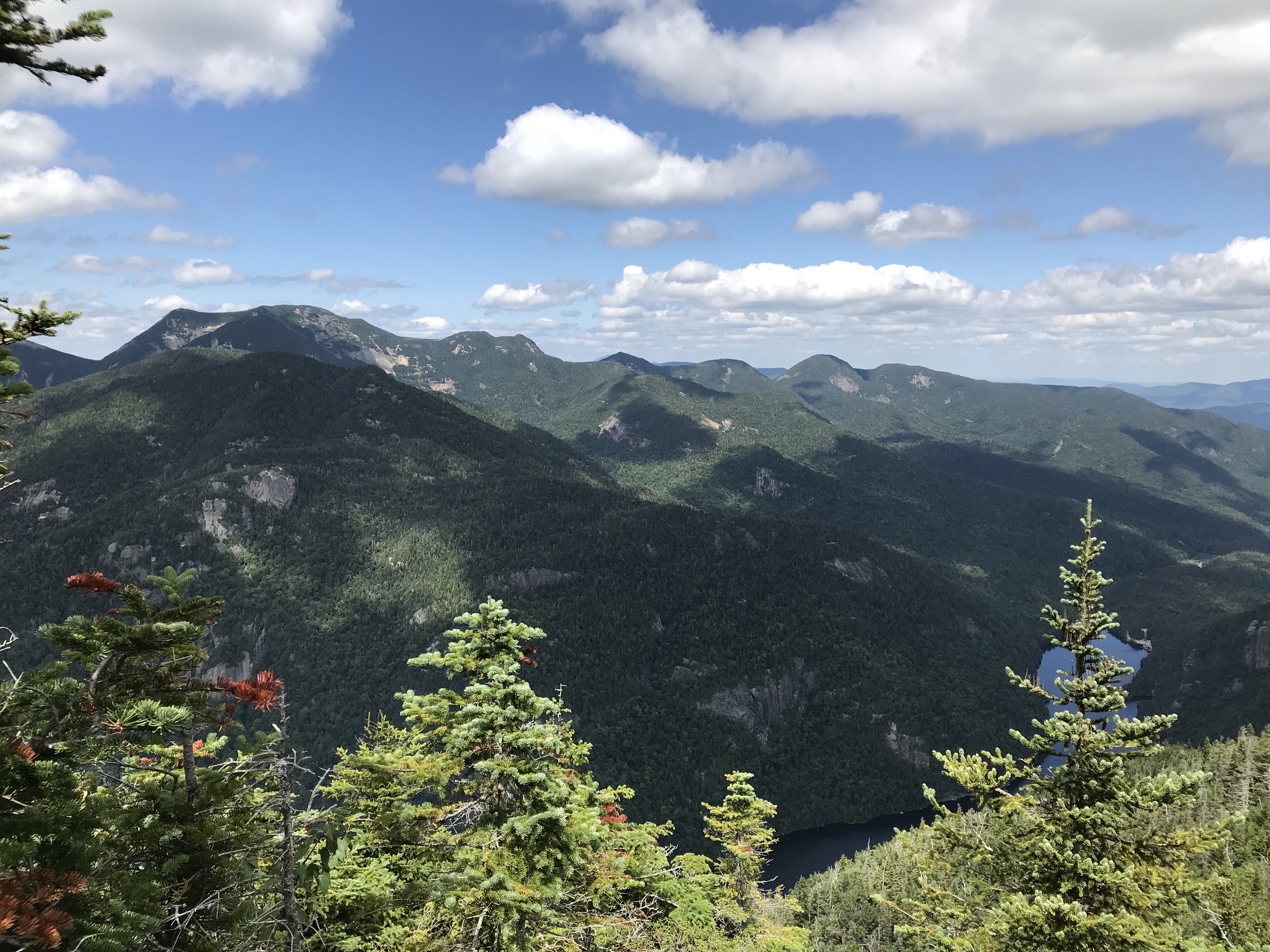
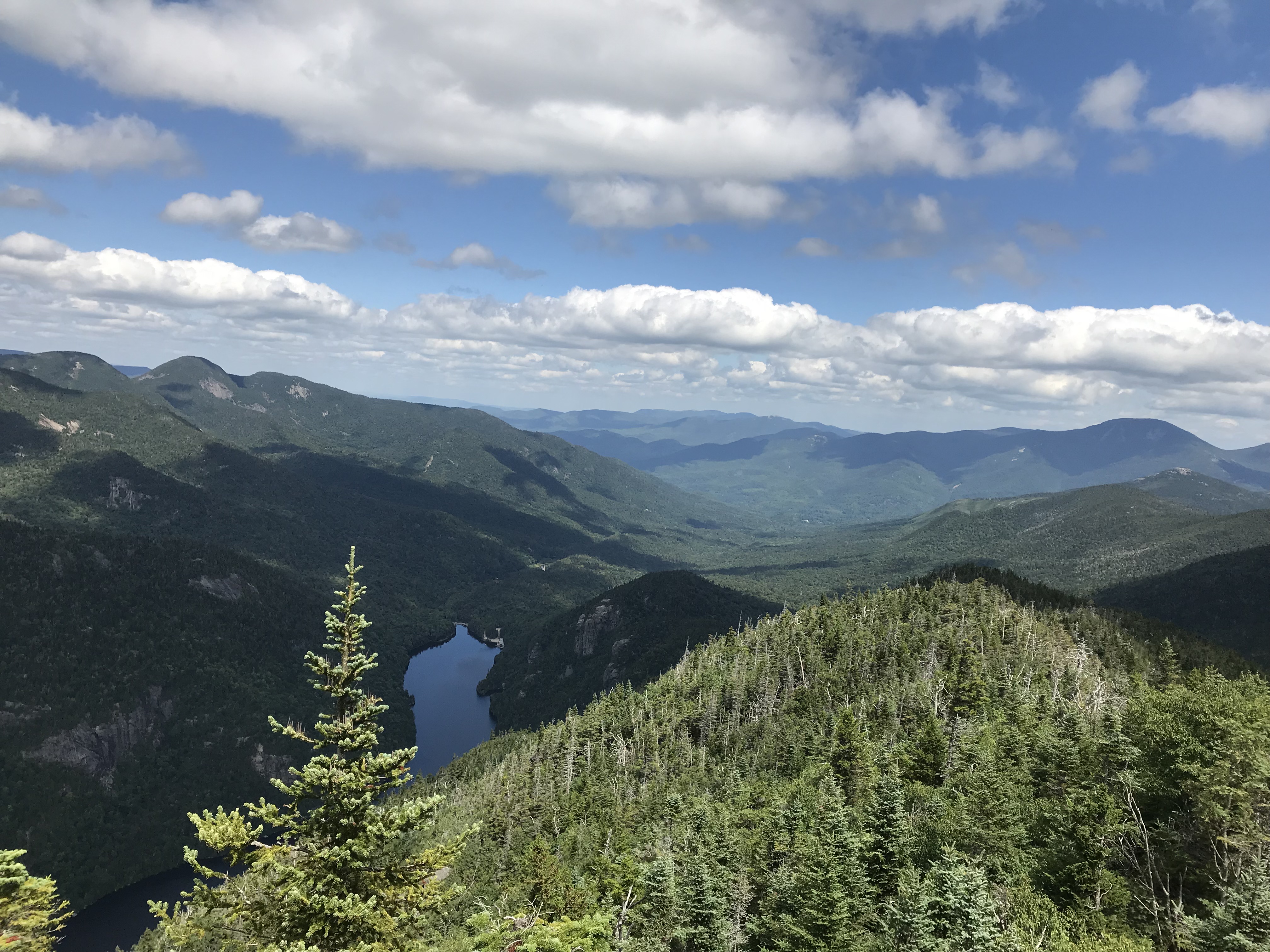
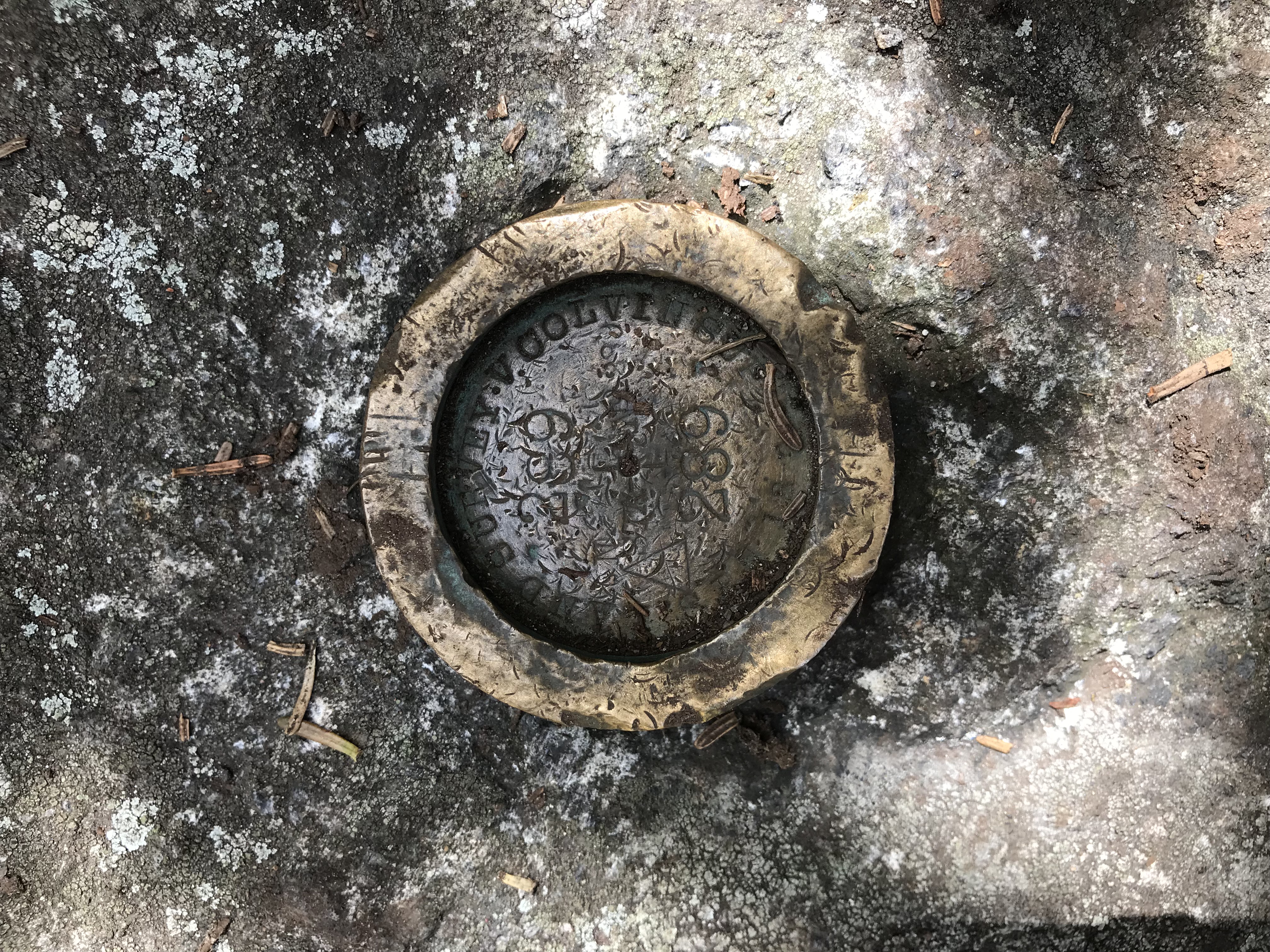
We came across a few tricky rock scrambles that were quite steep. While climbing these, a group of three hikers whom had just completed Colvin crossed our path. They insisted that we did not have much further to go and we joked how the sign had to of had the mileage wrong. After one last rock scramble, we had reached the summit of Mount Colvin (4057′).
This peak is at the smaller end of the 46 High Peaks, but offers astounding views of the surrounding High Peaks. From here the Dix Range is visible, Lower Ausable River, and Indian Head. We had this spot to ourselves as well and soaked in every minute eating, telling jokes, and taking pictures.
A Slight Error in Judgement
After talking it over and being the ambitious bunch that we are, we figured that Blake Peak was in our grasp. We started heading on the trail towards the second mountain that was roughly a mile or so away according to the sign. We descended further through mud and towards a valley between Colvin and Blake. Eventually, we finally saw how far we would have to hike down into the valley to then climb Blake Peak. After checking the time, the unanimous decision was made to head back to the car. Being about 6.5 miles from the lot, it would take significant time to get back. We had not planned to be hiking into the late evening either. Sometimes decisions have to be made whether you like them or not. Blake Peak is not going anywhere and we will be sure to come back for it!
Gear
I am not going to provide a picture of what I brought for this trip. The reason being is that it is essentially the same as the picture posted in the previous blogs. Some of the important items that I brought included:
- Canon Camera
- Five Water Bottles (I forgot to fill up my large water 32 ounce plastic containers)
- Wheat Thins, Larabars (fantastic and filling granola bars), almonds, and a peanut butter sandwich
- Knife
- First-Aid
- Paracord
- Bug-Spray
Other Trails/Mountains Accessed from the Ausable Lot
- Noonmark Mountain (Non High Peak)
- Round Mountain (Non High Peak)
- Dial & Nippletop Mountains via Leach Trail (High Peaks)
- Upper and Lower Wolfjaws (High Peaks)
- Cathedral Rocks (Hiking Trail, can include Pyramid Falls)
- Gothics & Armstrong (High Peaks)
- Mount Colvin & Blake Peak (High Peaks)
RTW Note
Thanks for taking the time to read about this adventure Road Trip Warriors! I hope it was helpful and that you enjoyed the photos. Thank you for taking the time to read this. Remember to get outside, leave no trace and take awesome photographs!
Pingback: Snowshoeing and Breaking Trail to Indian Head! – Road Trip Warriors