My Latest Expedition…
What up my fellow road trip warriors!? Let me tell you about the most recent adventure undertaken by yours truly and my comrades. My brother (Alex), my best pal (Adam), and I traveled up to Newcomb to the Dix Range to hike some Adirondack High Peaks. We had the best intentions of snagging all five peaks in this range (Macomb, South Dix, Grace Peak, Hough Peak, and Dix). Unfortunately, due to some setbacks, we could only manage to check two High Peaks off of the list. Let me start from the beginning.
Our First Setback
We get to the parking lot for the Dix Range trailhead and immediately see that we are screwed for parking. The lot was full at 8:00AM which threw a wrench in our plans. Parking in the overflow lot adds about a 2ish miles (could be less, felt like at least 2) extra trek down the dirt road. This added a total of 4 extra miles to our trip. This setback did not concern us though (we are road trip warriors after all). We decided to see how far we could make it and turn back when we ran out of time.
Hiking Macomb
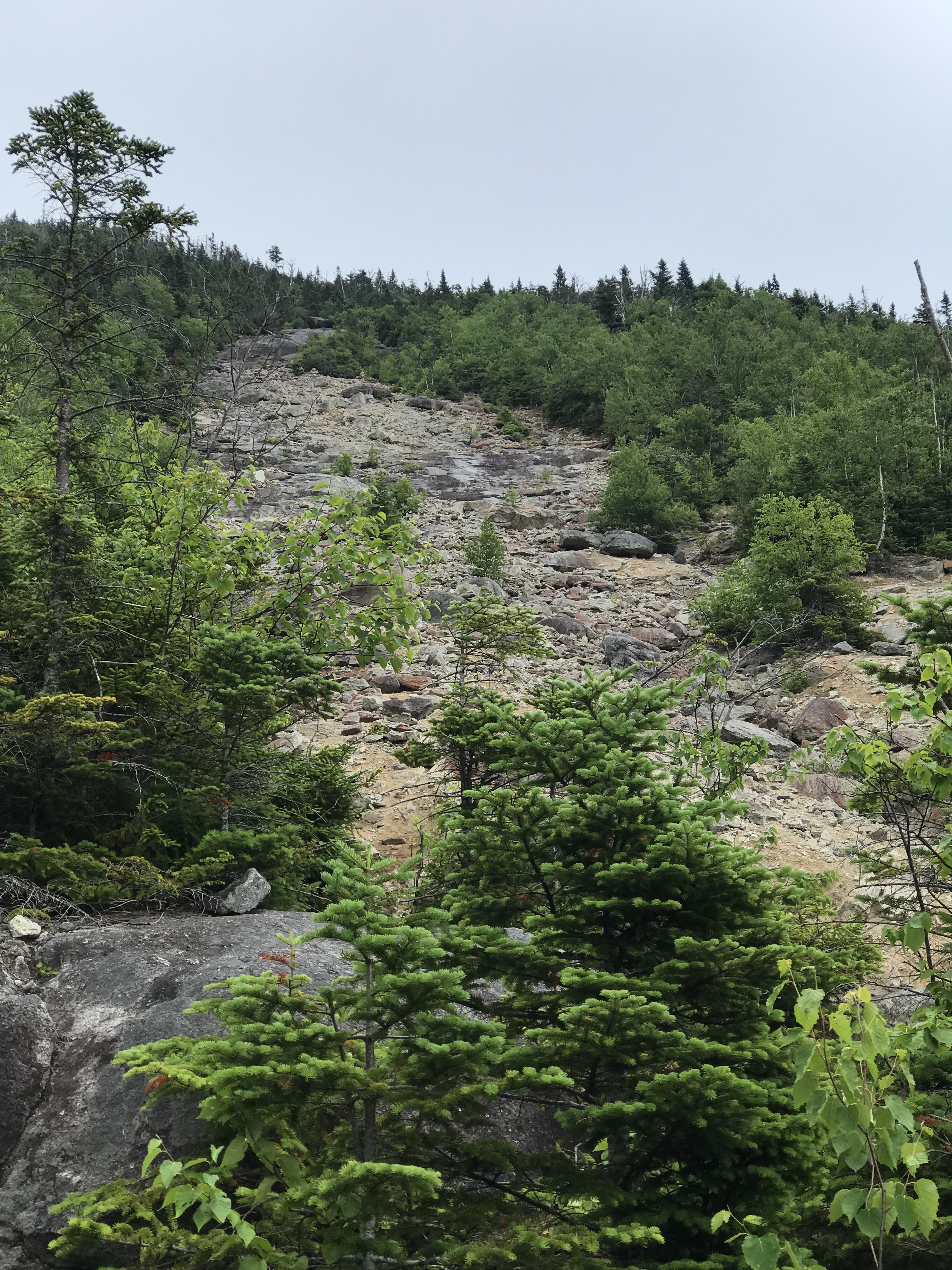
We hit the trailhead between 8:30AM-9:00AM and made our way towards the Slide Brook Lean-To roughly 2.3 miles from the trailhead. Once there, we took a right and walked through a campsite following the hiking path. The initial hike was not too strenuous. It was a gradual and steady incline, but enjoyable. This all changed once we hit the rock slide that we had to climb. The rock slide on Macomb is unlike anything I have hiked. The slide is all loose rock and dirt. If you are with a group (you should be, I do not advise hiking alone), I recommend not hiking behind one another. The rocks come loose and tumble down the slide with each step. Hiking on the far sides of the slide helped rather than trying to hike straight up it. It was exhilarating as it was dangerous, but we were extremely cautious along the way. Alex was tense the whole time as one of his fears is tumbling down a mountain. His humor about his impending doom was actually quite entertaining. The photo below does not do the slide any justice.
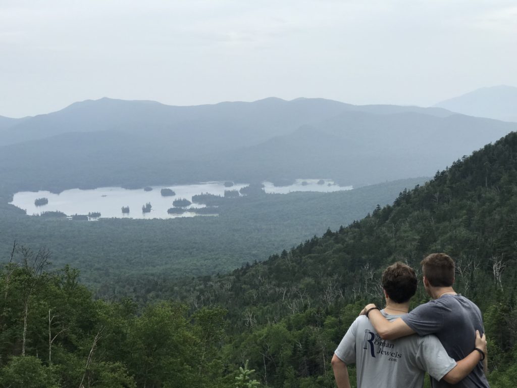
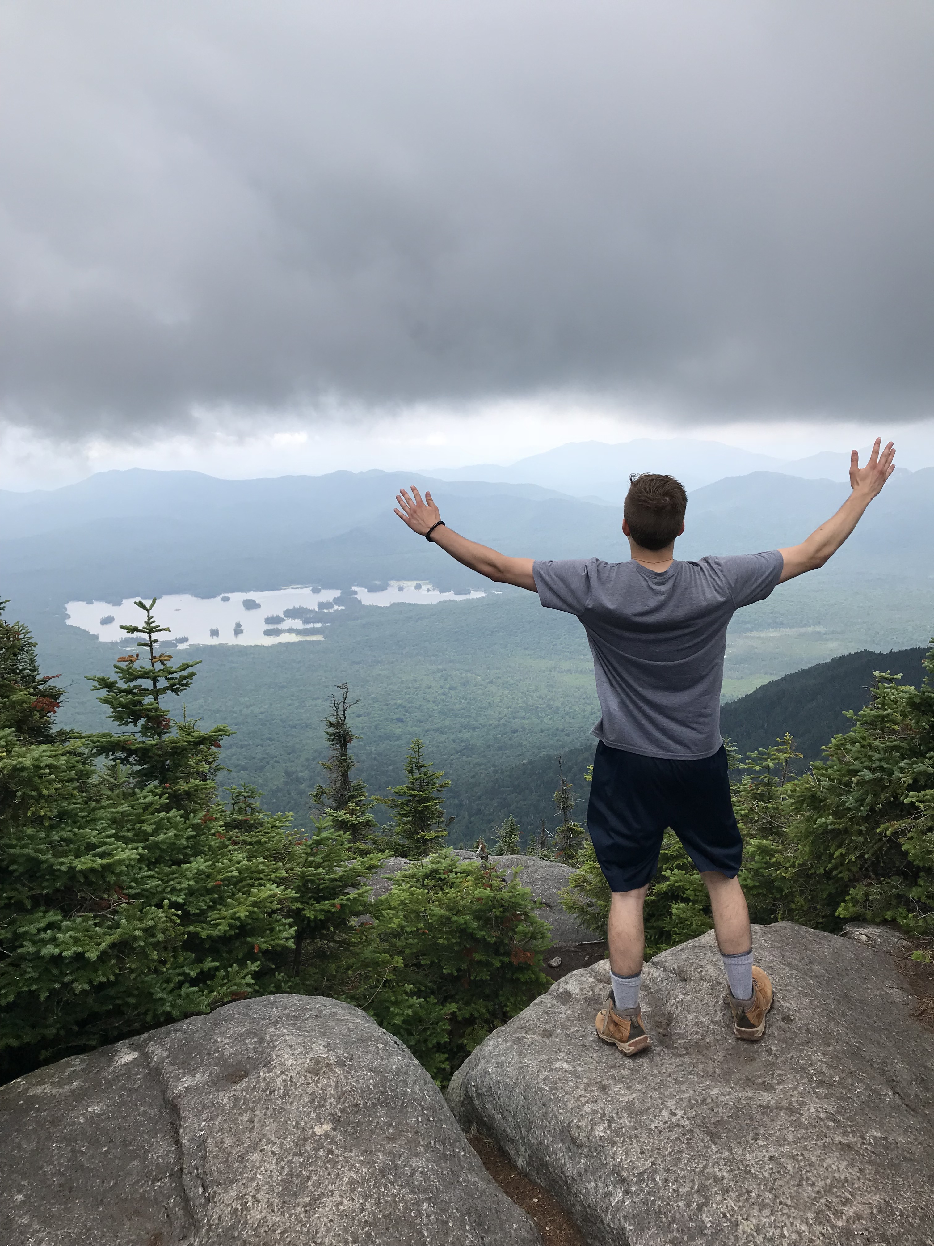
Following the slide, the hike still has a little bit of work. It maintains a pretty steep ascent, but it is not too much longer. I ended up on the summit of Macomb Mountain around roughly 12:15PM. The view from the summit is amazing as you can see Elk Lake in the distance. It was a great place to chill out and snack on some food for about twenty minutes. We then set our sights on South Dix. Some of the views from the summit of Macomb Mountain below.
South Dix
Once you get up onto Macomb, getting to South Dix is rather easy. Follow the herd path (was very easy to follow) for about .7 of a mile. It will bring you down Macomb for a bit and you will find some rock scrambles to climb. They are relatively simple to hike up. Before moving forward, make sure you turn around and enjoy the view of Macomb mountain as it towers over you. After climbing the scrambles, follow the herd path through the trees and keep on the lookout for a yellow tag nailed to a tree. This yellow tag displays that you have reached the summit of South Dix. It is also carved into the tree itself. Take the time to walk around the area on this mountain as it offers some amazing views.

Back to the car (Helpful tip here – please read)
After taking numerous photos and hanging out on South Dix, we realized we did not have time to head over to the other peaks. We decided to head back to the car. A ranger gave us a tip on how to avoid going back up and over Macomb and going down that loose rockslide like we saw others doing. Tip- When following the herd path toward South Dix, you encounter a cairn before the rock scrambles. There are stones piled up to lead you towards South Dix. When heading back towards Macomb, at this cairn, take a right. It will bring you around Macomb allowing you to avoid going back up and over it. The benefit here is not having to go down the loose rockslide. It is much safer and only has a couple of steep spots. The only downside to going around Macomb is that it adds a couple miles to your hike. Trust me when I say, the couple extra miles is the better option in terms of safety for yourself and for others hiking up that rockslide.
Conclusion
I hope this was helpful and insightful to any other road trip warriors out there or anyone looking to hike these two beautiful mountains. Remember to always clean up after yourself and leave these trails and forests the way you found them. This world is beautiful and as much as it deserves to be explored, it deserves to be maintained. Hike on my Road Trip Warriors!
Directions and Parking
We left Saratoga on 7/14/18 around 6:30AM and hopped onto I-87 Northbound. It was about an hour and twenty minutes drive until we pulled off at exit 29. Once off the exit, take a left onto Blue Ridge Road and drive down that baby for about four miles. Once you see Elk Lake Road, take a right and follow that dirt road until you reach the parking lot near the trailhead. This lot was full around 8:00AM on a Saturday as there are many camping areas around this mountain range. There is overflow parking on the way down Elk Lake Road that one can turn back and park on, but it adds significant distance to your hike (we had to, it sucked).
-Ant