Saranac 6er Number Four!
What up Road Trip Warriors!? It has been a few since I posted last! As soon as I got home from my road trip I started a new job and have been focused on that. I did get a hike in though that I wanted to share with you all! It was my fourth Saranac 6er mountain, Haystack, and it was TERRIBLE. I have never had a hike I disliked until this one. It had nothing to do with the length, incline, or any of that…..it was the mosquitoes!!!! I have never been attacked by more mosquitoes in my life while out in the woods…..anyways, I wanted to give you all some info about the hike and what to expect!
Summary of Haystack Mountain
- Difficulty: Easy-Moderate
- Length: 6.6 – 7 miles round trip
- Elevation: 2,878′ above sea level
- Hiking Time: It took us just under 2 hours to reach the summit. We didn’t take many breaks to avoid being eaten alive by mosquitoes…
- Photo Opportunities: The summit of Haystack offers some good views, but I wasn’t able to see them. It was extremely overcast and the fog was thick.
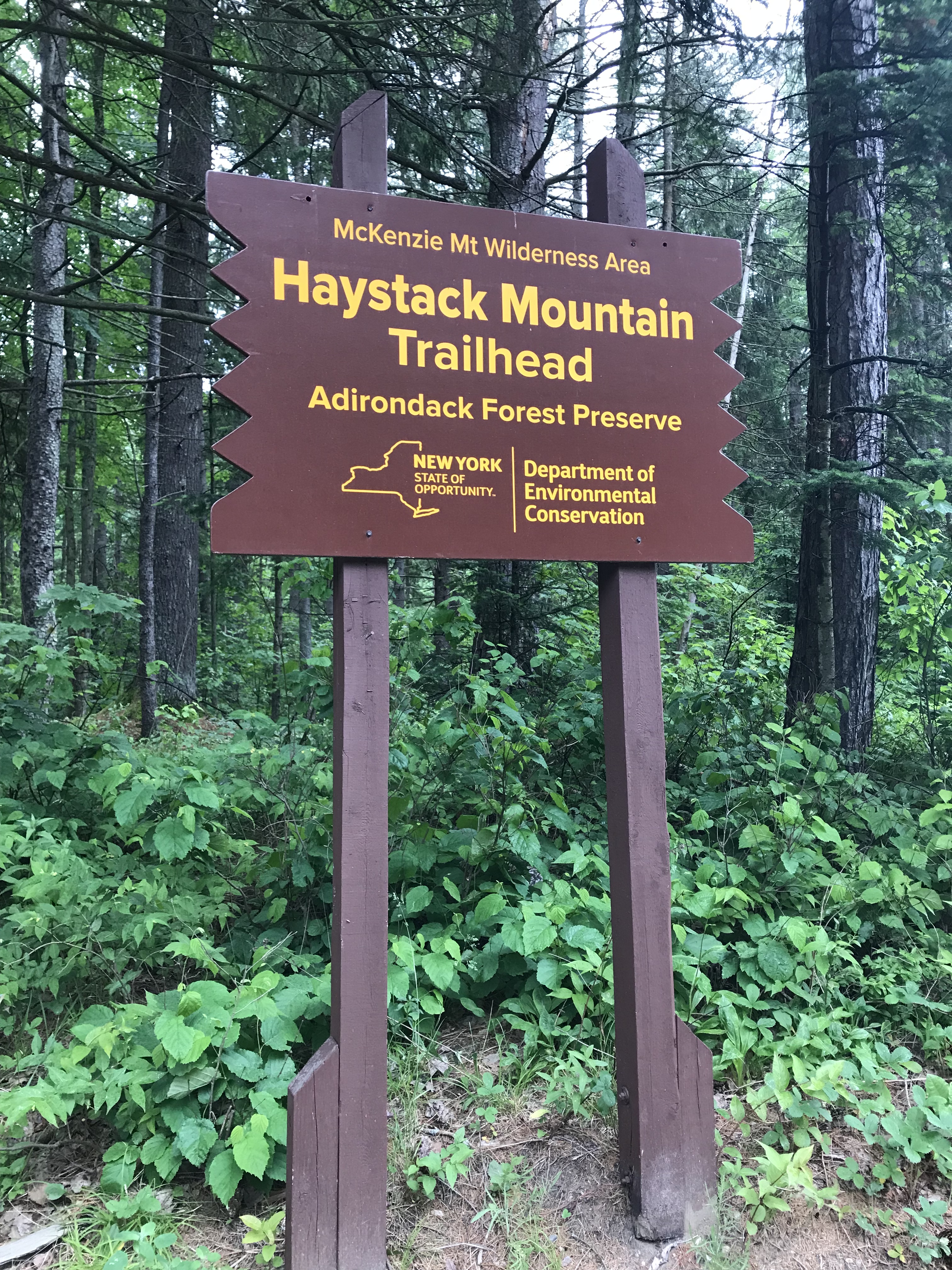
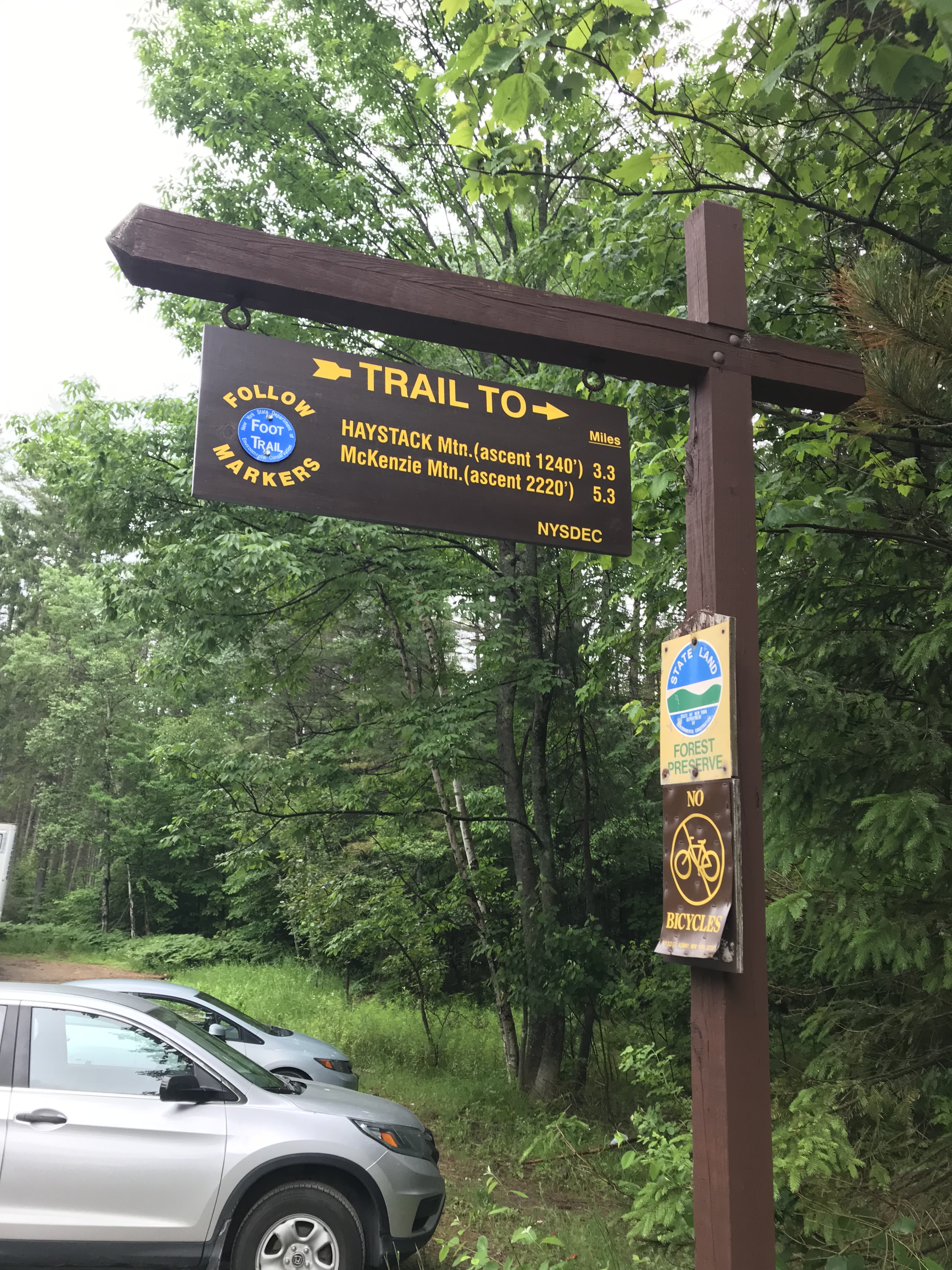
Beginning of the Hike
The trailhead is right off off Route 86 near Lake Placid. There is a large parking lot with a trailhead sign that is hard to miss. Here is a picture of the sign below.
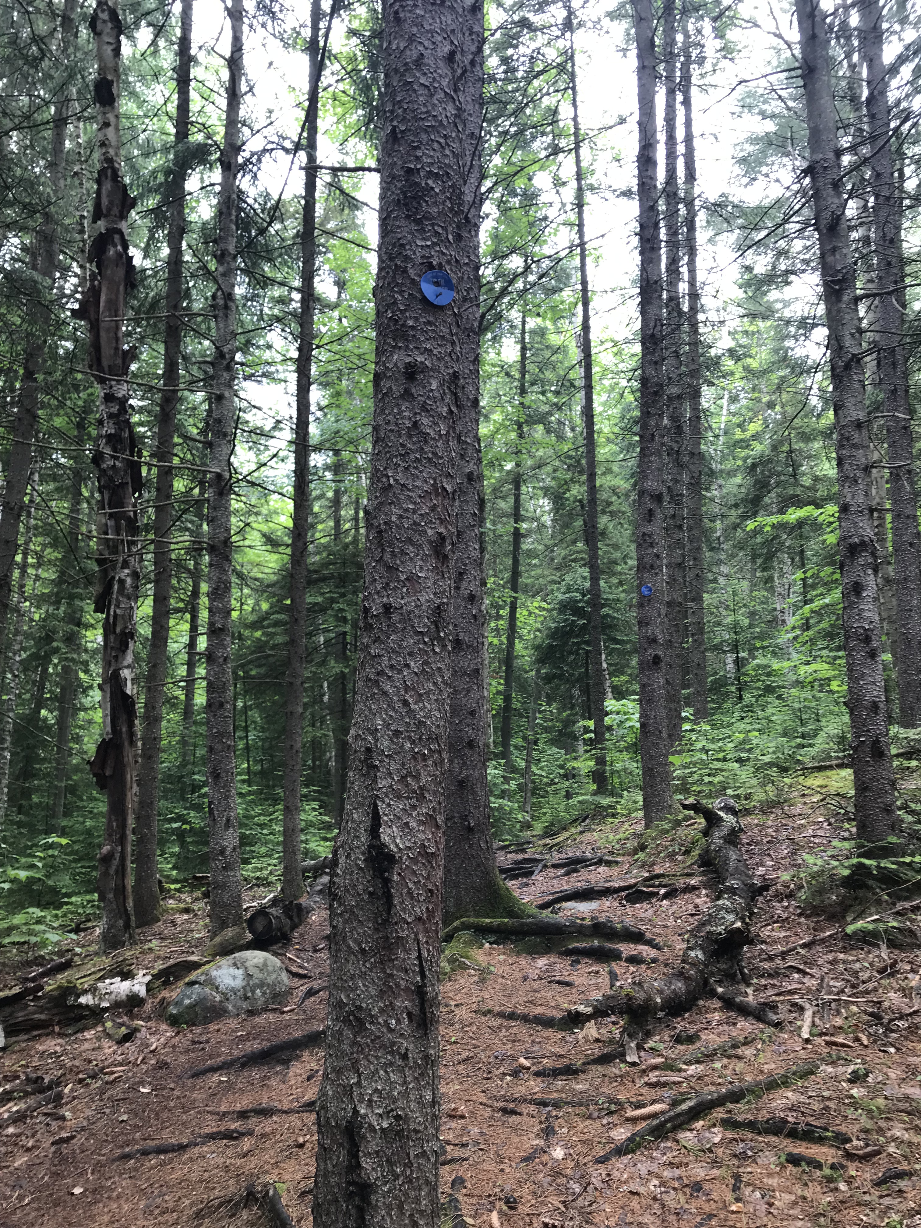
The Trail
The trail follows blue trail markers for a couple miles through thick woods. On the day we hiked this mountain, it had just rained and the amount of moisture in the air made the hike more daunting. The trail traverses a few small streams and occasionally the streams flow alongside the trail. None of this was helping the mosquito situation. Below is one of the blue trail markers that you’ll be following along the trail to Haystack.
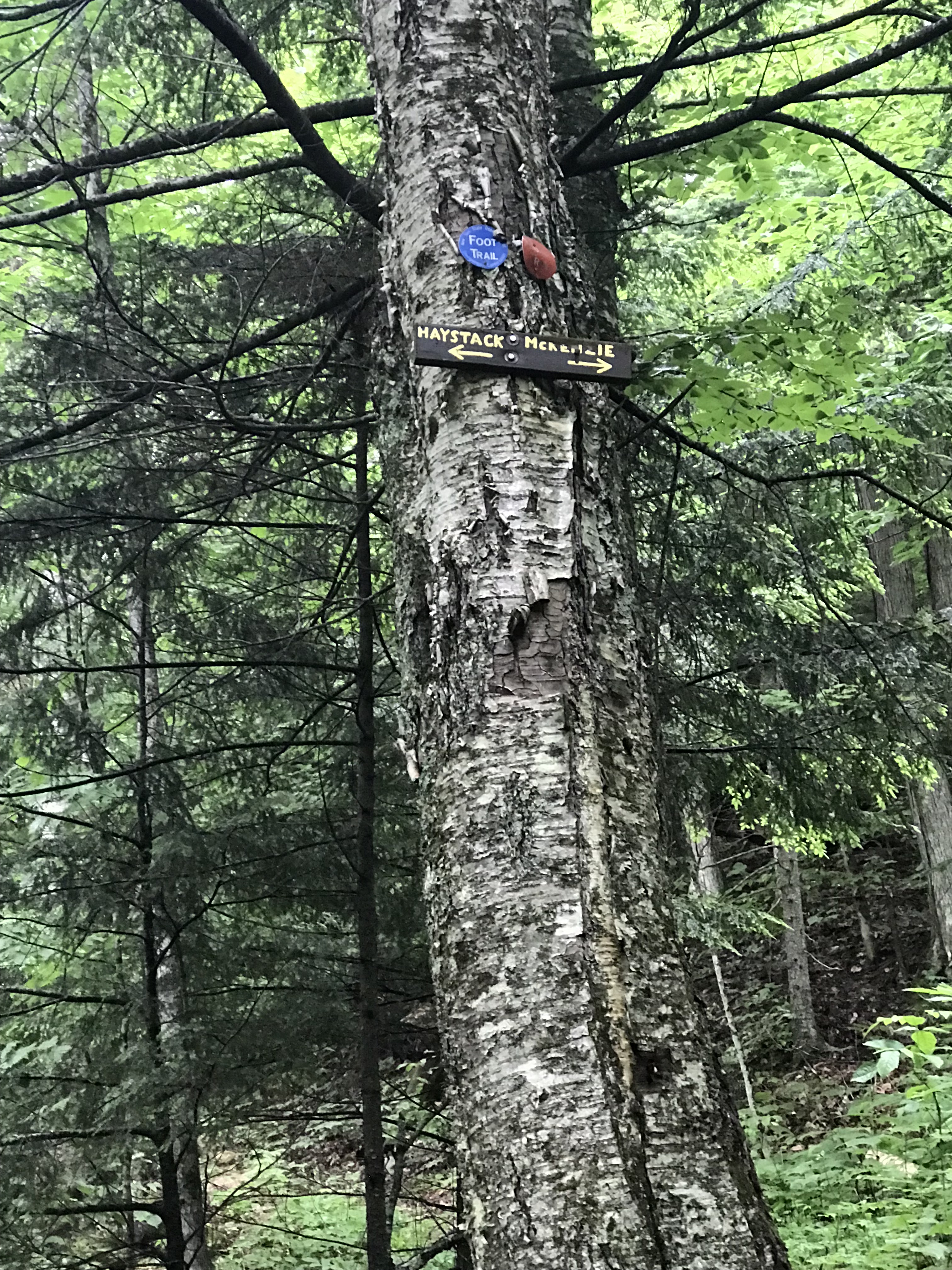
Trail Split: Haystack or Mckenzie
After hiking for some time along the relatively flat trail through the woods the trail splits. There is a noticeable sign which points to Haystack and Mckenzie. We continued onto Haystack on the left of the split.
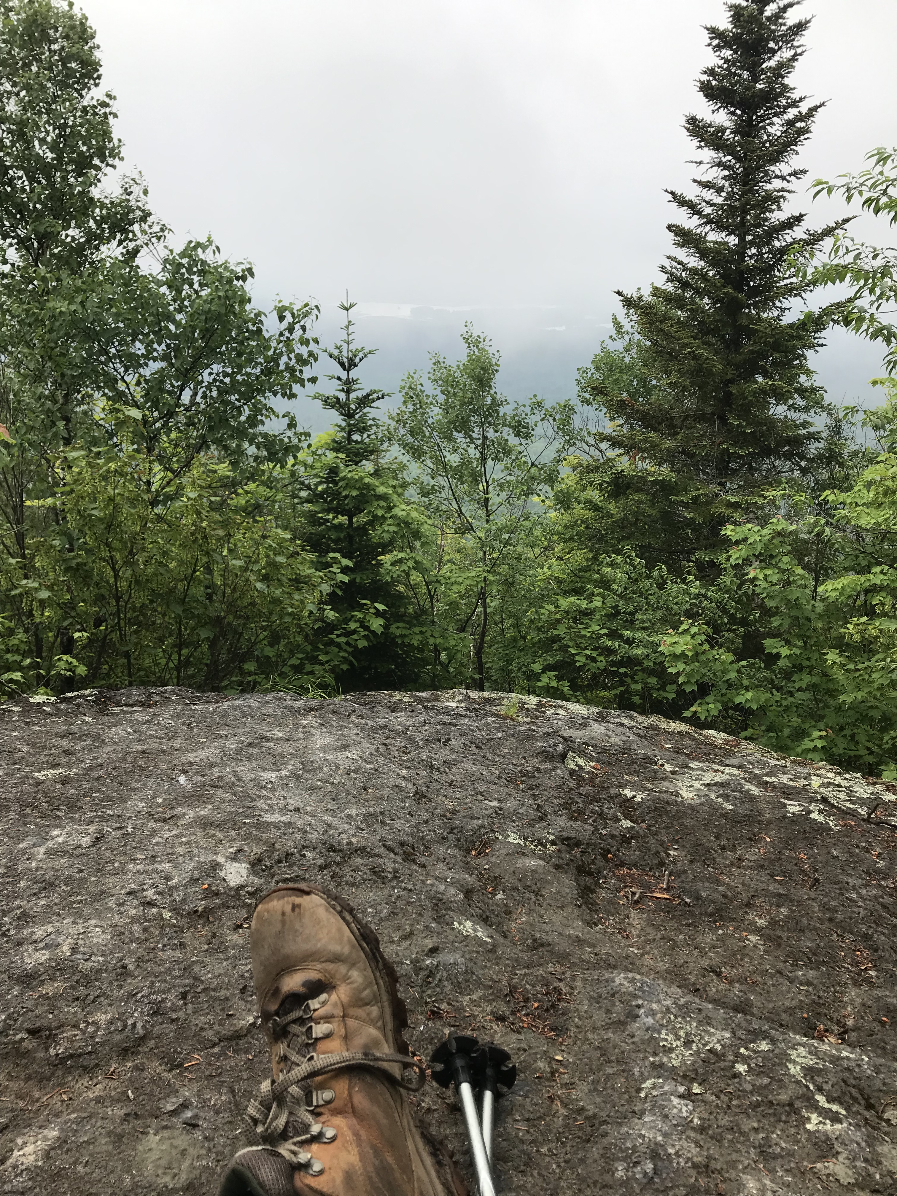
Summit of Haystack in Saranac!
After the trail split, the hike starts to climb, and at around the 3 mile mark of the hike, the climb gets more aggressive. You’ll know when you’re at the summit because it is an open ledge with plenty of space to walk around. The views would have been great if it weren’t for the fog. I still recommend doing this hike, just maybe when the mosquitoes aren’t as bad and the weather is better.
Continuing Towards Mckenzie Mountain and Calling the Hike Off
You can continue hiking on a trail (not the one you were just on, walk along the summit of Haystack and you’ll find it on the opposite side of your initial approach) after summiting Haystack. It will descend and you’ll eventually reach a cairn. Turn right at the cairn. This trail will lead you to an intersection upon which you can turn left to continue onto Mckenzie or right to hike 3.4 miles back to the parking lot on Route 86. There is a wooden sign on a tree at this intersection that you can reference.
The mosquitoes had gotten so bad at this point that I had been bitten at least 12-15 times, and that’s being conservative. It was probably more than that. Because of this, we decided it would be best to come back to Mckenzie another time. It is the highest of the Saranac 6ers, so I want better weather and hopefully less bugs the next time that I go. Before anyone starts picking on me, YES I did bring bug spray and it did NOTHING.
Getting Back to the Trailhead/Parking
This trail loops around so you can summit Haystack and follow the new trail down that was mentioned above. Just be careful you pay attention and turn right at the small stone cairn. After that, the hike back to the car is rather self-explanatory. Just don’t trip in a stream while running away from mosquitoes like I did…bloodied my hand up pretty good when I punched a mean boulder upon my fall.
Dog-Friendly
This hike is dog-friendly. I saw a dog or two hiking along the trail. Just bring extra water for your pup and he/she will do just fine. There wasn’t any part of the hike a dog would struggle with.
Fam-Friendly
This hike is easy/moderate because of its length and dependent upon your fitness level, but most individuals should be able to do it. It is a great workout and a good choice for people that want to get away from the crowds of the High Peaks.
Clothes Worn
- Timberland Boots
- Nike Compression Leggings
- Athletic shorts
- Athletic T-shirt
- Patagonia hat
- Hiking socks
Gear Brought
- 3L of water
- Almonds and peanut butter sandwiches
- Wind/Rain pants
- Extra layers (UnderArmour)
- Extra hiking socks
- Knife
- Paracord and two carabiners
- Water-proof matches
- LifeStraw (water filtration, costs about $20)
- Trekking poles
- First-Aid Kit
- Garmin inReach (satellite device that has a GPS, can send texts, send SOS, and has many other helpful features)
RTW Note
Thanks for taking the time to check out this hike even though I shared how rough it was! I hope it was helpful/informative for those looking to hike in the Saranac Lake area. I am sure this hike is a lovely when it isn’t as humid and the bugs aren’t as cumbersome. I still would recommend it to a friend. Hit the like and follow buttons if you found this post helpful or enjoyed it in any way. Leave a comment if you want to reach out. I enjoy reading your thoughts and remarks! I will keep the posts coming as I continue to hike!
-Ant