*Note*
From now on I am going to try and be even more detailed in regard to the hikes/trips that I take on with my pals. I want to offer as much information as possible so people feel better prepared if they head onto any of these trails. On the bottom of each post, there will be tips for each specific trail, a picture of the trail on a map (with our route highlighted), if a hike is dog-friendly, and if it is family-friendly. As usual, I will include the time it took for the hike in its entirety as well as how long it took to get from peak to peak if we bagged more than one mountain. I will also be updating my previous posts in the near future to include said information. If anyone has any other info they think I should add, don’t hesitate to offer your input.
We Bagged Four More High Peaks Baby!!
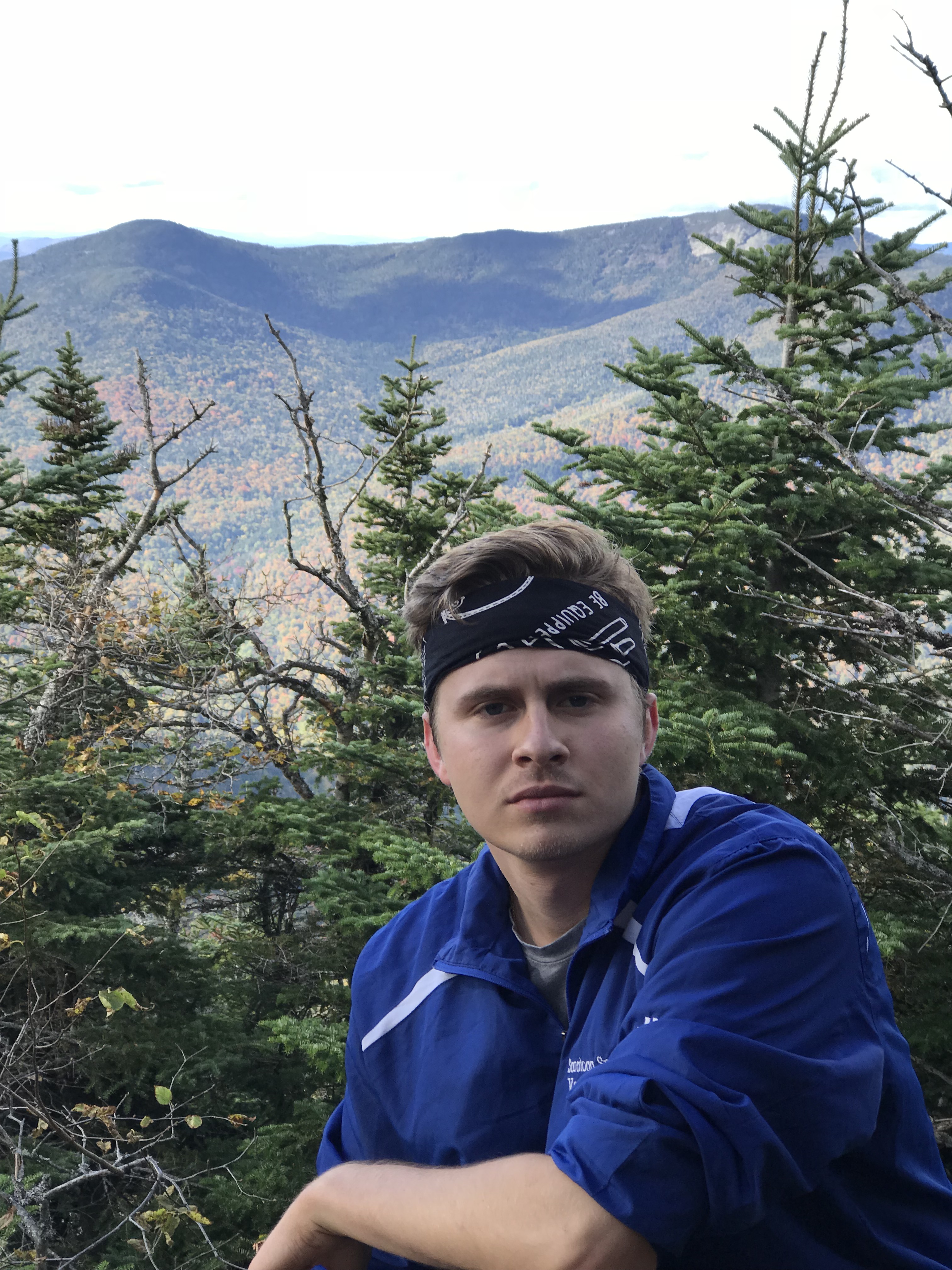
What is good my Road Trip Warriors!?!? This past Saturday (9/29/18) my brother and I headed back into the Adirondacks to take on some more mountains. The four peaks we were after were Gothics Mountain, Armstrong, Upper Wolfjaw, and Lower Wolfjaw. It was an amazing day and the weather could not have been more perfect at a cool 59º. We hopped out of the car at 6:30AM and did not get back until 12 hours later. That being said….I clearly have a lot to talk about! I am excited to share information and photos with you from these four lovely mountains!
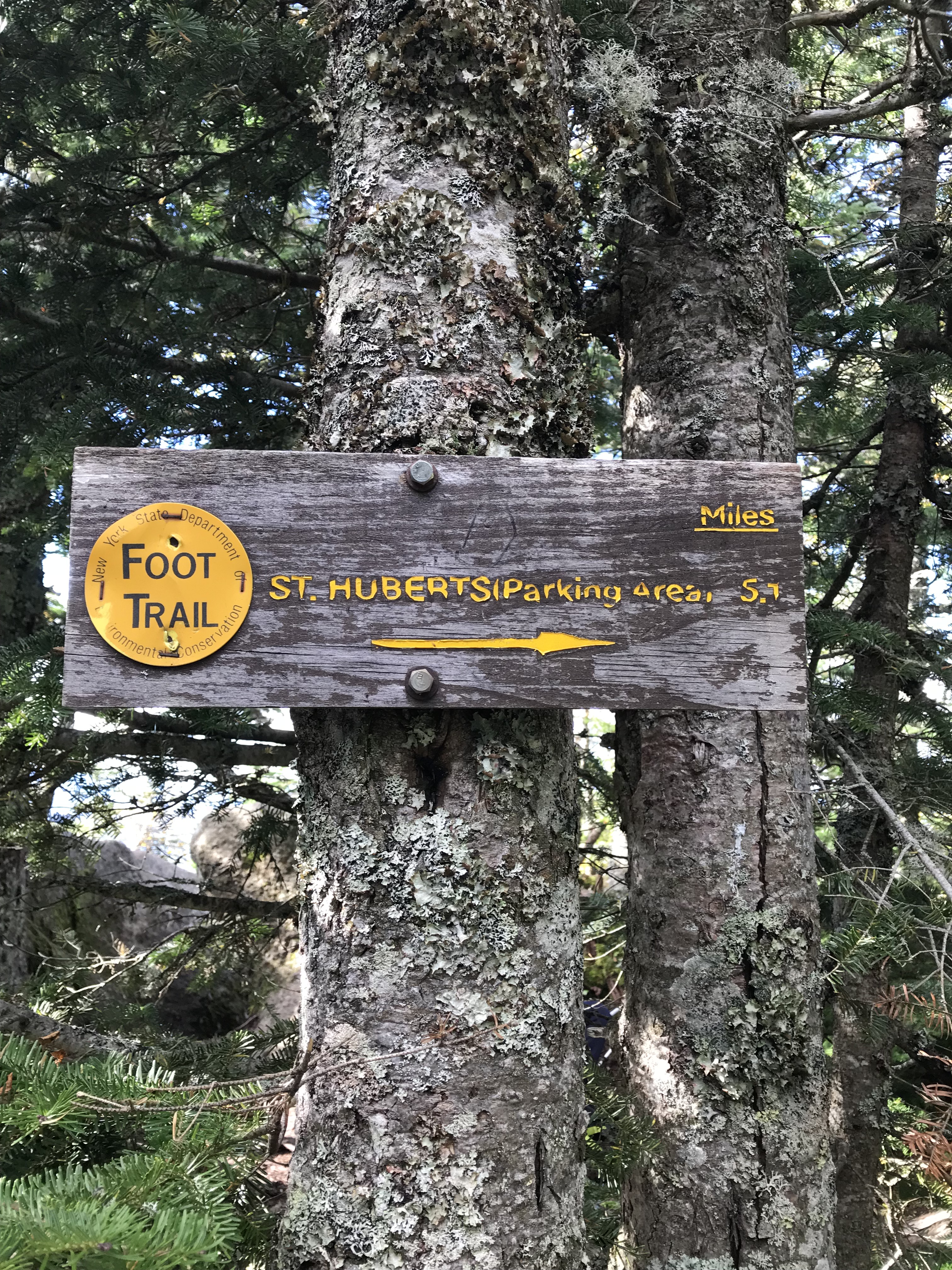
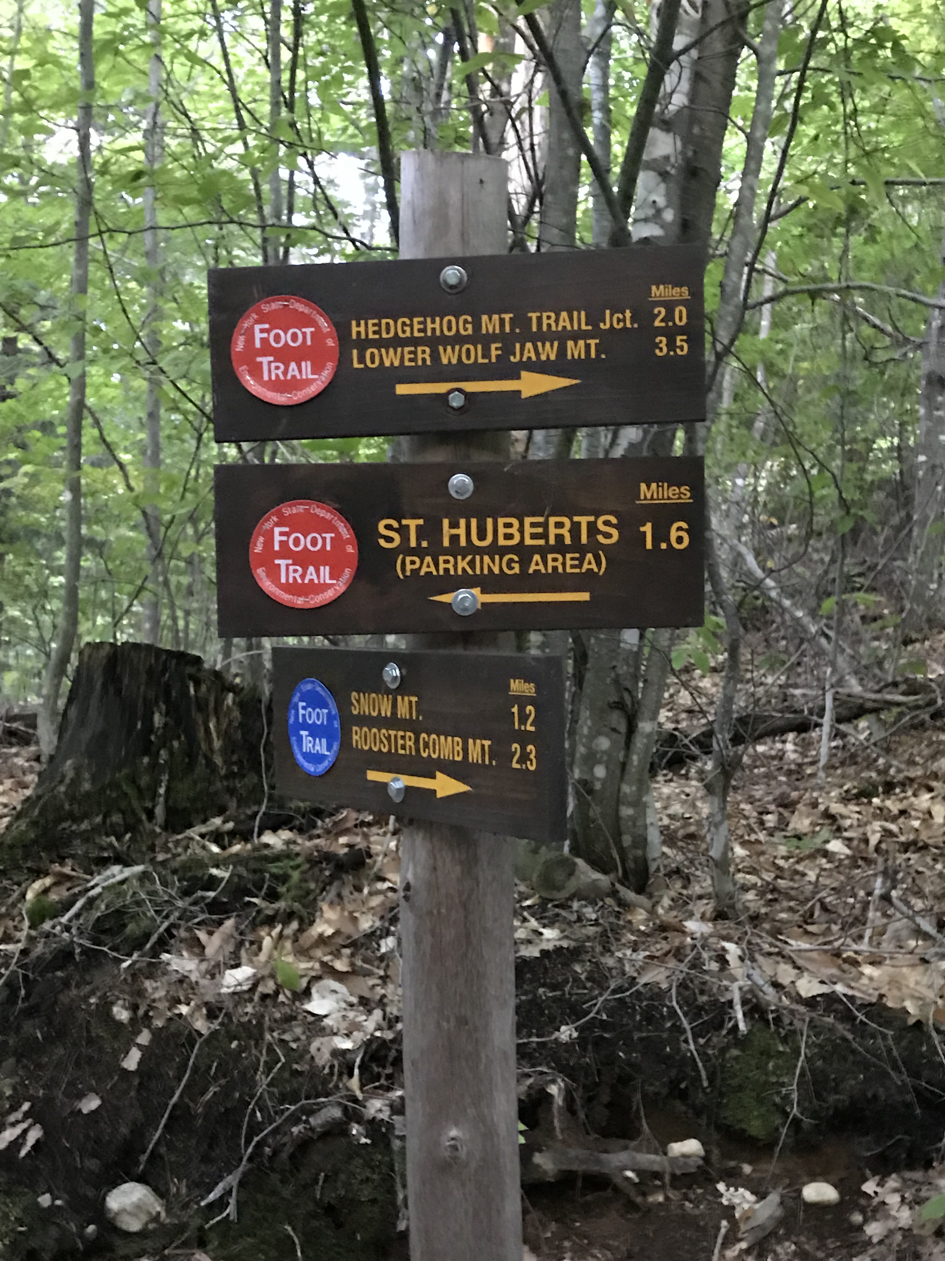
6:30AM at the St. Huberts Parking Area
My bro and I hit the St. Hubert’s parking area at 6:30 in the morning when the sun was just starting to rise above the mountains. The parking lot was already three quarters full at this point. I assumed it would be as the weather was supposed to be perfect and the fall foliage in the Adirondacks is to die for. The colors that you’re able to witness when you climb these mountains in the fall is absolutely stunning. We watched other individuals getting themselves ready for their treks as we did the same. We put any remaining items that we would need in our bags and made our way.
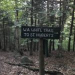
After parking in the lot, you’ll head up the dirt road for about a half-mile. Once you hit the tennis courts, you take a left in between them and walk down the road for a short while. Eventually, you will hit the small building with the sign-in sheet just outside of it. Don’t forget to sign in and leave your information!
Down Lake Road Way & Beginning of the Trail
After signing in, you’ll walk down Lake Road Way for two miles. Just after the little green two mile marker on a tree, you’ll see the sign where you’ll take a right into the woods to head towards Beaver Meadow Falls and Gothics.
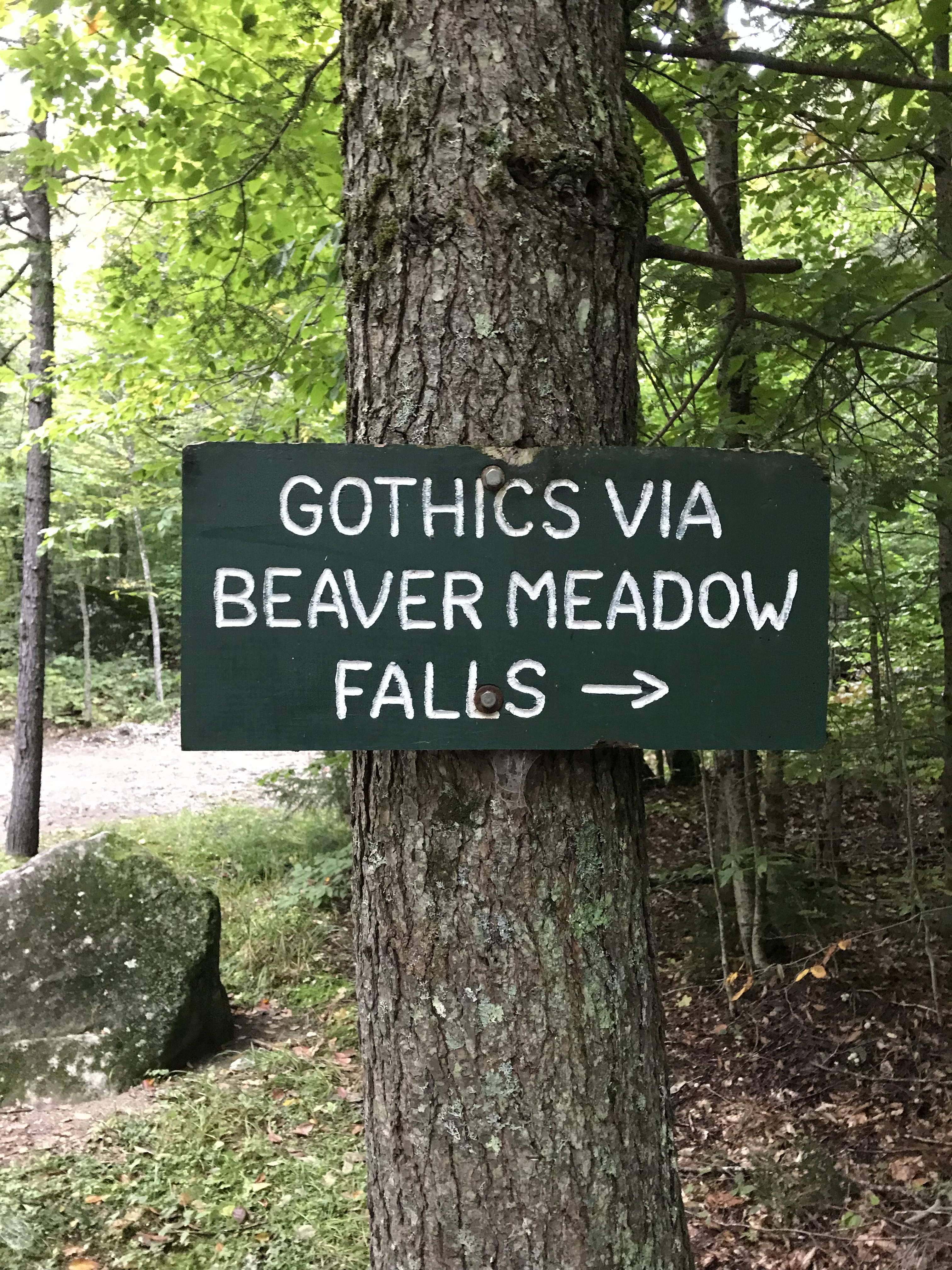
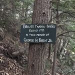
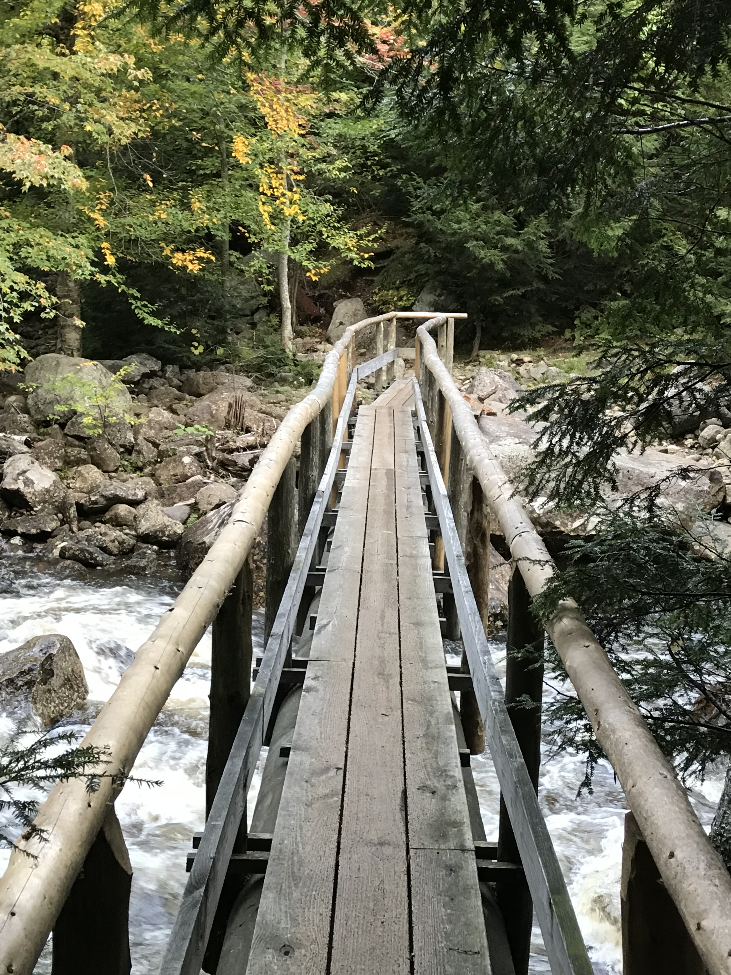
After hiking through the woods for 0.5 – 0.6 miles, you’ll reach another sign. This sign points you in the direction of Beaver Meadow Falls as well as Gothics. You’ll drop down to cross Beaver Meadow Bridge and at this point you’ll be very close to Beaver Meadow Falls.
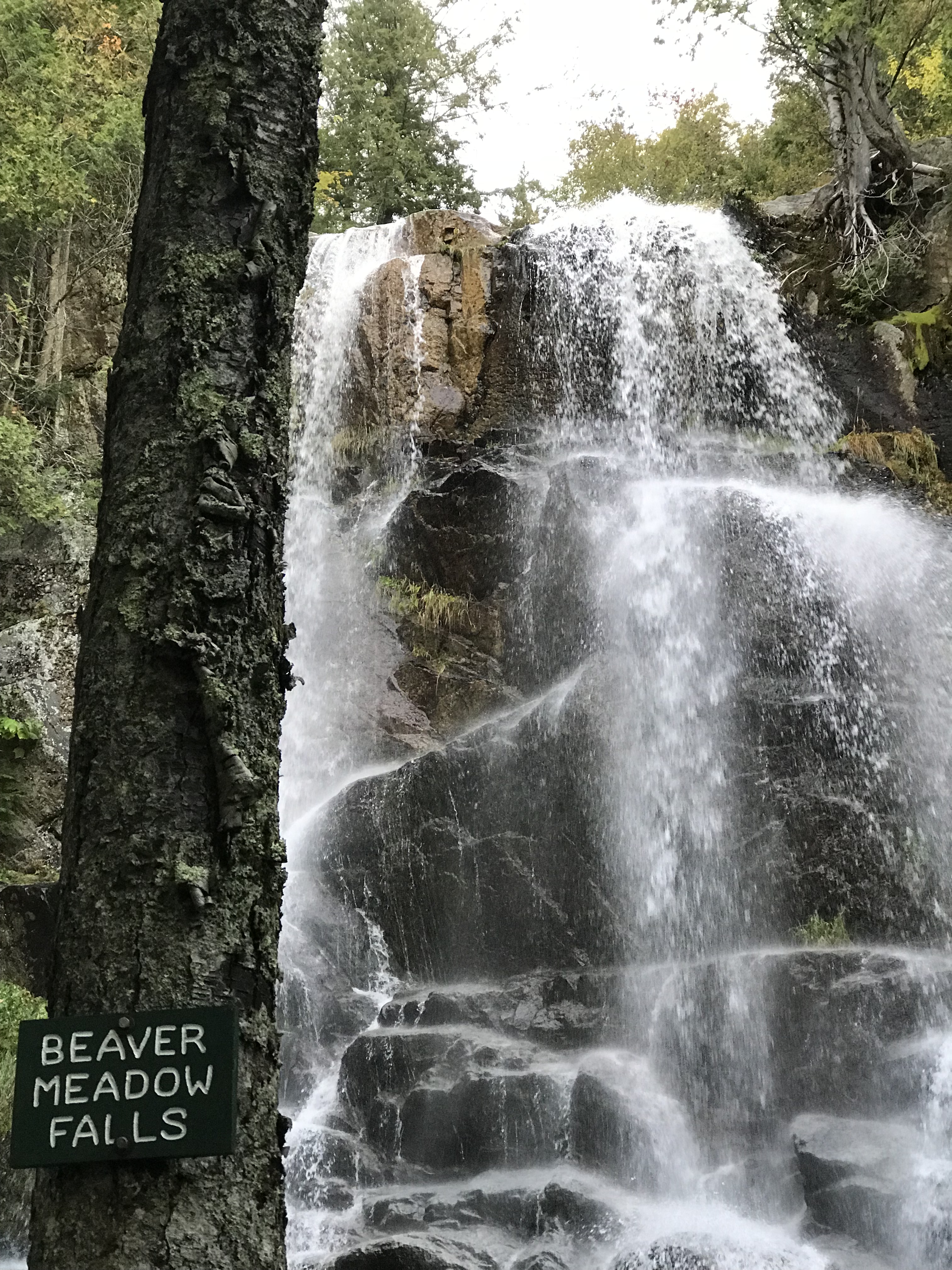
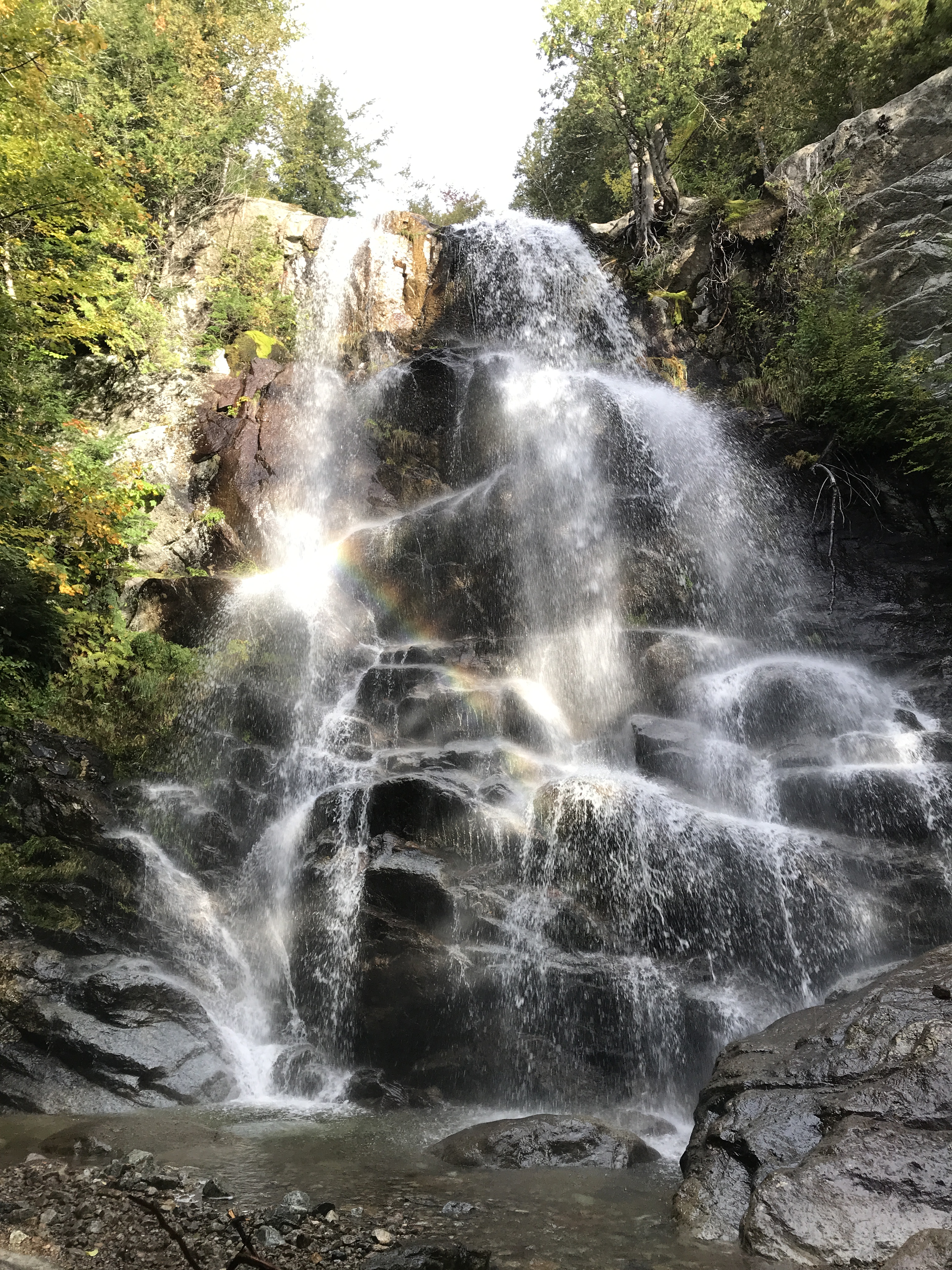
Beaver Meadow Falls!
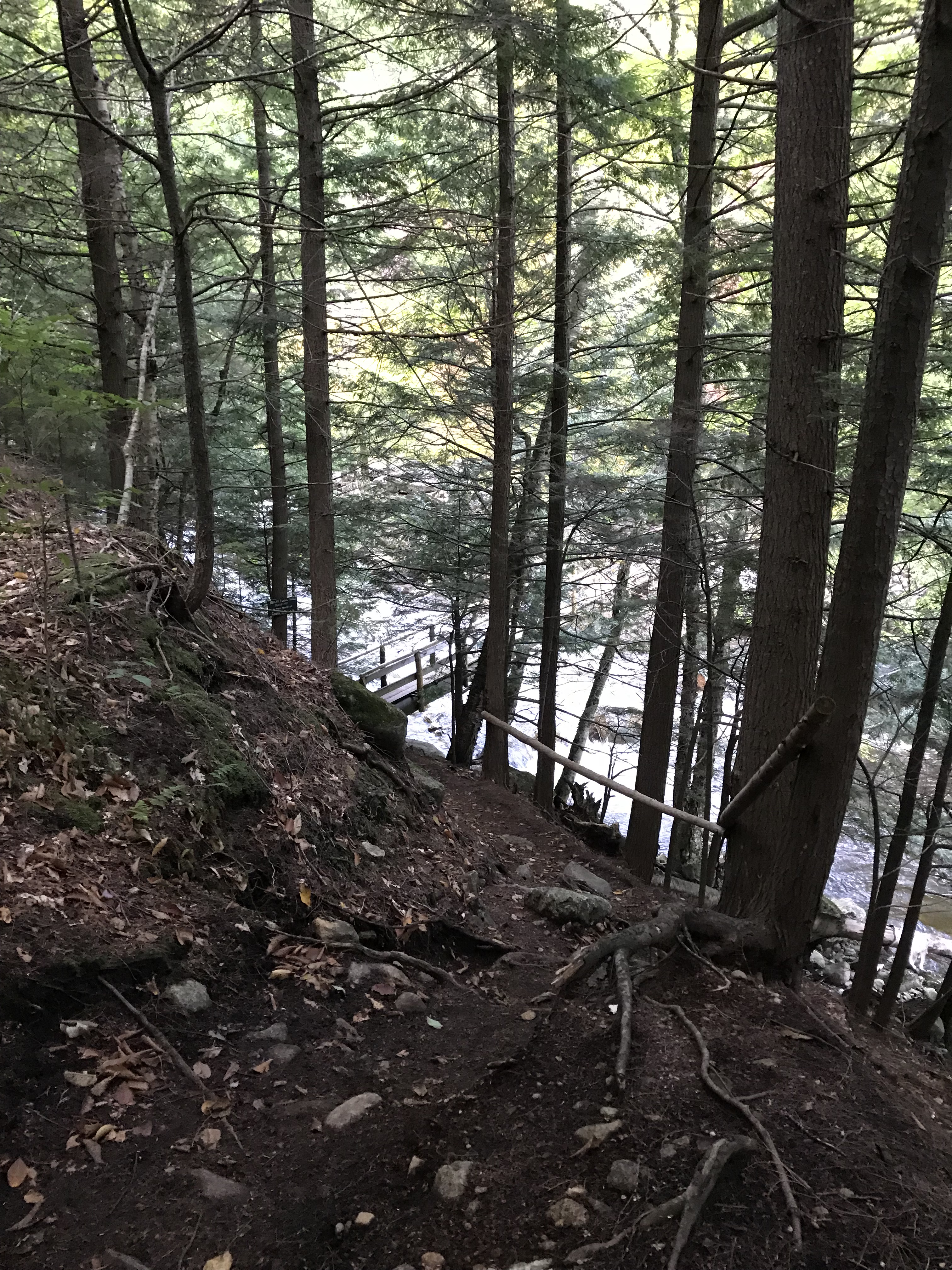
Continue on the trail for another 5-10 minutes and you will find yourself at the bottom of Beaver Meadow Falls. My brother and I got here around 7:45AM (roughly an hour and twenty minutes after leaving the car). The waterfall here is amazing and if you hit it at the right time, the sun hitting the mist will create a gorgeous rainbow. My brother and I stopped here for about a half-hour to admire the falls, eat some food, and take tons of photographs/videos of the falls.
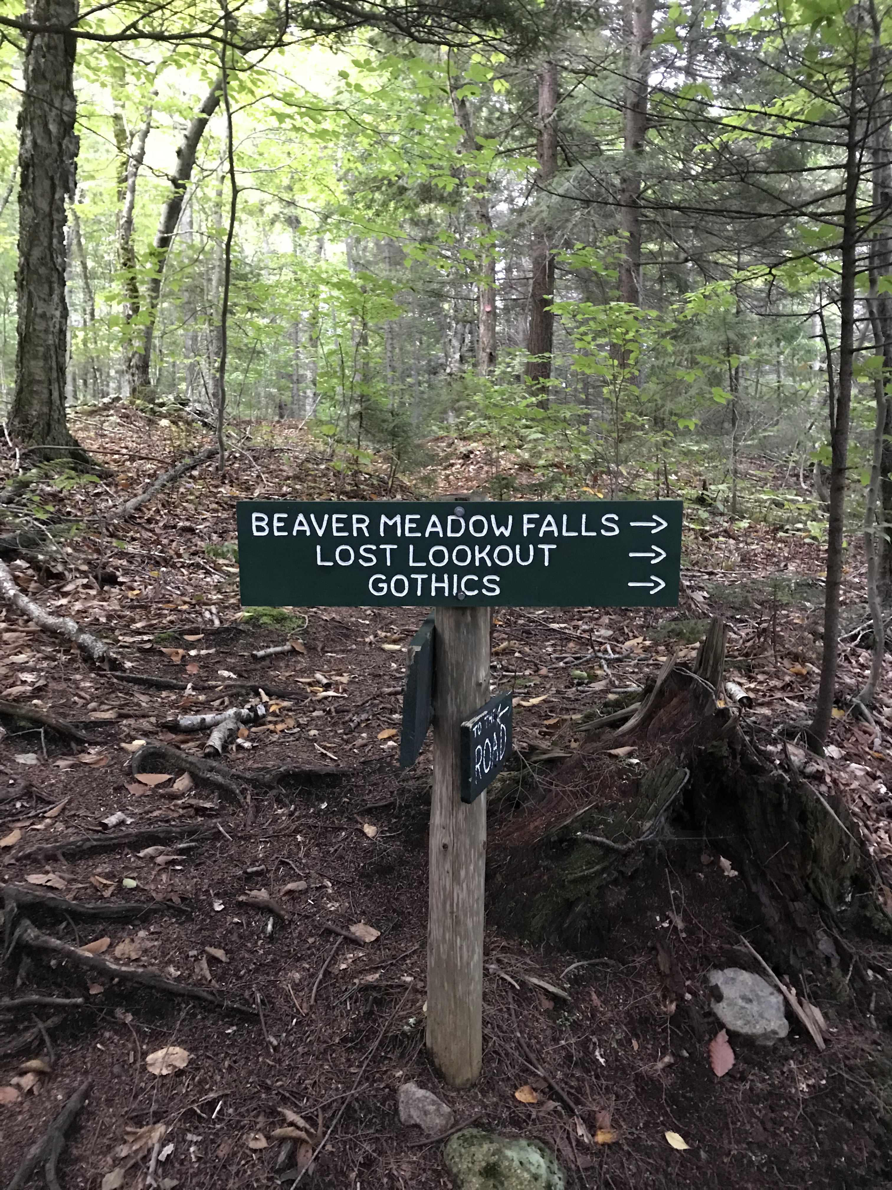
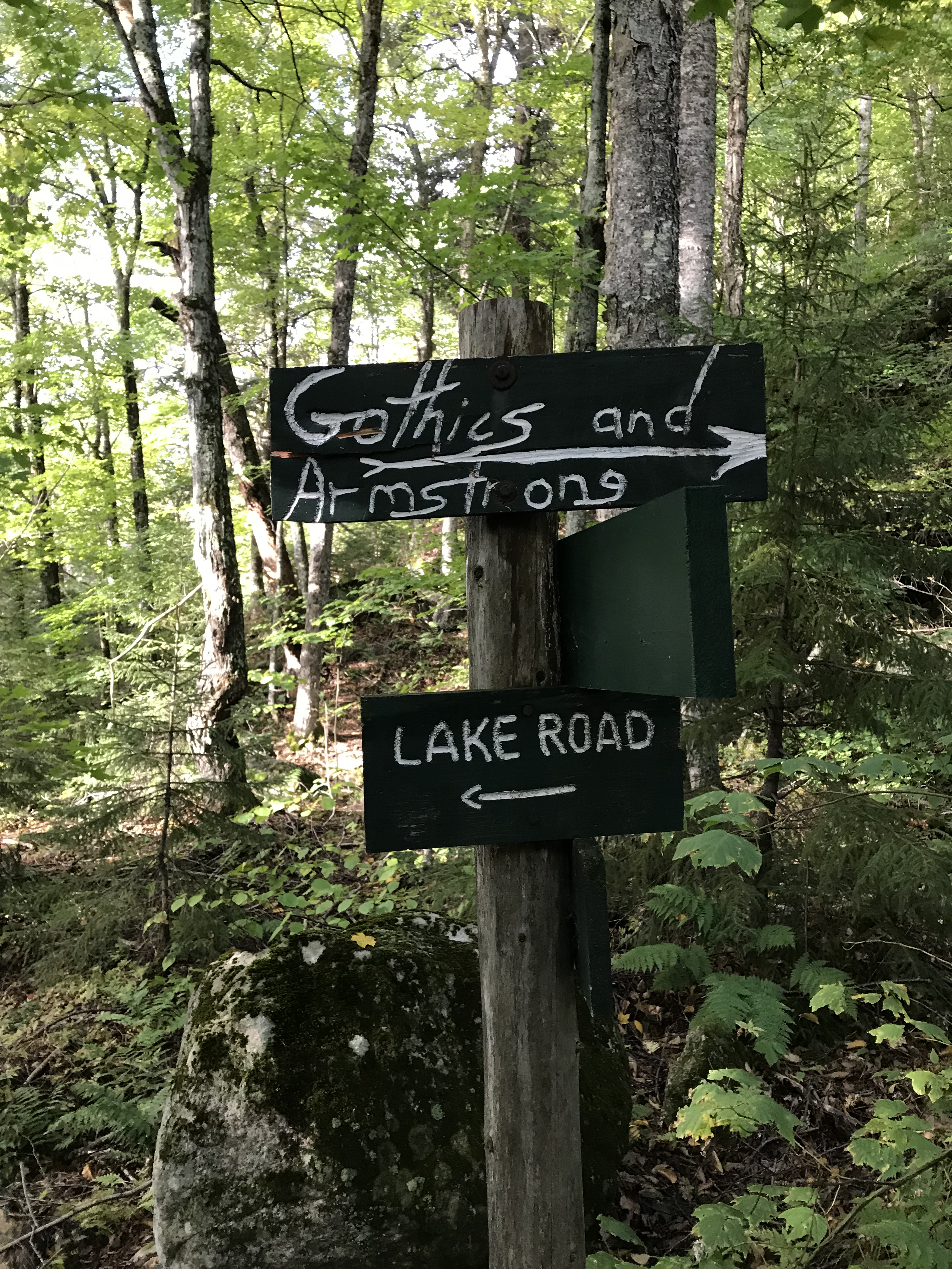
Hop back on the trail and near Beaver Falls, you will find this sign pointing you in the direction of Gothics and Armstrong.
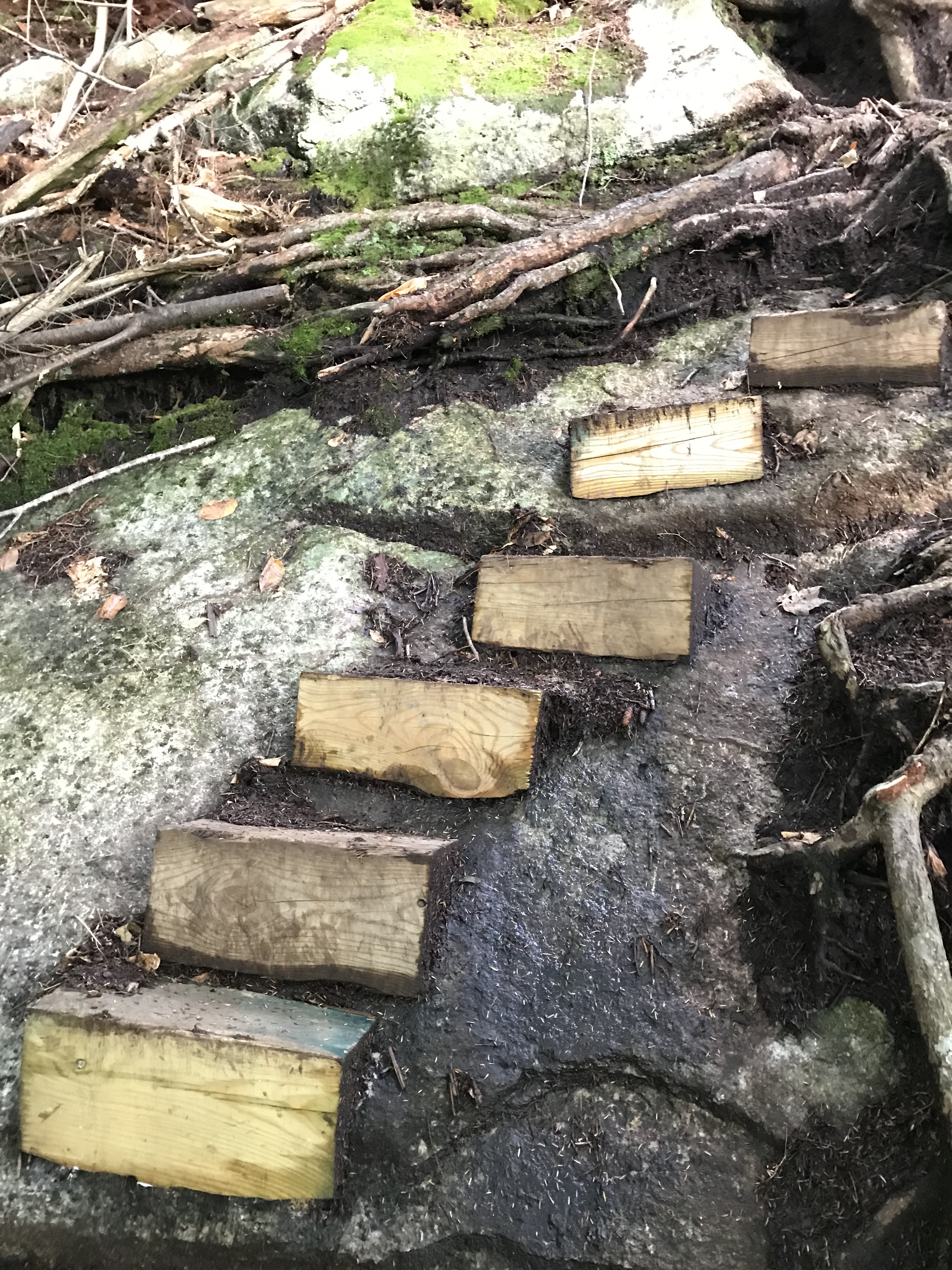
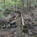
Following the Trail
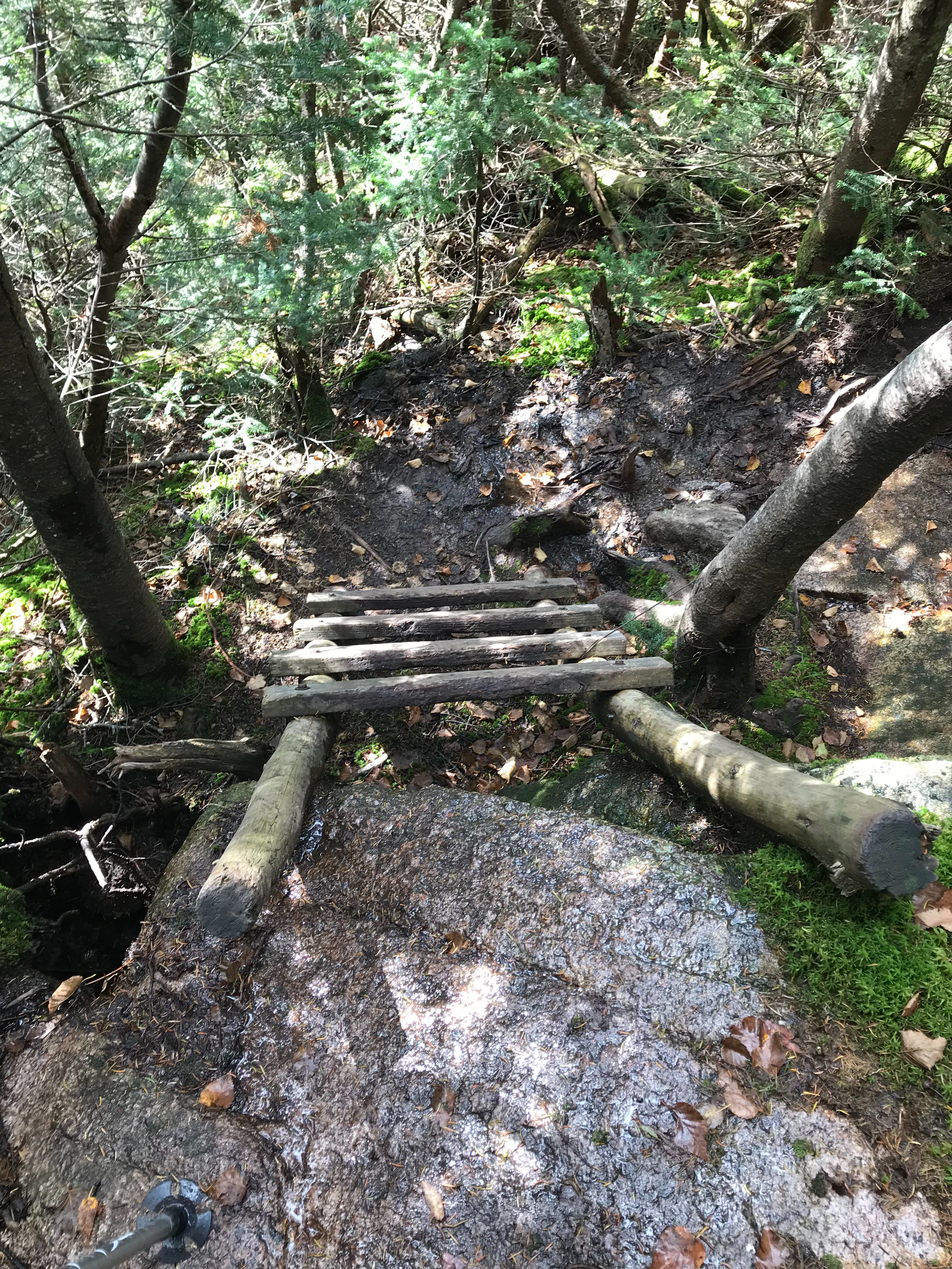
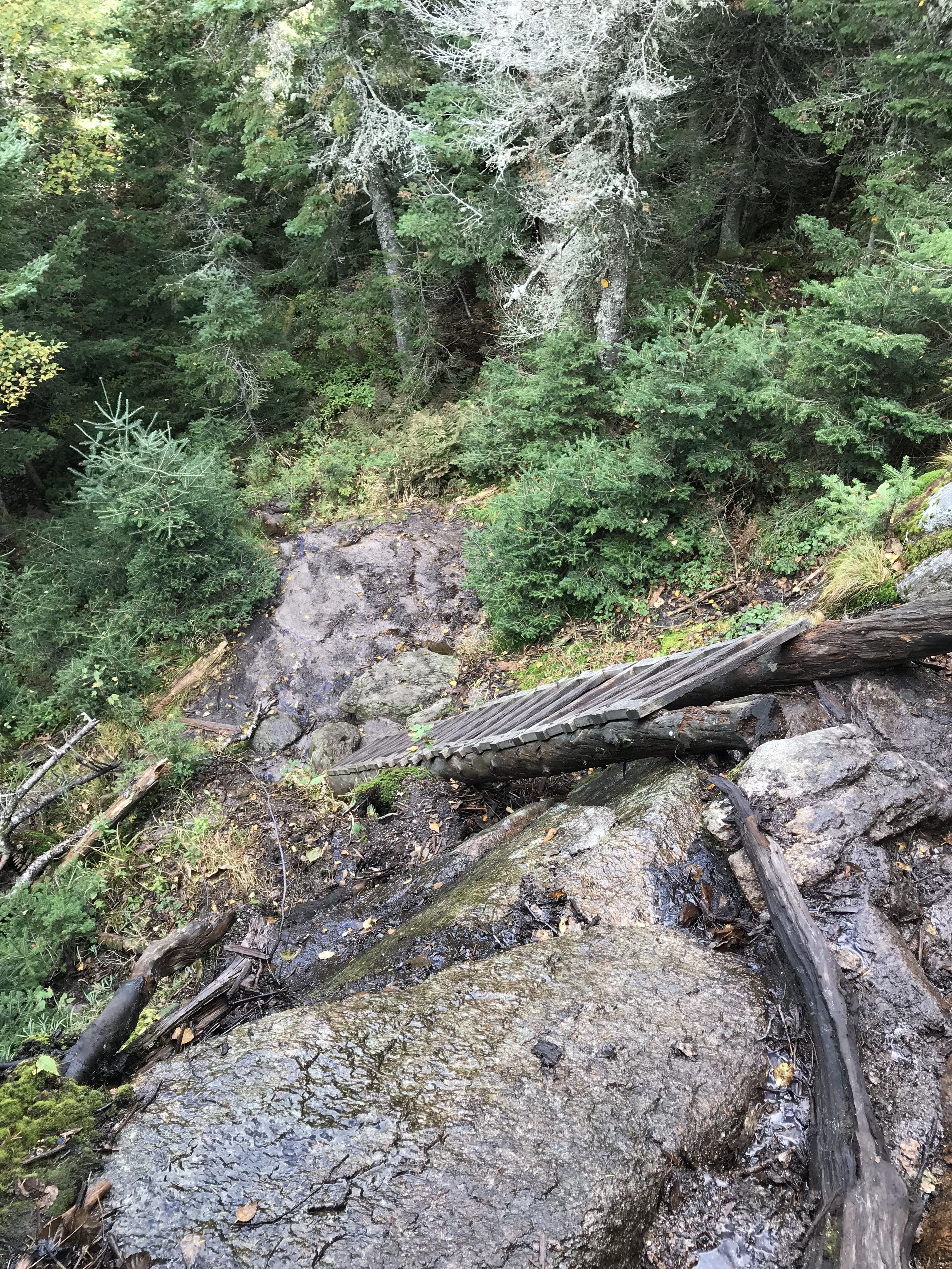
This trail has numerous ladders along with some steps and they start right after leaving Beaver Meadow Falls.
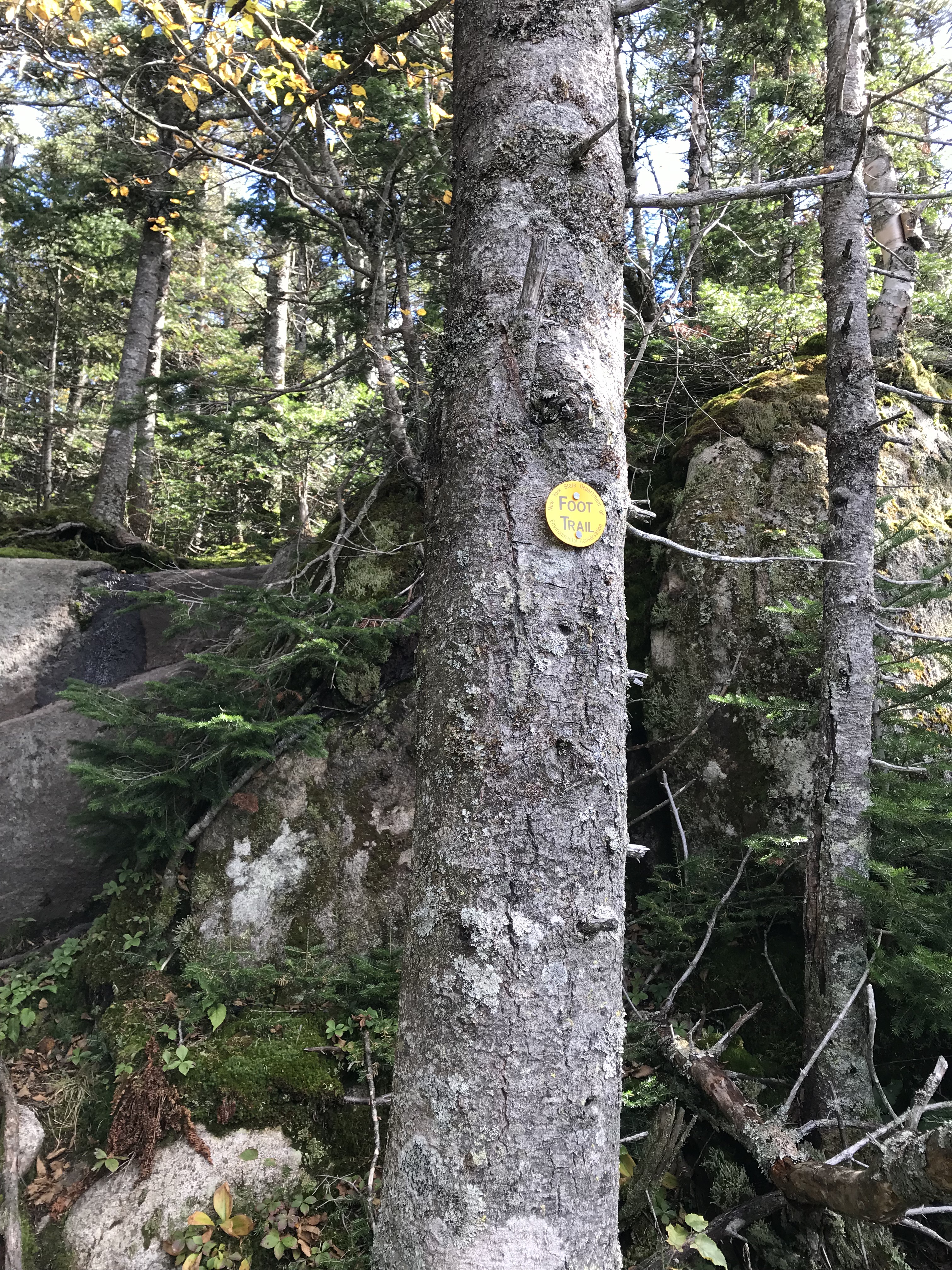
Take notice that you will be following blue trail markers like this one below.
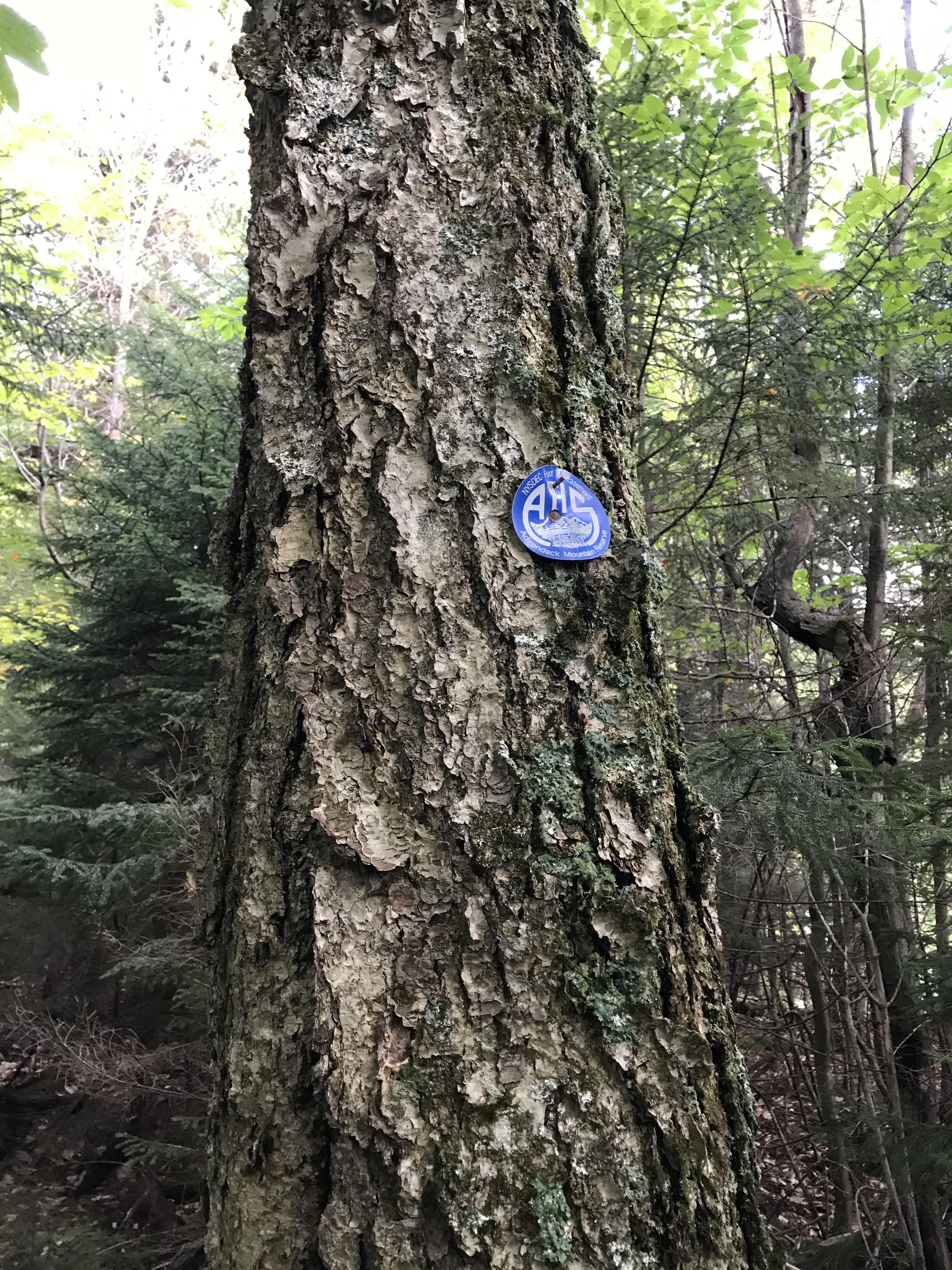
This trail is well-marked with these blue markers as you continue to ascend towards Gothics. The signs are hard to miss and I took pictures of each one we came across to make sure this post was explicitly detailed.
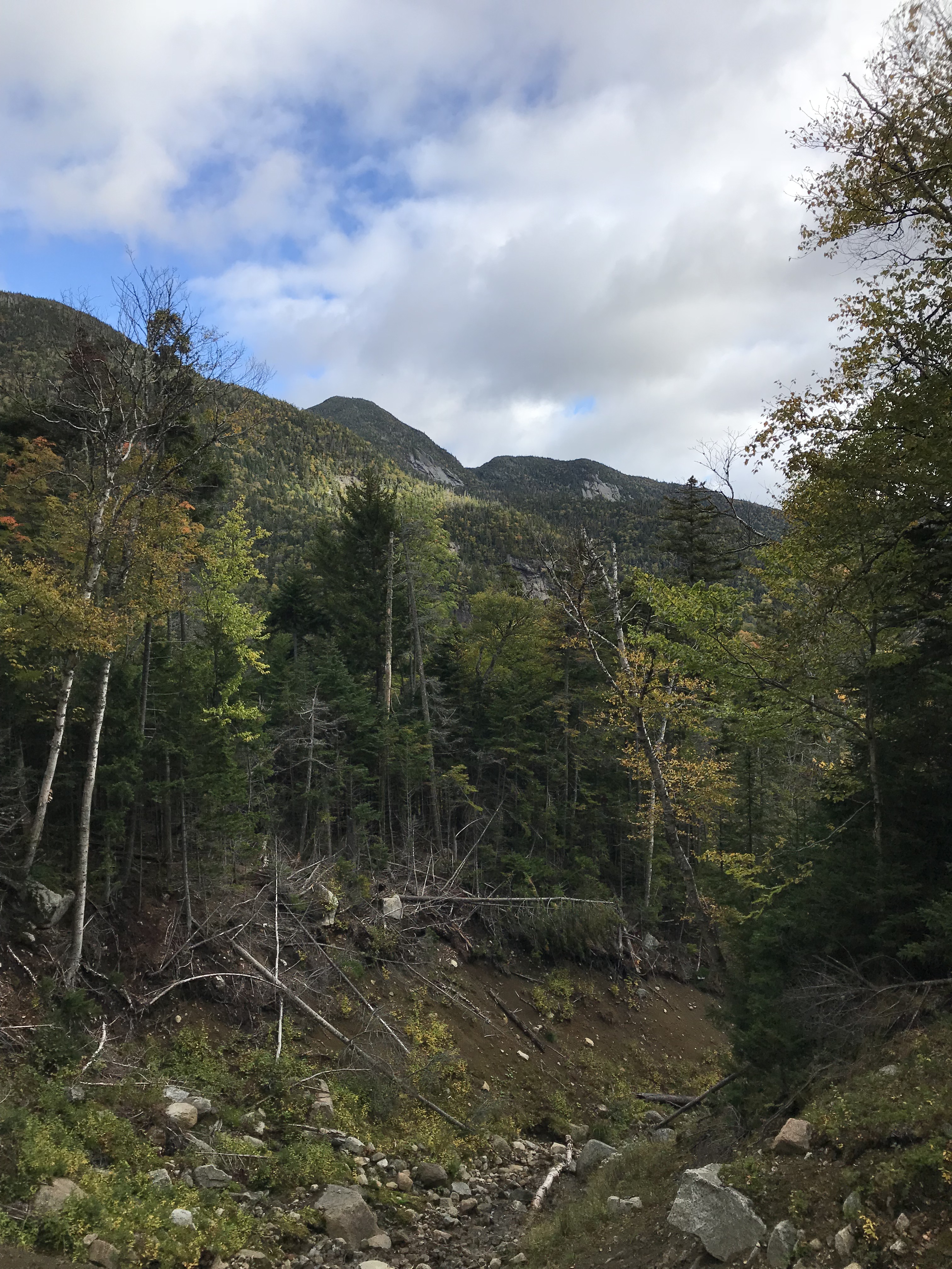
The trail continues to steepen and it does not let up. There aren’t many spots that flatten out on the way to Gothics so be prepared for a leg workout. Eventually, you’ll reach an opening and this is where my brother and I stopped to rehydrate. The opening does not offer many views. It looks more like an open slide caused by erosion.
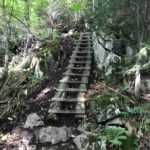
Ladders, Ladders, Ladders
As you continue to finesse this trail like a Road Trip Warrior would, you’ll come across a few ladders. None of them are too difficult, and I find them fun to climb up and down. Here are some photos of said ladders.

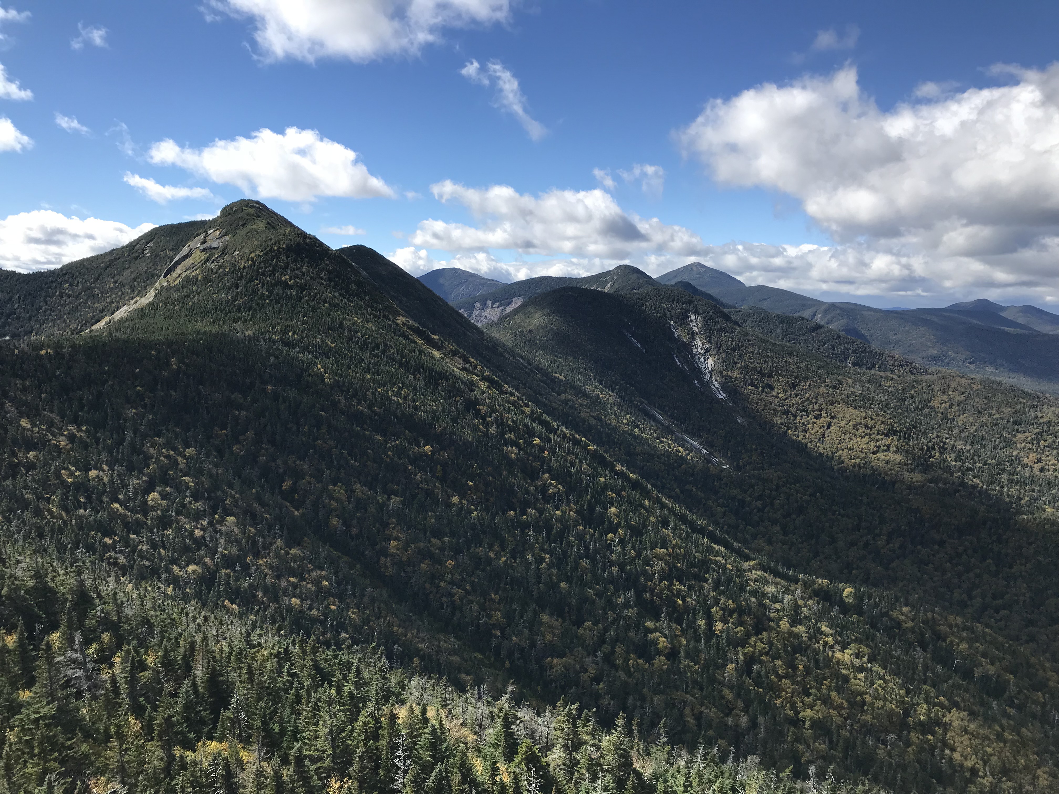
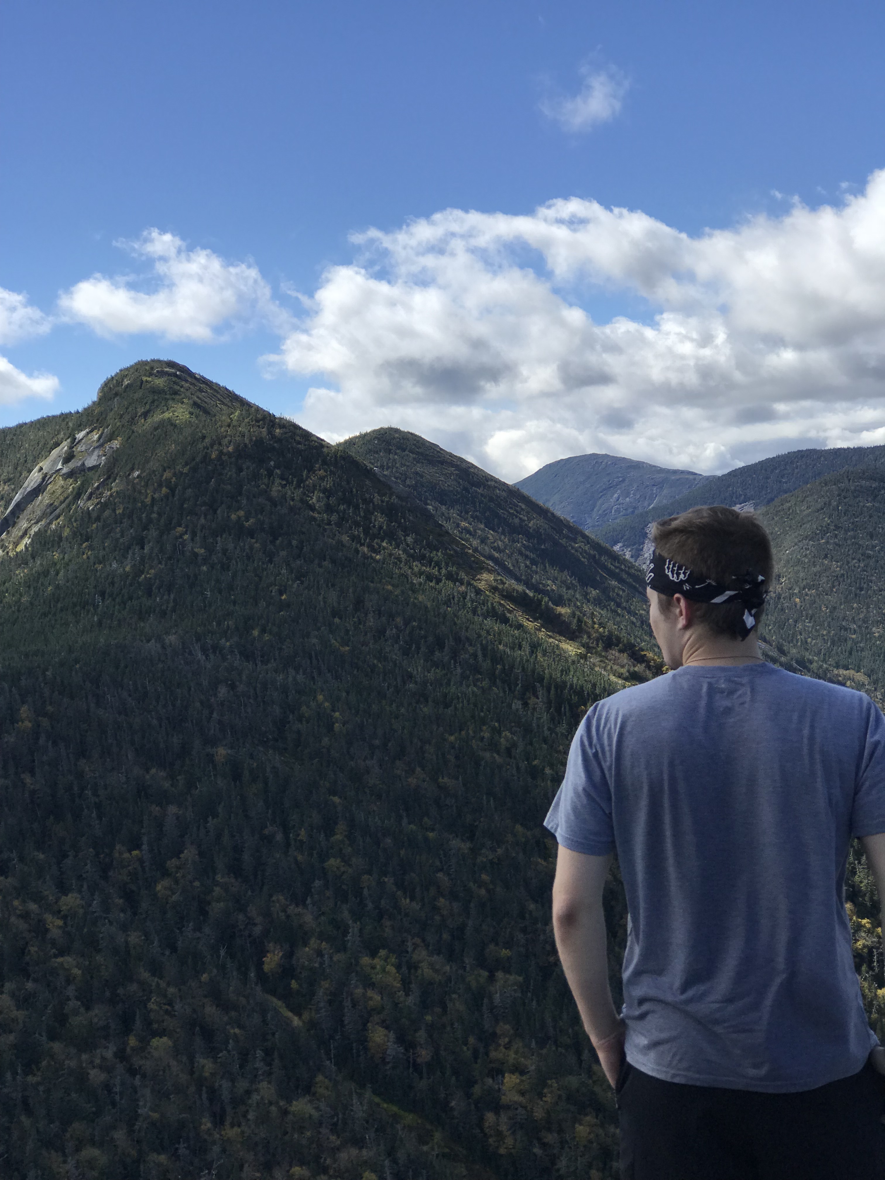
While you’re having fun going down these ladders, take a look out to admire some of the views. At this point, you’ll be able to see Gothics. We were also able to take in some fall colors.
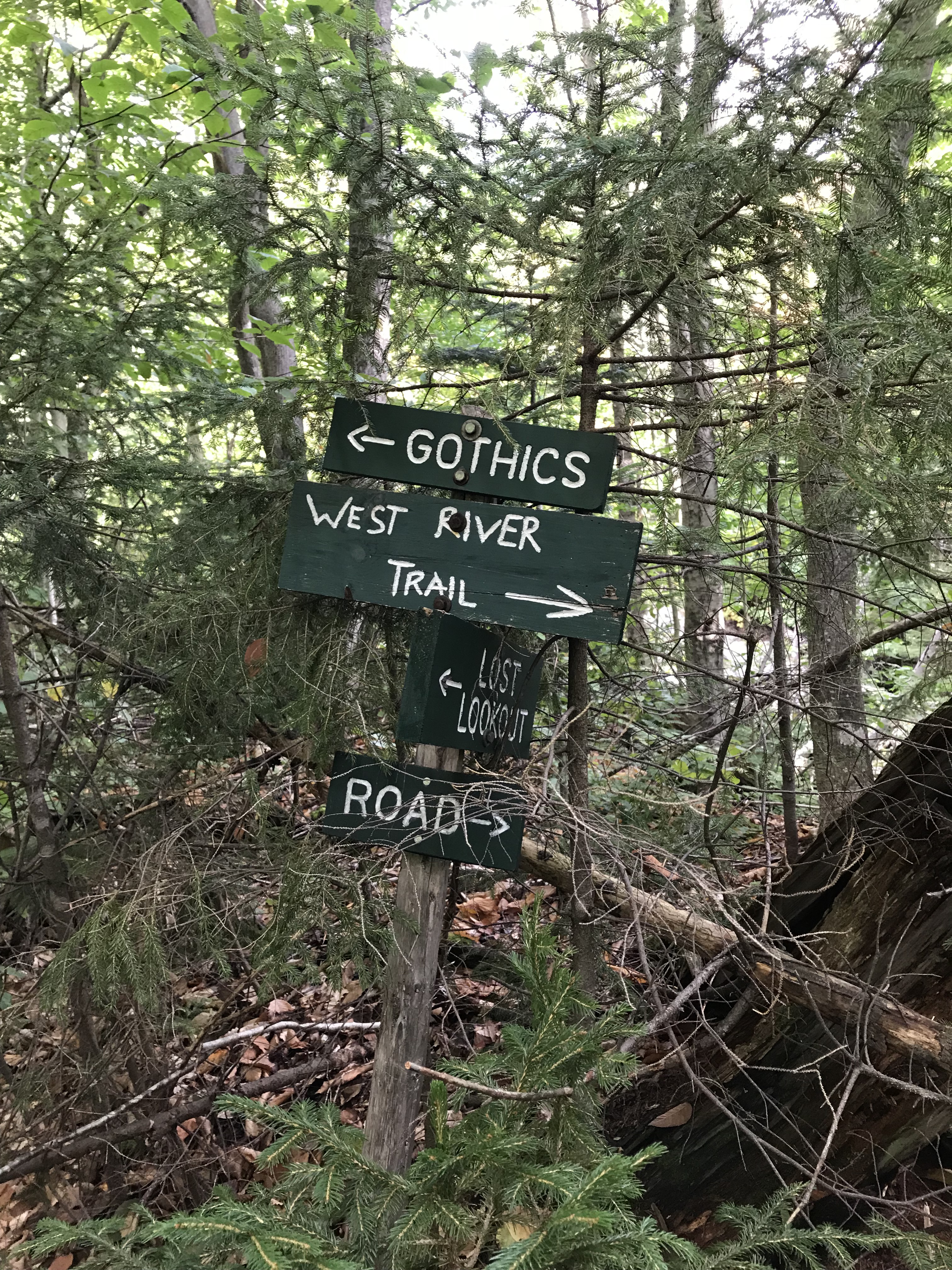
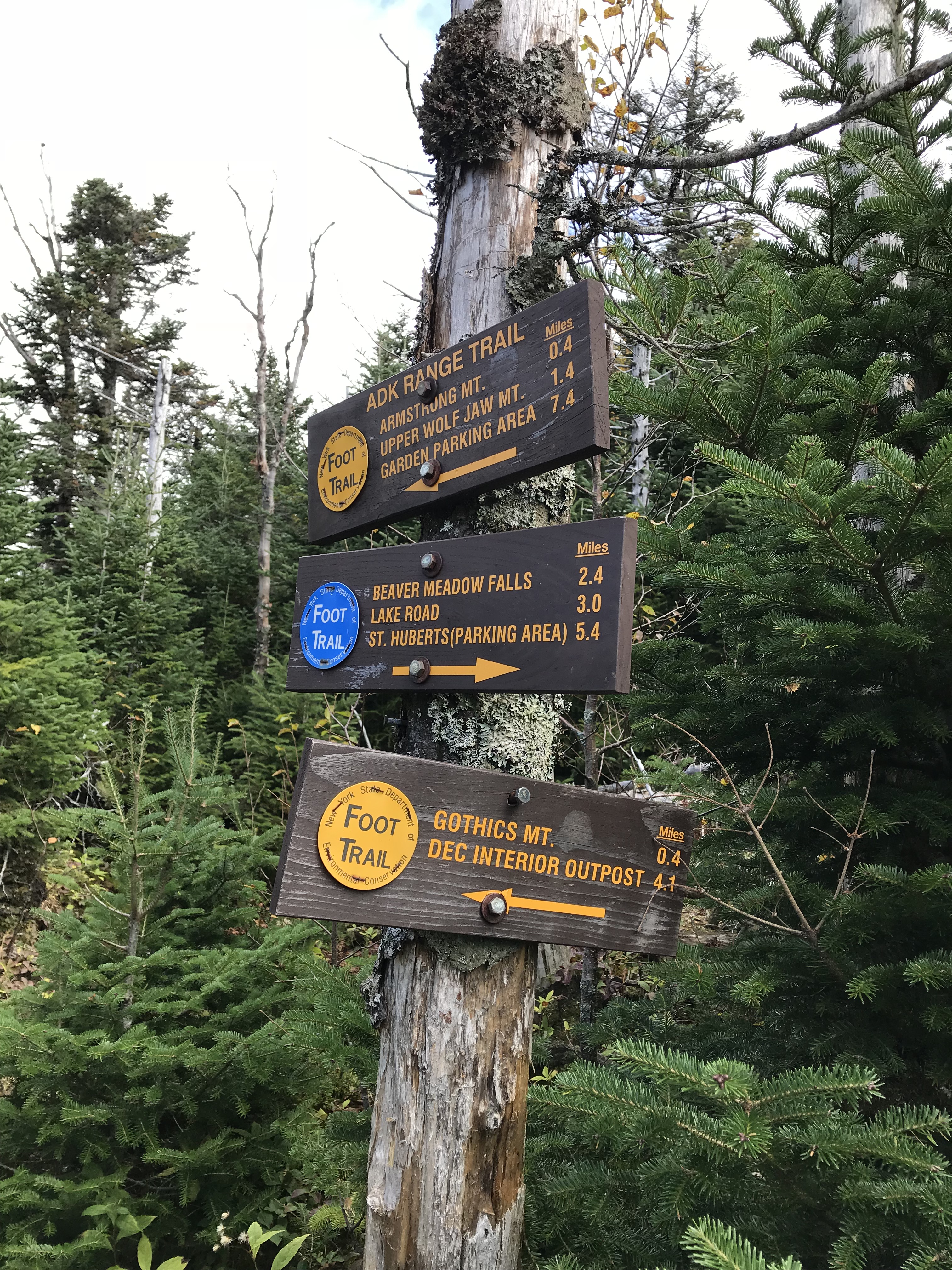
Last Sign Before Gothics and Summit of Gothics
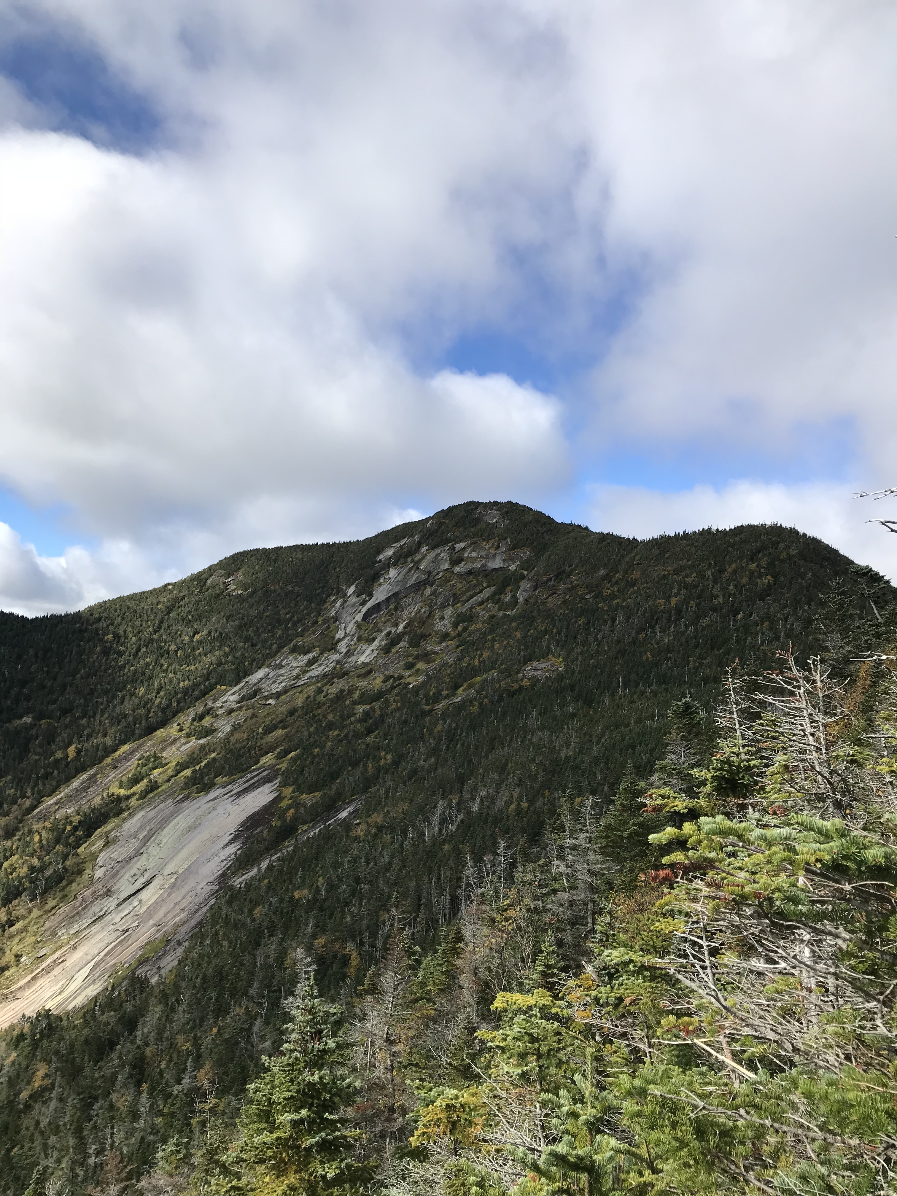
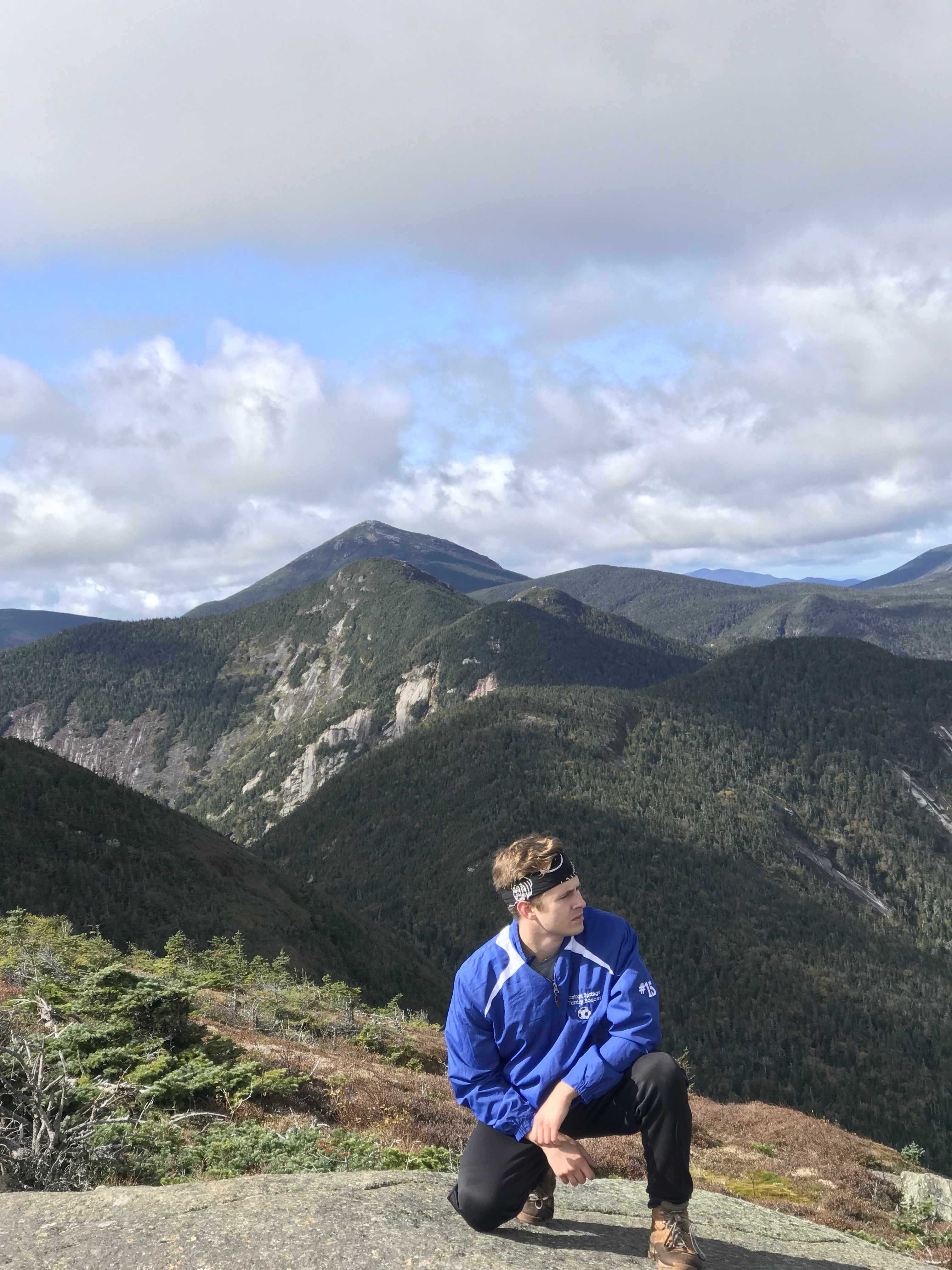
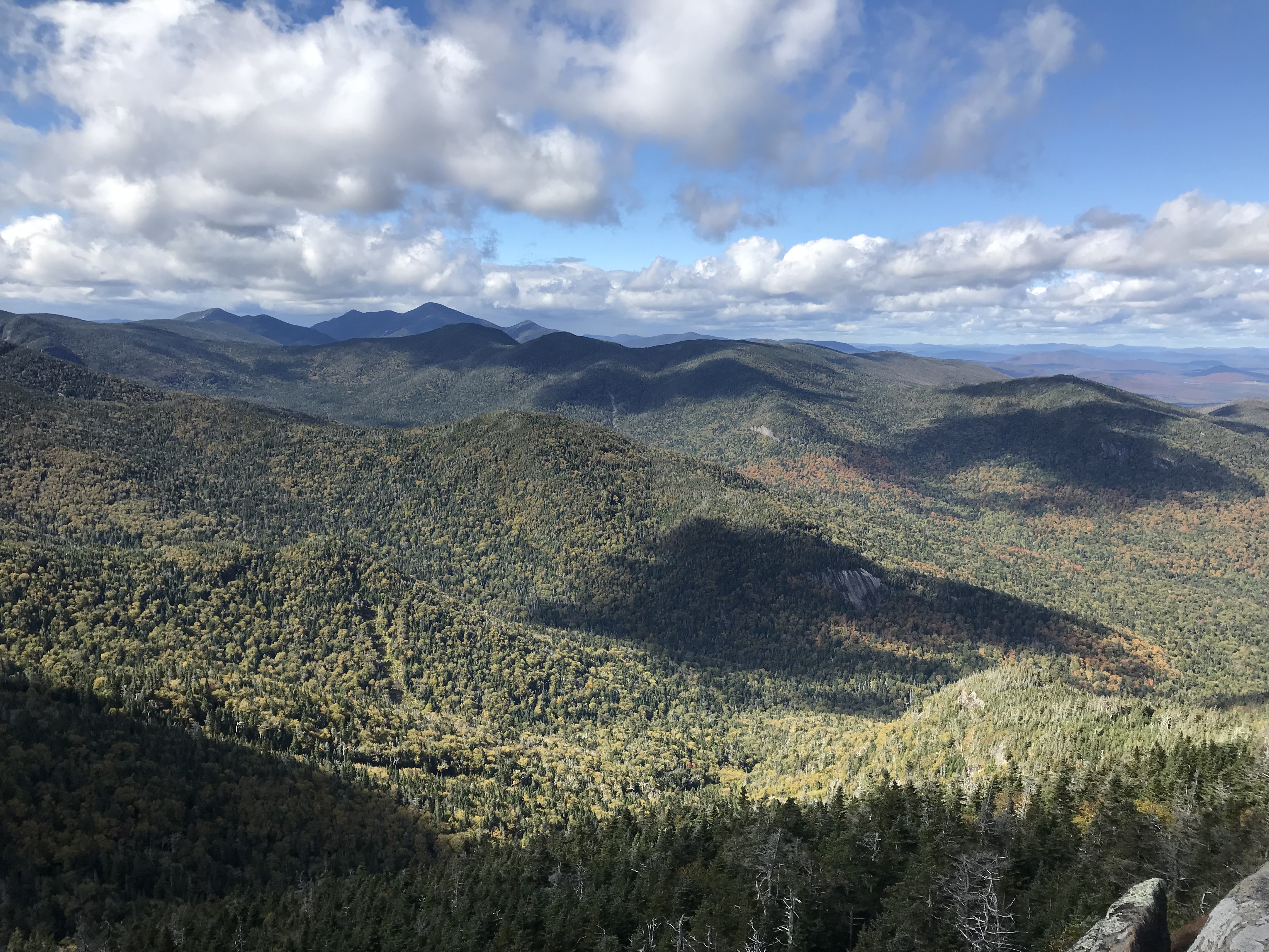
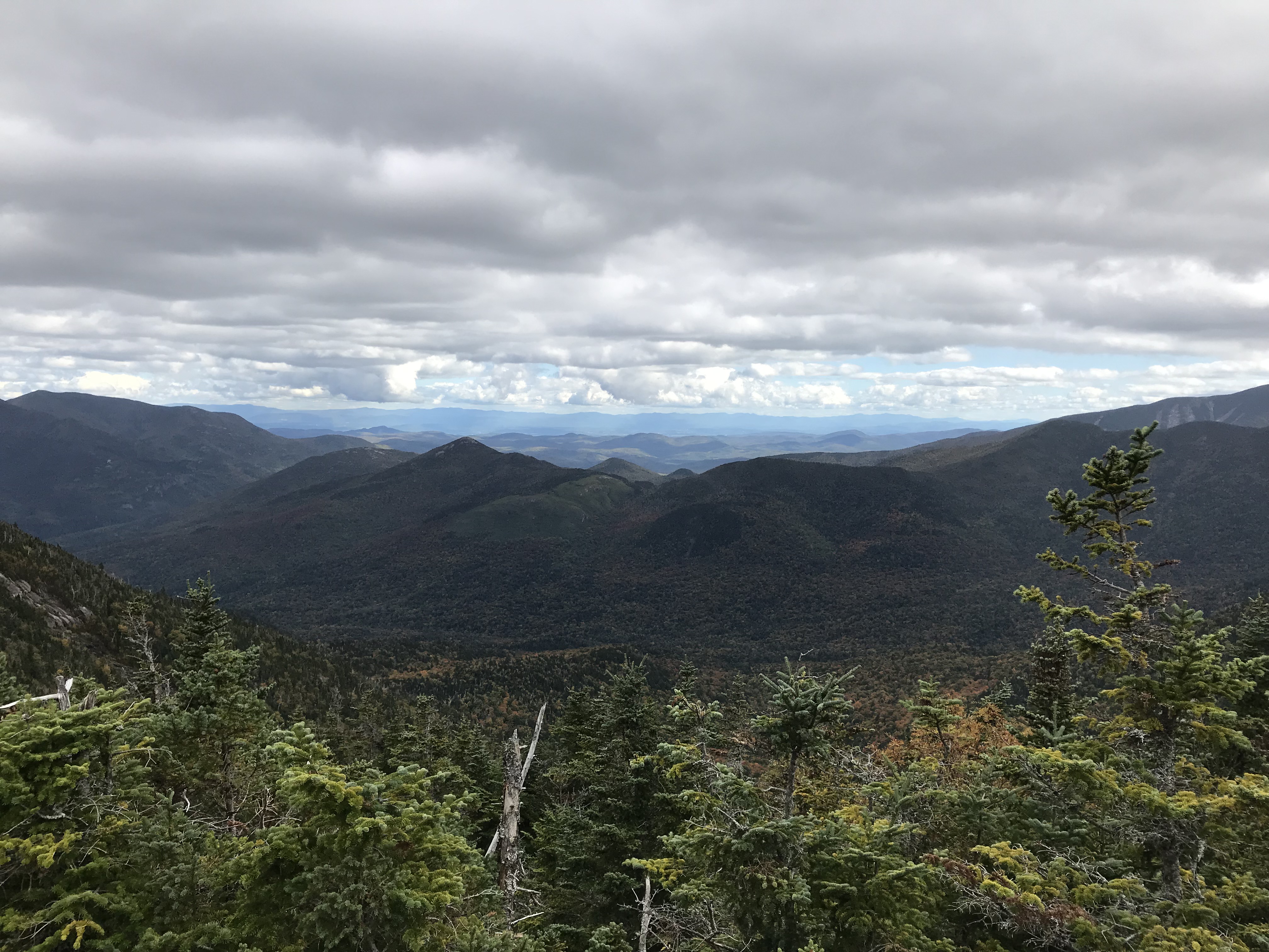
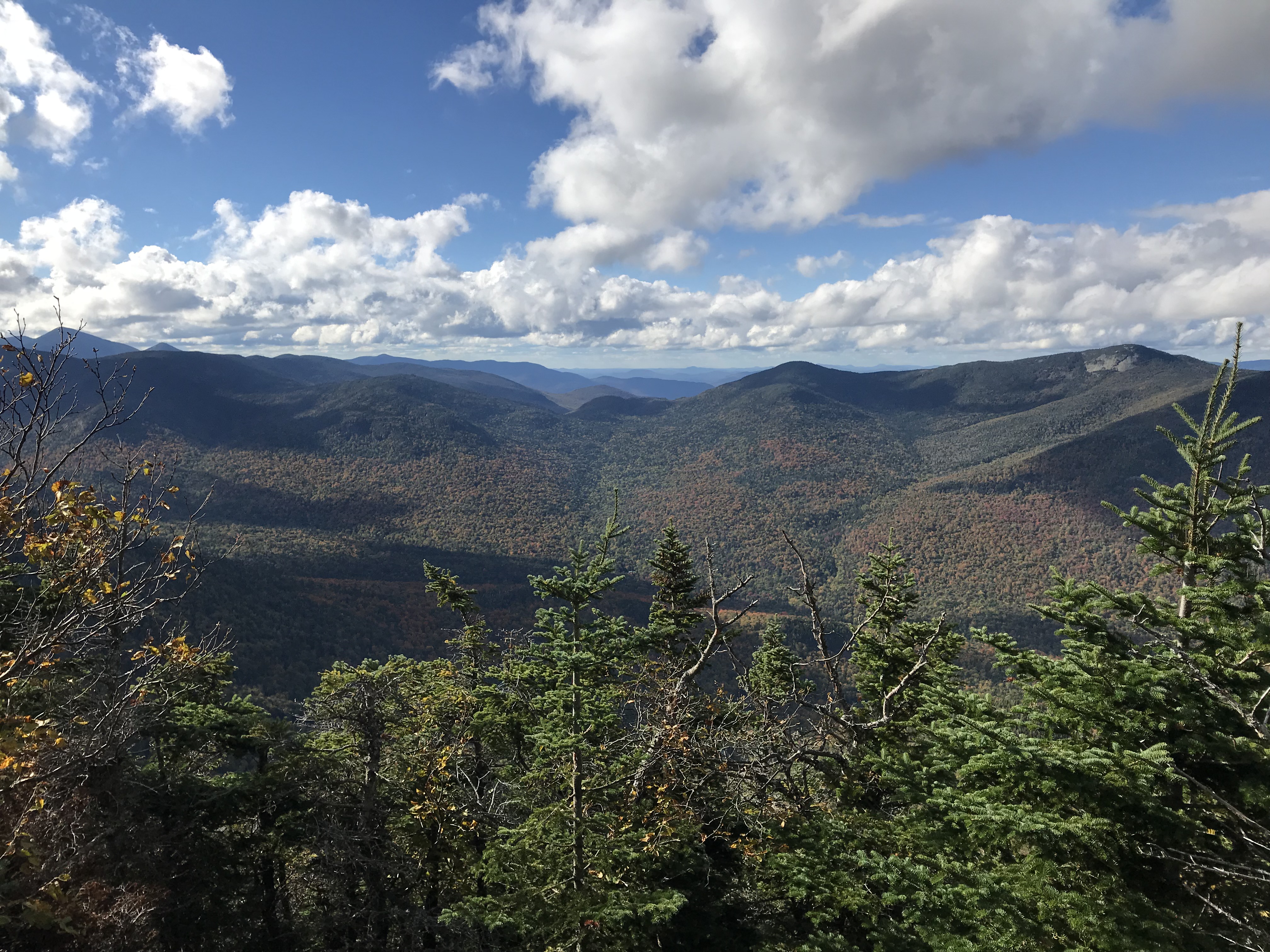
You’re going to reach a sign in which you can take a left and continue to Gothics, or take a right and head towards Armstrong. We took a left to head towards Gothics Mountain. It is only 0.4 miles away and it should not take more than 20-30 minutes to hit the summit. Gothics is number 10 of the Adirondack 46er’s sitting at an elevation of 4,736′. It boasts some amazing 360º views and you’ll be able to see many other High Peaks such as Giant, Whiteface, Armstrong, Sawteeth, etc. If you take off the 30 minutes that we spent at Beaver Meadow Falls, it took us roughly 4 hours to reach the summit of Gothics. This can take more or less time depending on your fitness as well as how much you want to push yourself. We had all day so we were in no rush.
Next: Armstrong Mountain
To reach Armstrong Mountain, you’ll head back down Gothics the way you came until you reach that sign pictured above. If you want to continue, Armstrong is only another 0.4 miles away as the sign indicates. Take notice that the trail signs have turned yellow once you head this way. Another important note is that the trail is very muddy from here on out. I did not use gaiters, but it would probably be helpful to have them. We were careful where we stepped so we didn’t bury our boots.
Summit of Armstrong
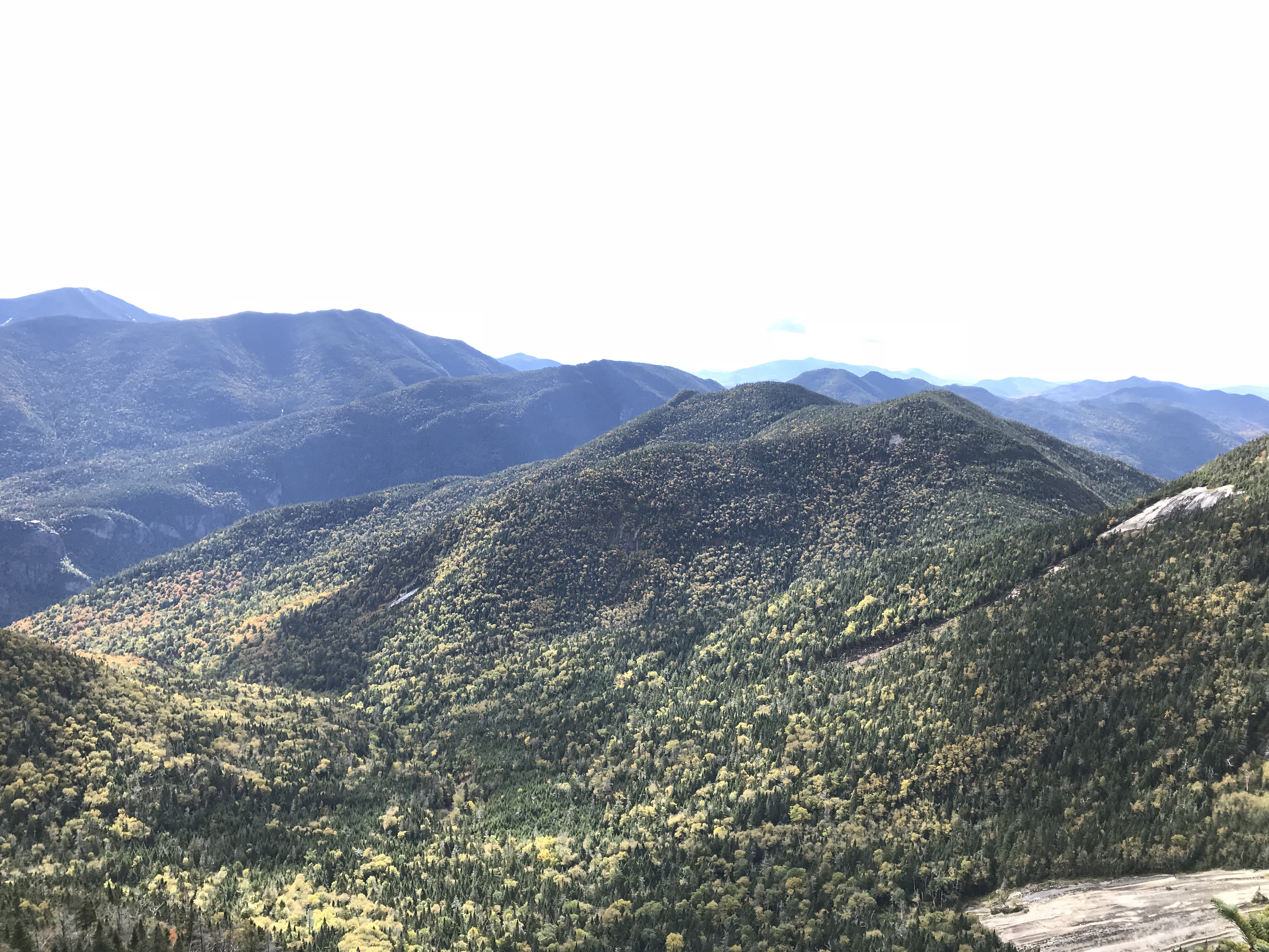
We hit the summit of Armstrong Mountain at about 12:30PM. This was about an hour after we left Gothics. The summit of this mountain does not have a marker, but you’ll know you hit it when you reach the lookout on a large rock. You’ll be rewarded with views of Gothics as well as other mountains in the area. It is a nice place to stop and rest before heading towards the Wolfjaws if they are on your itinerary. Armstrong sits at 4,410′ and is number 22 on the list of ADK 46ers.
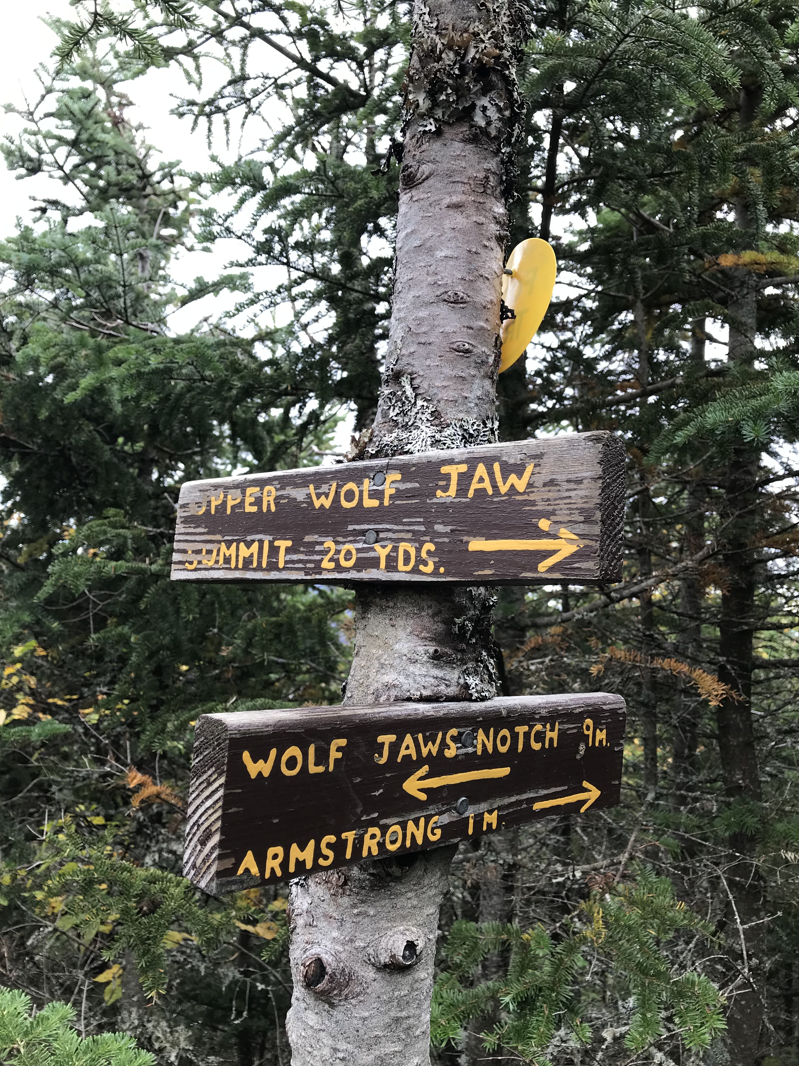
Moving Towards Upper Wolfjaw Mountain
Trekking from Armstrong Mountain to Upper Wolfjaw is rough. It is muddy for a majority of the way there, you’ll descend steeply into a col, and then have to ascend again to reach the peak. We left Armstrong at roughly 12:50PM. The trail is roughly a mile to Upper Wolfjaw, and there is a one ladder you will have to descend. There is also one sign you will encounter very close to the summit of UWJ.
Summit of Upper Wolfjaw
The summit of this High Peak is not as admirable as the two mountains before this, but it still offers a decent view. We hit the summit at 1:50PM which was about an hour after leaving Armstrong. This peak sits at 4,203′ and is number 29 on the list of Adirondack 46ers.
Onward to the Last High Peak of the Day
We left UWJ at 2:00 PM and started heading towards Lower Wolfjaw. We were unsure about doing this mountain because the weather was looking iffy and I had known the views of this High Peak are subpar. The sun decided to come back out and we thought it be best to tag this peak while we were in the mountains.
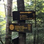
LWJ is about 1.4 miles away on the trail from UWJ. You’ll encounter three signs as you make your way to this High Peak. These signs can be seen below.
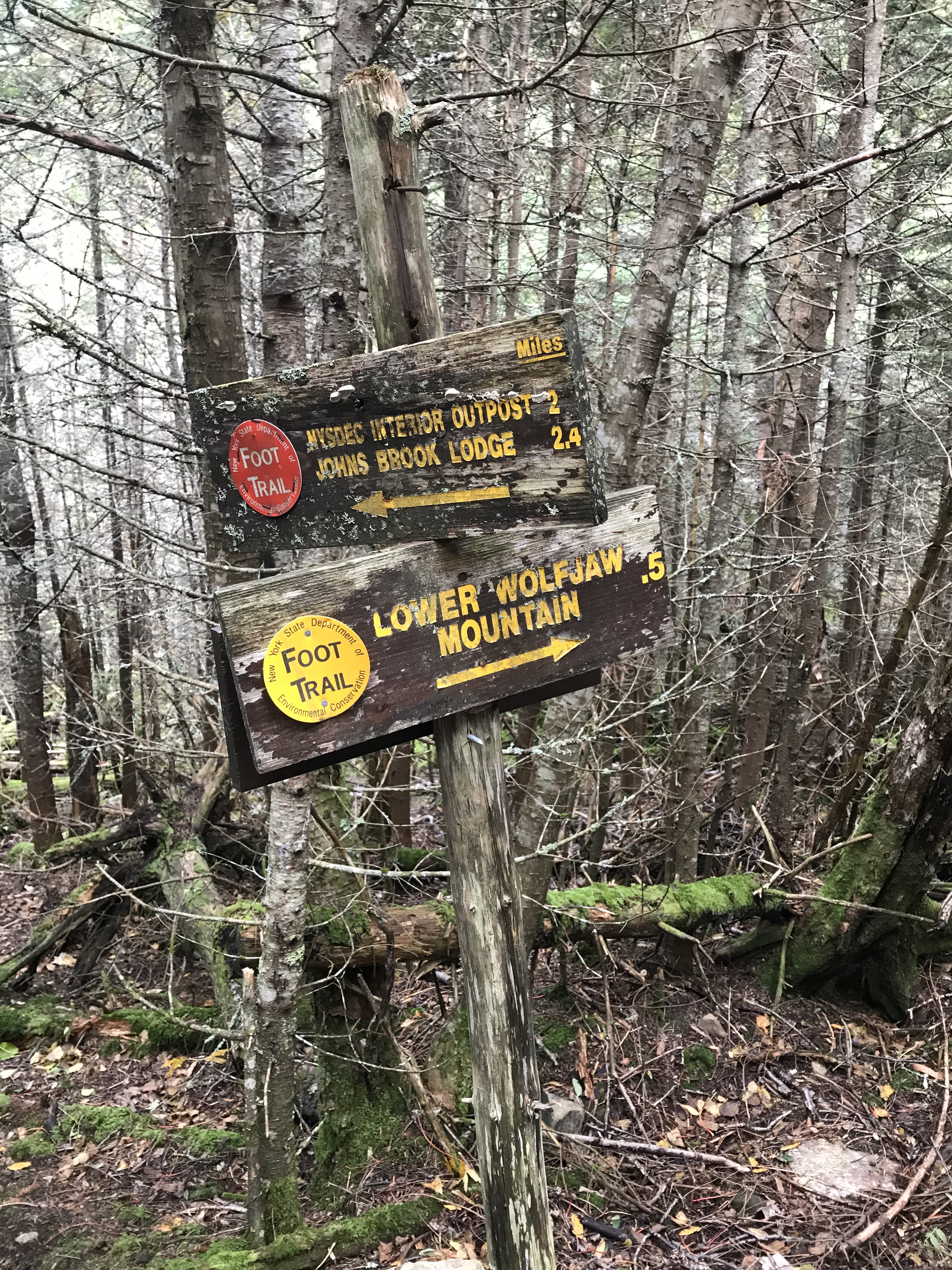
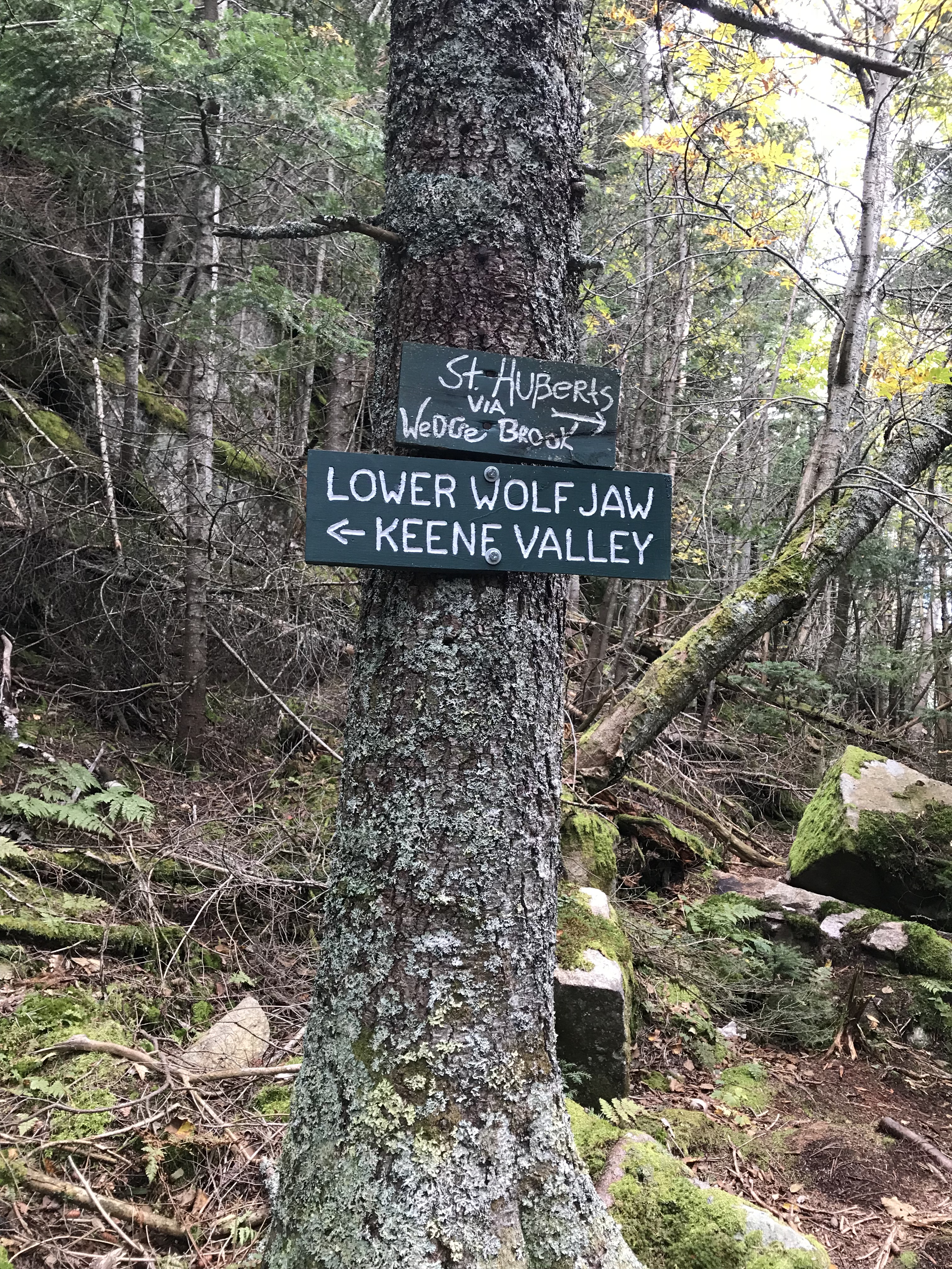
Lower Wolfjaw Mountain
The summit of this ADK High Peak has limited views, but its completion is necessary if you wish to be a 46er. The peak sits at 4,175′ and is number 30 on the list of High Peaks. There is no marker for LWJ, but you’ll know when you get there. There is a large rock you can stand on to look over the trees/vegetation to get some half-decent views. I personally did not think the sights were as limited as I have heard from others. It was 3:40PM when we hit this last summit of the day, roughly an hour and a half after leaving UWJ.
Getting Back to St. Hubert’s Parking Area
The trail does continue from the summit of Lower Wolfjaw back to St. Hubert’s and as the sign states, it is about 5.1 miles away. We left the summit around 3:55PM.
Follow the trail for 1.5 miles and you’ll reach your second sign. In-between these two signs, you’ll be dealing with some ascending with your descent so don’t be alarmed when you find yourself climbing. My brother started to wig out because we had to go up to go down and was worried that it was the wrong way. Also, the trail down has some steep sections so take caution. Once you hit the second sign, it is 3.6 miles to the St. Hubert’s parking area and you’ll be following red trail markers.

After following the red trail markers for 2 miles you’ll hit another sign that will be a morale boost. It informs you that you’re only 1.6 miles away from your vehicle.
In between this sign and the trailhead you emerge from you will encounter one more sign, two bridges (one over running water that I do not have pictured), and finally, the sign-in sheet area.
We hit the sign-in sheet at 6:30PM. Our entire day was around twelve hours, but you could cut a few hours off of that if you make haste. My brother is a slower hiker than me and he also tweaked his knee which further slowed his pace. We had plenty of time so it was no big deal and he’s fine now. I just want you all to know that this entire hike could be done in less than the time it took us or more. Make sure you plan accordingly.
Summary
- The total mileage was roughly 15 miles (give or take)
- Hike includes Beaver Meadow Falls and four Adirondack High Peaks being Gothics, Armstrong, Upper Wolfjaw, and Lower Wolfjaw
- Total time spent on the trails was 12 hours
- Trail was heavily trafficked, at one point on Gothics there were twenty other individuals
Dog-Friendly
Dogs are absolutely PROHIBITED on the property of the AMR. If you would like to bring your dog on these High Peaks, you’ll have to take a different trailhead to these mountains. We did see two or three large dogs and they seemed to be doing well. Just be aware that there is a large ladder that descends on the way from Armstrong to Upper Wolfjaw.
Family-Friendly
Due to the length of this hike, it may be difficult for younger children. You might be able to bring them up to Gothics if they have the endurance for that. I do suggest introducing a family member or child to Beaver Meadow Falls as it is stunning and the round trip to get there and back would be about 5 easy miles.
Clothes Worn
- Timberland hiking boots ($100)
- Hiking socks
- Nike Pro spandex (full leg length)
- Long-johns
- Athletic shorts
- Adidas sweats
- T-shirt
- Occasionally I tossed on my windbreaker
Gear Brought
- 4.5L of water
- Granola bars, trail mix, peanut butter sandwich
- Wind/Rain pants
- Gloves
- Extra layers (UnderArmour)
- Extra hiking socks
- Knife
- Paracord and two carabiners
- Water-proof matches
- Map
- LifeStraw (water filtration, costs about $20)
- Adhesive body warmer
- Balaclava
- Winter hat
- Trekking poles (A MUST => weight off knees, test how deep mud is, etc)
Map of Route We Took
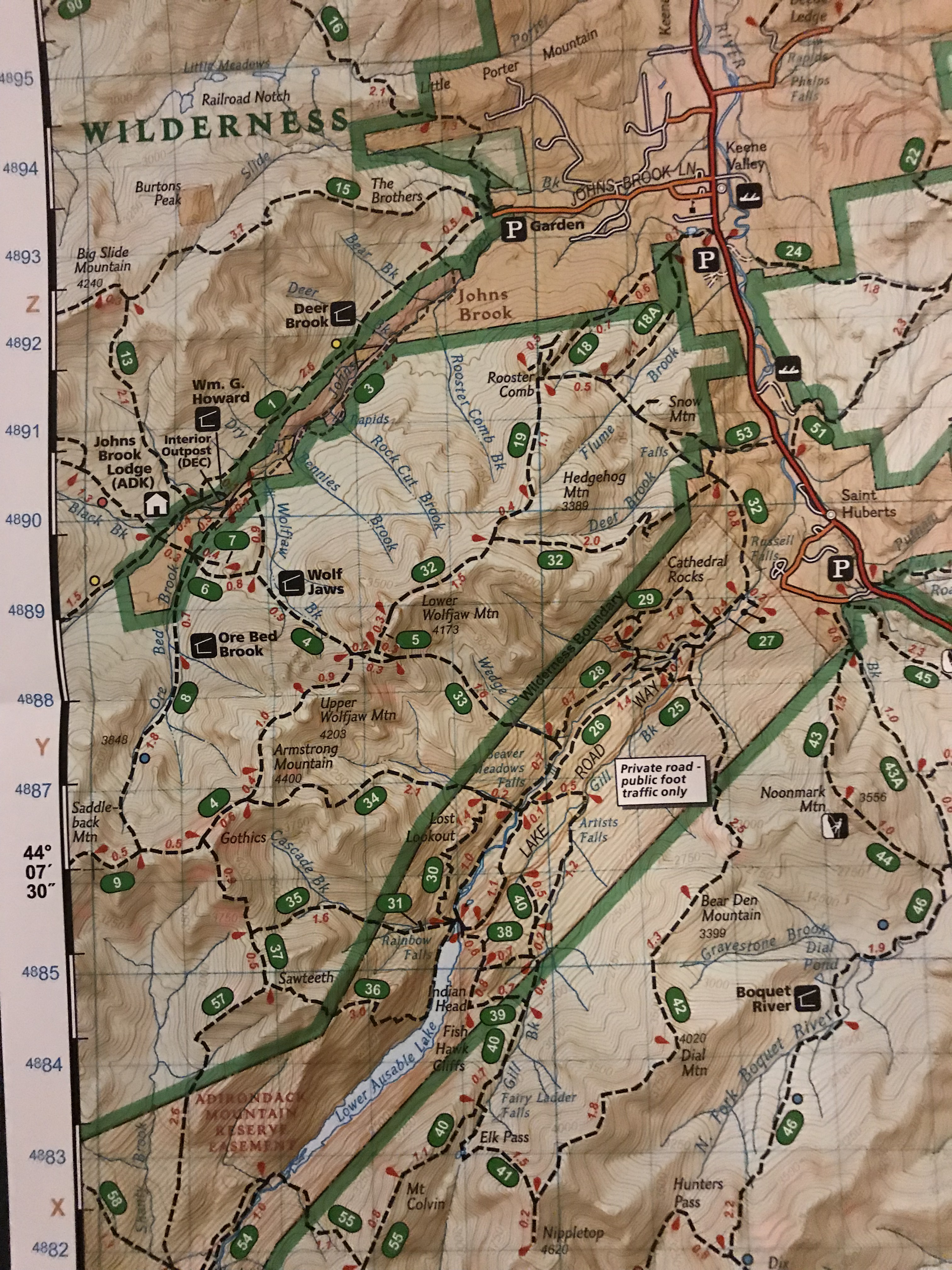
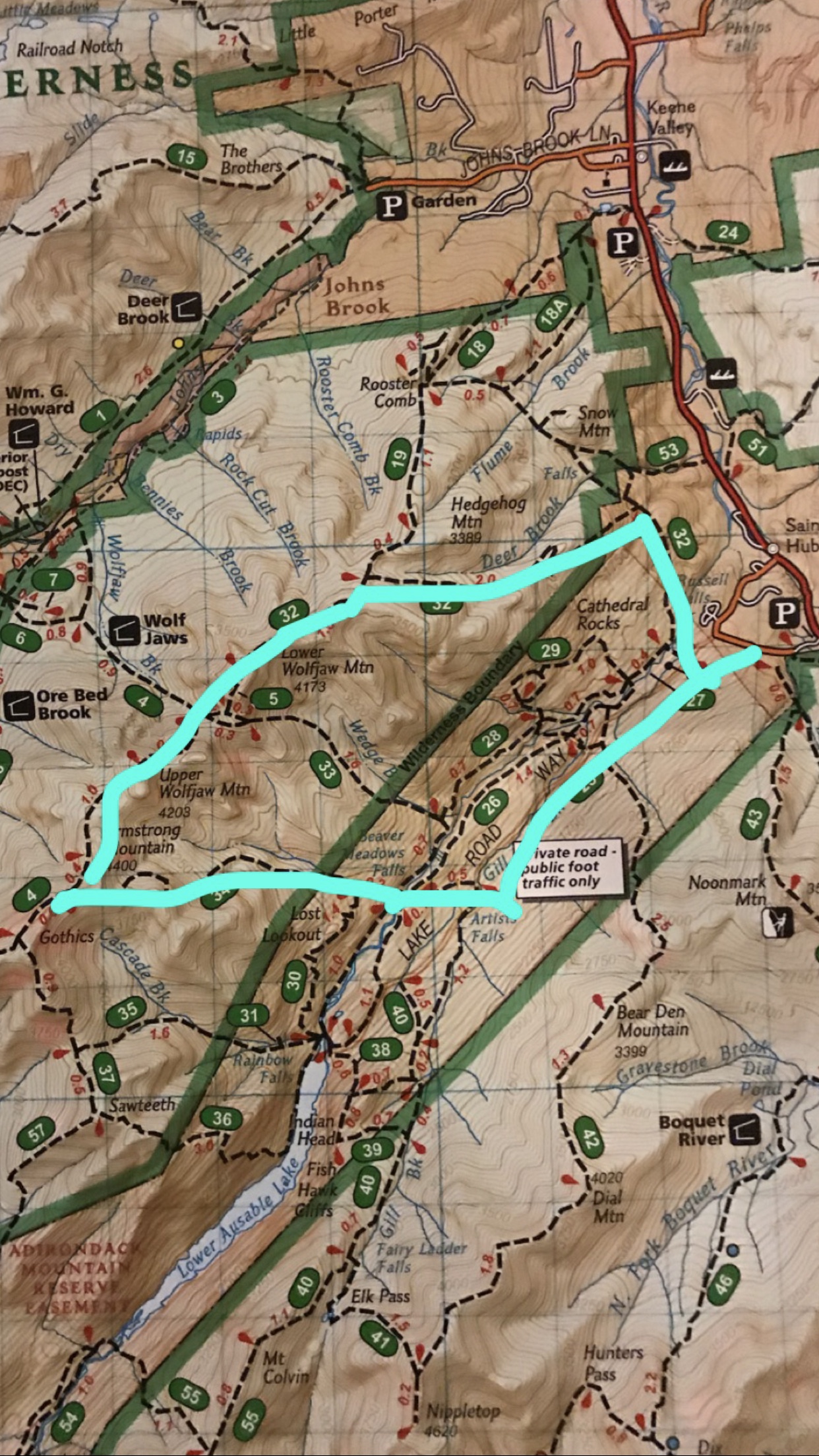
Map is the Nat Geo’s map of the Adirondacks
RTW Note:
Thanks for taking the time to read this and feel free to reference this post if you know anyone in New York looking for an outdoor adventure. Don’t forget to practice “Leave No Trace” and protecting our forests. I wish all you Road Trip Warriors safe travels and amazing adventures. I’ll end this post with a question. How have the outdoors benefitted you personally whether it be sparking creativity, alleviating stress, getting exercising, etc?
-Ant