An Improvised Trip…
What’s going on Road Trip Warriors!? I have been trying to fill in this last month of summer with as many hikes as possible and it was noticed that many other people are as well! I took off with my friend, Adam, to the Adirondacks yesterday with the intention of doing Haystack Mountain, Saddleback Mountain, and Basin Mountain. It is a 16.5 mile loop that starts at the Garden parking lot near Noonmark Diner. We arrived there at 7:00 AM and it was absolutely full. Since I do not tend to get discouraged I decided we would go to the Ausable Road lot and hike the Dial/Nippletop Mountain loop…..that lot was also overflowing. Then I decided that maybe the Adirondack Loj would have open spots…you get the point. Luckily, the Adirondack Park offers many other beautiful mountains besides the High Peaks. I had read about Hurricane Mountain before and I knew that the peak sat at an altitude not much less than a High Peak (3678′). I decided that this was the best alternative.
The Climb up hurricane mountain
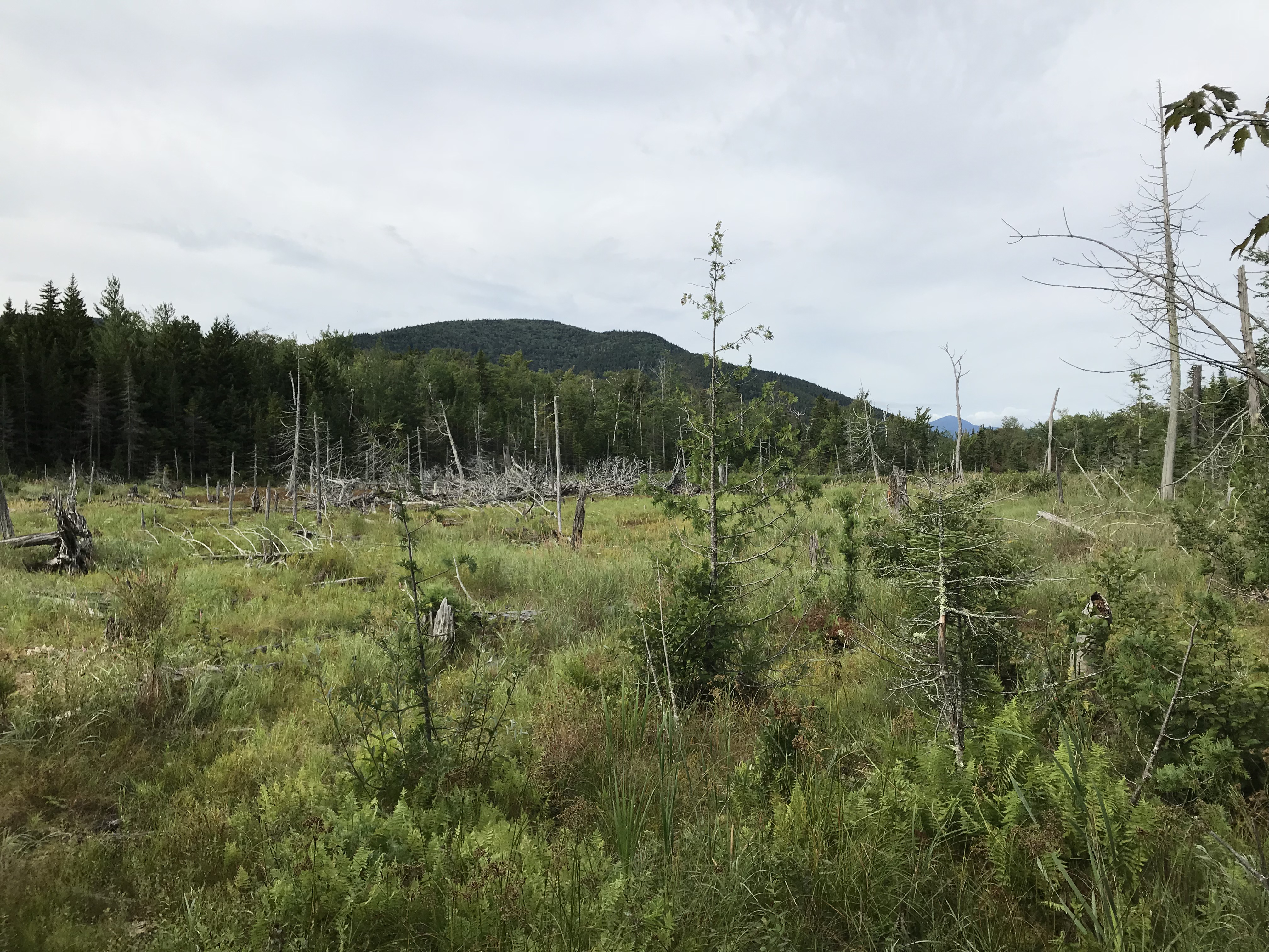
The trail is located on Route 9N a few miles East of the junction of Route 9N and Route 73. It is past Baxter Mountain and the trail is on the left side of the road. There are signs on the side of the road that will point you in the right direction. The trail begins between two metal posts with a red sign stating that the trail is 2.5 miles and has an elevation gain of 2000′. This sign is inaccurate as the trail is 3.4 miles to the summit. Do not be discouraged as the hike is relatively easy. The trail initially begins with a couple switchbacks, nothing too steep. After this, the trail becomes flat for a ways and there are some bridges over a swampy terrain. Do not forget to look around, there is always something beautiful to see.
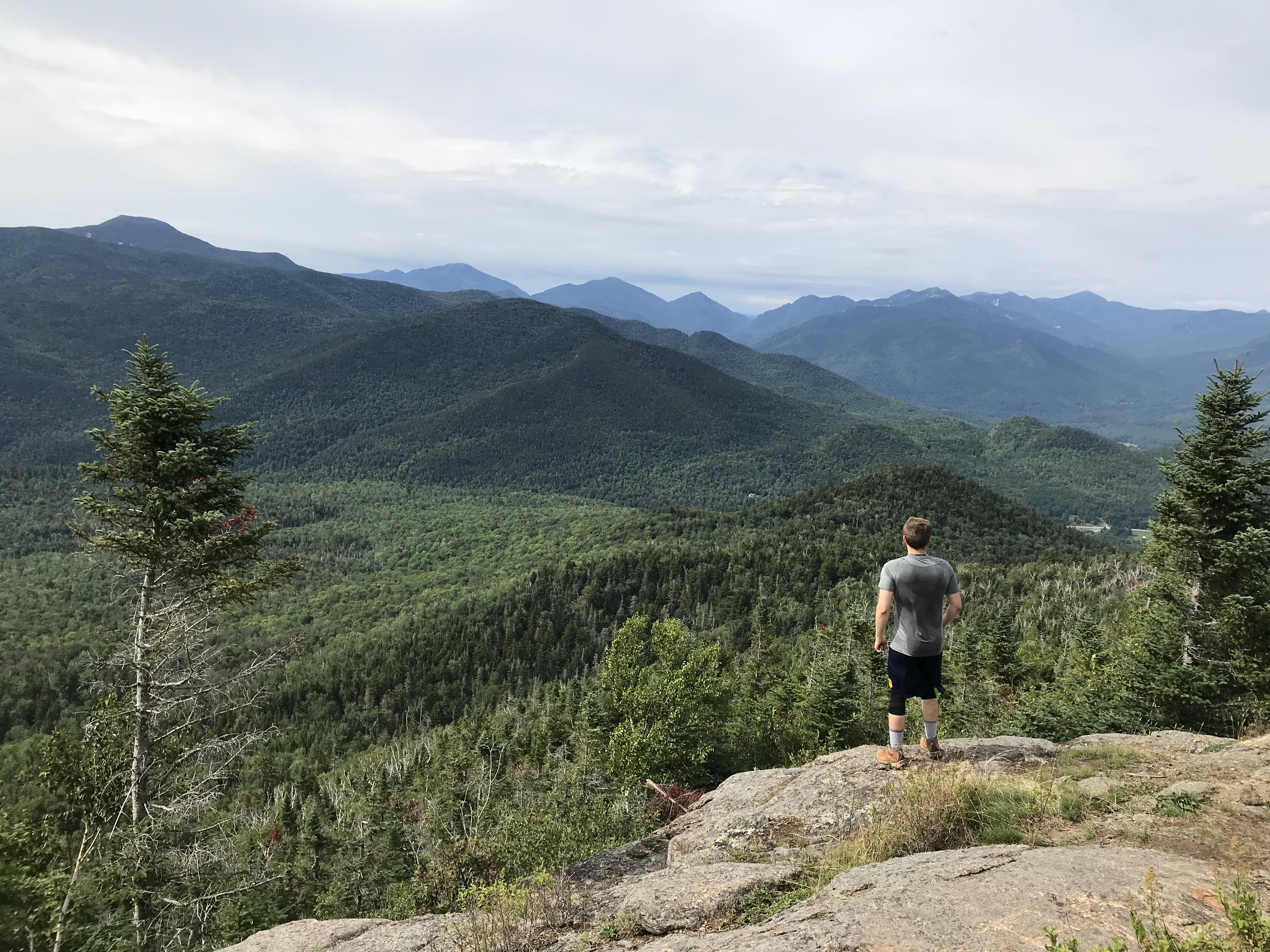
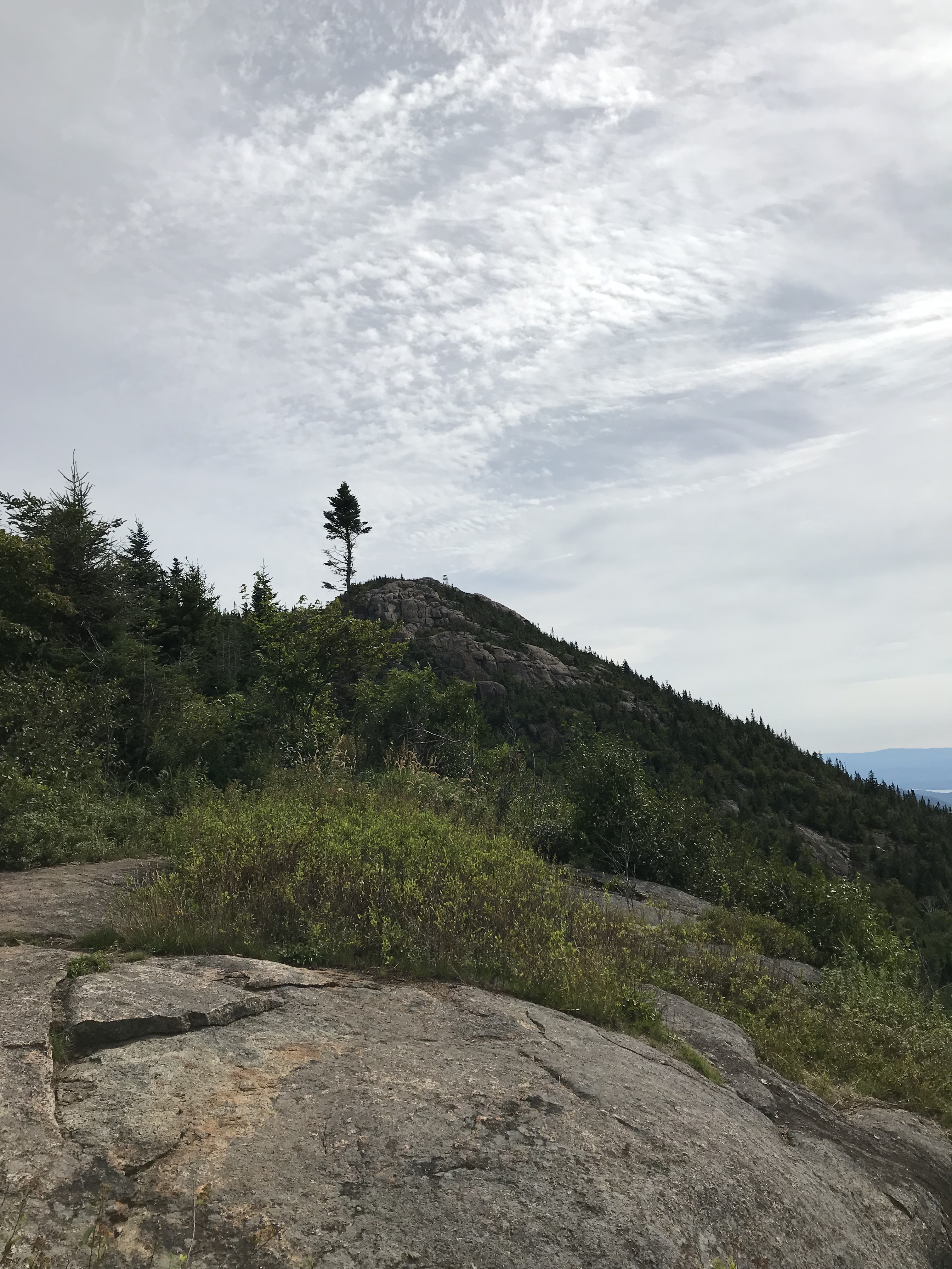
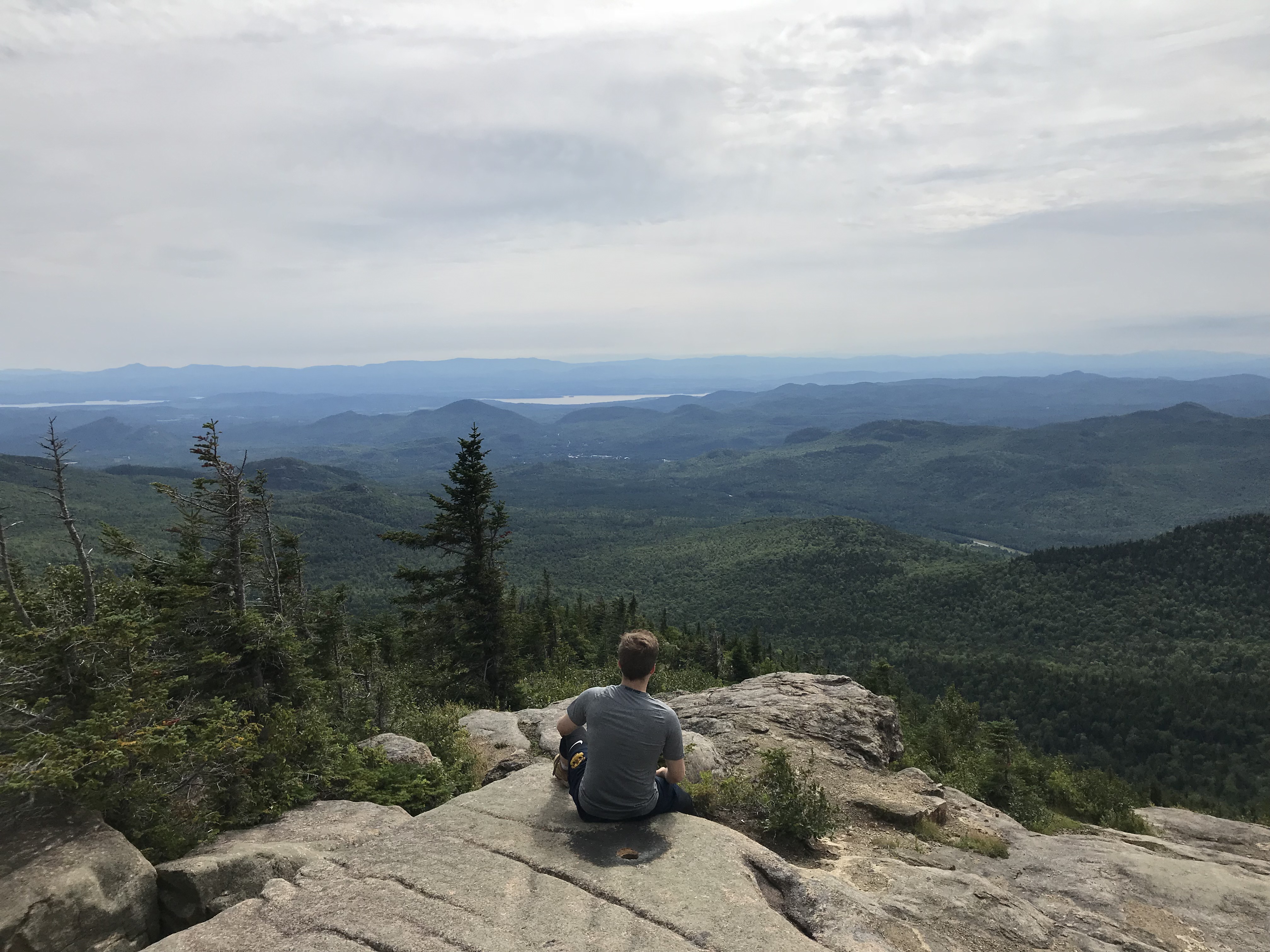
The trail begins climbing again and just under 3 miles into the trek you’ll be granted with an amazing view of the surrounding mountains. You will also be able to view the fire tower sitting on the peak of Hurricane Mountain. It looks further away than it really is and at this point, you are just about there. From the trailhead it took us about an hour and twenty minutes to reach this point. We stopped and took numerous photos.
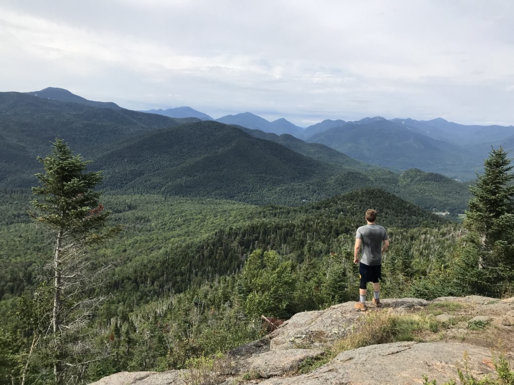
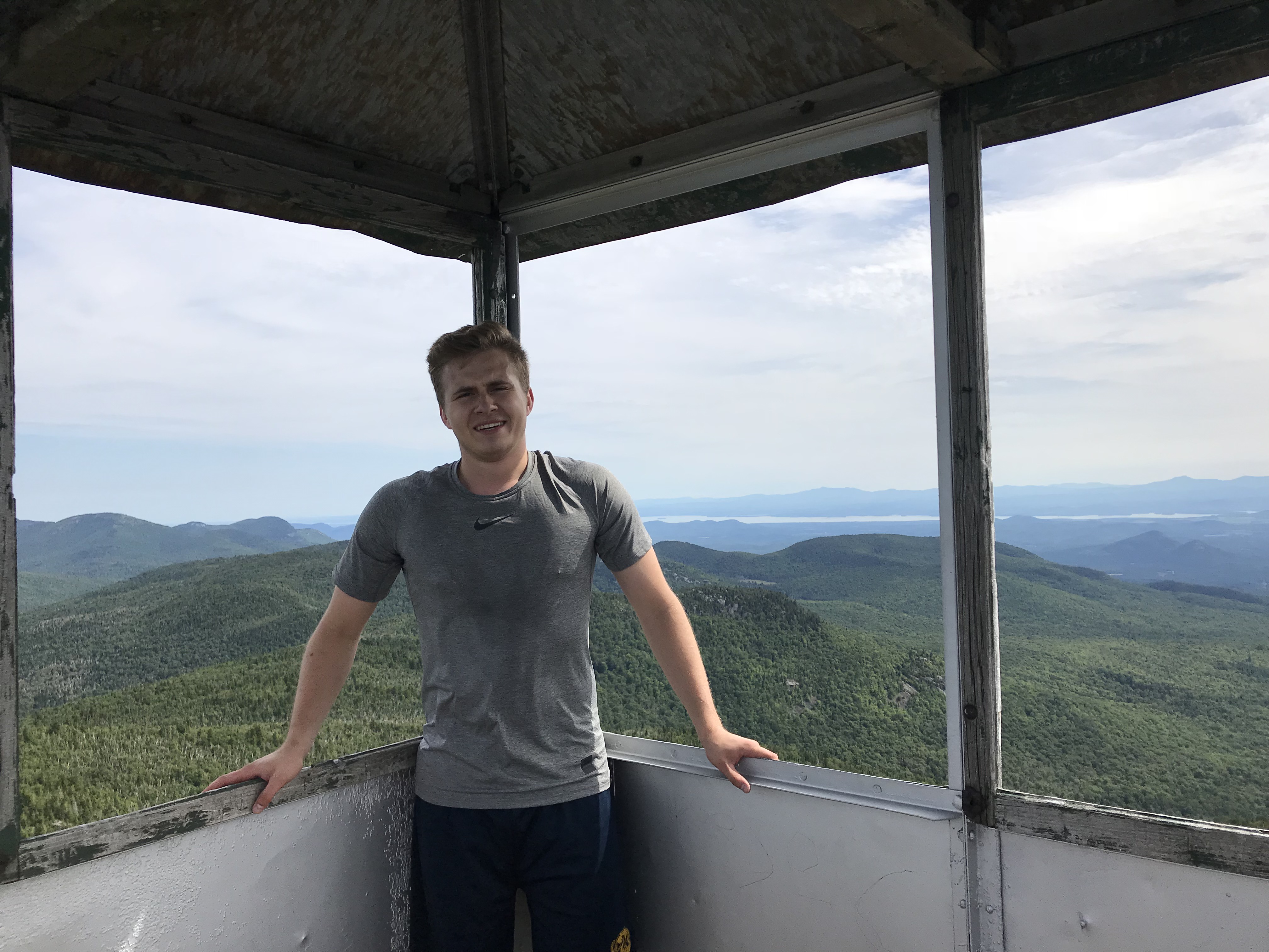
Hurricane Mountain Summit
That tiny thing on the summit is the fire observation tower. After our brief ten minute break, we pushed on. After overcoming a few rock scrambles we were on the summit in less than twenty minutes. The summit of Hurricane Mountain was a genuine surprise. I would not say that I had low expectations, but I did not think that the sights would be as grand as a High Peak would offer. I was glad that I was wrong. It had 360º views and you have the option to climb the fire tower (no more than six people at a time). In the far distance, you’ll be able to see Lake Champlain in its glory. The lake is quite large stretching for 120 miles with borders of New York, Vermont, and Canada. It was a little breezy up there, the sun was out, and it was roughly 75ºF. I could not have asked for better weather. Again, we took countless pictures as we relished the far stretches of land this mountain allowed us to see.
The Descent
I am not going to spend too much time going over the descent as it is pretty self-explanatory. We followed the same trail back down and in an hour and a half we were back at my car. The total mileage for the day ended up being around 6.8 miles.
Gear
I have decided from here on out that it would be helpful to fellow Road Trip Warriors out there if I listed off the gear I bring for each of my excursions. Unfortunately for this hike I was carrying much more than was necessary as I initially planned for a much longer trek. The photo below shows items that I had packed in my hiking bag (a 35L Eddie Bauer bag).
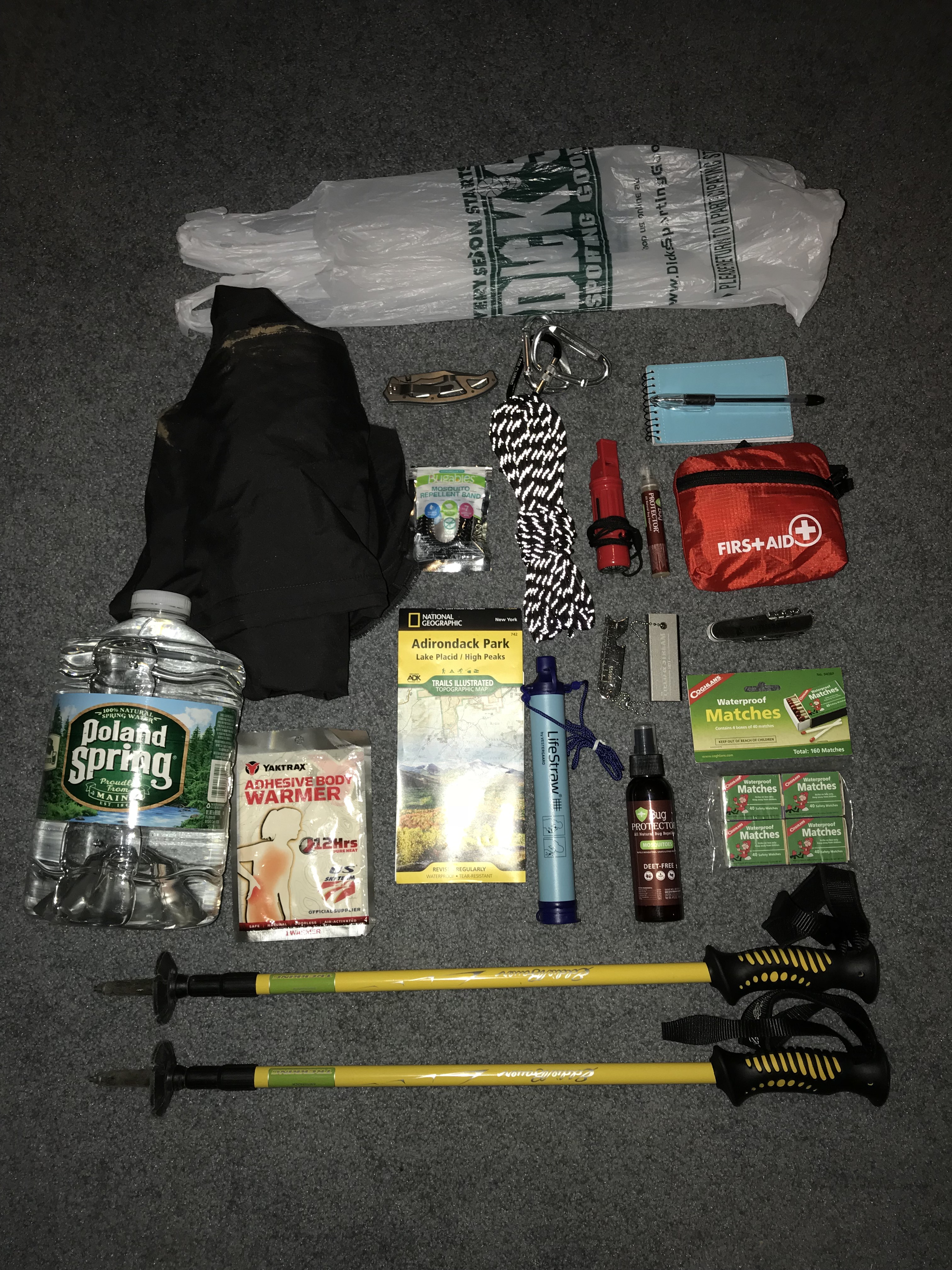
gear list
- The plastic bag is for my garbage
- Wind/Rain resistant pants
- 3L Poland Springs water, I also brought a filled 32 ounce bottle
- Adhesive body warmer
- Knife
- 50 foot paracord rated to hold 550 pounds
- Three carabiners (those metal clips on the paracord)
- My two trekking poles
- Citronella bracelet to repel mosquitos
- ADK park map
- LifeStraw (if I ever ran out of water, can be used to drink water found along trails)
- Fire starter and waterproof matches
- Whistle
- First-Aid kit (small)
- Notepad and pen
- Bug sprays
- Multi-tool
I also brought extra socks, shorts, shirts, UnderArmour, granola bars, almonds, peanut butter sandwiches, and cooked rice. I would suggest carrying a smaller day pack filled with a significant amount of water and snacks as well as a basic first-aid kit (should always have one), bug spray, and trekking poles. The trekking poles are always helpful considering the weight it takes off the knees descending a mountain. I saw many individuals on my way down going up the mountain in sneakers and not carrying much on their backs. Although this hike is not too difficult, I strongly recommend always wearing either trail shoes or hiking boots for grip and to protect from sprained ankles. I strongly recommend this hike to anyone looking for a good workout with generous rewards only 3.4 miles away from the trailhead. Remember to pack-in-pack-out and happy hiking my warriors!
-Ant